< Previous | Next >
5.1 Housing
Policies in this Section:
| HS1: Housing Allocations |
HS5: House Extensions and Alterations |
| HS2: Affordable Housing Provision |
HS6: Agricultural Workers’ Dwellings |
| HS3: Housing Density and Mix |
HS7: Gypsy and Traveller Site Criteria |
| HS4: Housing Developments |
HS8: Gypsy and Traveller Site Occupancy Condition |
National Planning Policy Background
5.1.1 A core principle of the NPPF37 is to proactively drive and support sustainable economic development to deliver the homes, business and industrial units, infrastructure and thriving local places that the country needs, and respond positively to wider opportunities for growth.
5.1.2 The NPPF requires local authorities to boost significantly the supply of housing, and to:
- Use their evidence base to ensure that their Local Plan meets the full, objectively assessed needs for market and affordable housing in the housing market area, as far as is consistent with the policies set out in the Framework, including identifying key sites which are critical to the delivery of the housing strategy over the plan period;
- Identify and update annually a supply of specific deliverable sites sufficient to provide five years’ worth of housing against their housing requirements with an additional buffer of 5% (moved forward from later in the plan period) to ensure choice and competition in the market for land. Where there has been a record of persistent under delivery of housing, local planning authorities should increase the buffer to 20% (moved forward from later in the plan period) to provide a realistic prospect of achieving the planned supply and to ensure choice and competition in the market for land;
- Identify a supply of specific, developable sites or broad locations, for years 6-10 and, where possible, for years 11-15;
- For market and affordable housing, illustrate the expected rate of housing delivery through a housing trajectory for the plan period and set out a housing implementation strategy for the full range of housing describing how they will maintain delivery of a five-year supply of housing land to meet their housing target; and
- Set out their own approach to housing density to reflect local circumstances.
The Requirement
5.1.3 Section 4 and Policy SP2 set out the target for new dwellings over the Plan period 2012- 2032. Taking account of existing completions, the re-occupation of vacant homes, a windfall allowance and planning application commitments, it identifies a need to allocate sufficient land to deliver 1,798 new dwellings.
Identifying the supply
Housing and Economic Land Availability Assessment ‘SHLAA’
5.1.4 The NPPF (paragraph 159) requires local planning authorities to prepare a Strategic Housing Land Availability Assessment (SHLAA) to establish realistic assumptions about the availability, suitability and likely economic viability of land to meet the identified need for housing over the plan period. Paragraph 161 encourages authorities to undertake assessments of land available for economic development at the same time as, or combined with the housing SHLAA.
5.1.5 The Burnley Strategic Housing and Economic Land Availability Assessment Update of March 2017 (SHLAA) is a combined assessment which assesses the amount of land available within the borough that is potentially available to meet the identified need and demand for new employment and housing development.
5.1.6 It indicates that over the Plan period there is sufficient ‘developable’ land to provide approximately 3,620 new dwellings on a range of sites. Of these 3,282 could be accommodated on site of 0.4 hectares or larger.
5.1.7 Informed by the SHLAA, the housing target is to be provided for in line with the Spatial Strategy identified in Policy SP4 through the allocation of vacant or underused previously- developed sites within the existing Tier 1, 2 and 3 settlements (Burnley and Padiham, Hapton and Worsthorne) and through the allocation of new greenfield sites beyond but closely related to the 2006 Local Plan development boundaries.38
Site Allocations
5.1.8 The sites identified in Policy HS1 below will provide sufficient sites to meet the identified residual requirement and provide a range of sites to meet the full, objectively assessed needs for market and affordable housing. A number of these sites would be suitable for C3 sheltered or C3 extra care housing or custom and self-build housing which would contribute towards meeting the requirement set out in Policy SP2.
Policy HS1: Housing Allocations
| In order to meet the requirement of Policy SP2, the following sites, as identified on Policies Map, are allocated for housing development. |
| Site Ref |
Name |
Greenfield/Brownfield |
Site Area (Ha) |
Indicative Number of Dwellings |
| HS1/1 |
Former Hameldon Schools Sites |
Greenfield/Brownfield |
10.1 |
250 |
| HS1/2 |
Hollins Cross Farm |
Greenfield |
8.65 |
184 |
| HS1/3 |
Former William Blythe Site |
Brownfield |
6.00 |
151 |
| HS1/4 |
Land at Rossendale Road (housing) |
Greenfield |
7.52 |
188 |
| HS1/5 |
Former Baxi Site (housing) |
Brownfield |
8.23 |
244 |
| HS1/6 |
Lambert Howarth |
Brownfield |
2.99 |
100 |
| HS1/7 |
Ridge Wood |
Greenfield |
0.87 |
18 |
| HS1/8 |
Red Lees Road, Cliviger |
Greenfield |
5.00 |
125 |
| HS1/9 |
Higher Saxifield |
Greenfield |
5.17 |
120 |
| HS1/10 |
Land at Burnley General Hospital |
Brownfield |
1.27 |
64 |
| HS1/11 |
Former AIT Site |
Brownfield |
1.81 |
54 |
| HS1/12 |
Former Heckenhurst Reservoir |
Greenfield |
1.38 |
35 |
| HS1/13 |
Tay Street |
Brownfield |
1.18 |
35 |
| HS1/14 |
Former Gardner Site |
Brownfield |
1.43 |
43 |
| HS1/15 |
Coronation Avenue, Thompson Street |
Greenfield/Brownfield |
0.90 |
41 |
| HS1/16 |
Gordon Street Mill |
Greenfield/Brownfield |
1.41 |
39 |
| HS1/17 |
Livingstone Mill |
Brownfield |
0.95 |
38 |
| HS1/18 |
Perseverance Mill, Padiham |
Brownfield |
1.18 |
56 |
| HS1/19 |
Land NE of Sycamore Avenue |
Brownfield |
0.77 |
34 |
| HS1/20 |
Ridge Avenue |
Greenfield |
1.46 |
24 |
| HS1/21 |
Land adjacent 2 Queens Park Road |
Greenfield |
0.95 |
29 |
| HS1/22 |
Former Dexter Paints |
Brownfield |
0.83 |
27 |
| HS1/23 |
Land to rear of Bull and Butcher |
Greenfield |
0.95 |
24 |
| HS1/24 |
Land at Oswald Street |
Brownfield |
0.60 |
20 |
| HS1/25 |
Brampton House, 500 Colne Road |
Greenfield/Brownfield |
0.50 |
18 |
| HS1/26 |
Land adjacent 250 Brownside Road |
Greenfield/Brownfield |
0.73 |
18 |
| HS1/27 |
Clevelands Road (South) |
Greenfield |
0.42 |
13 |
| HS1/28 |
George Street Mill (EMP1/11) |
Brownfield |
0.00 |
0 |
| HS1/29 |
Lodge Mill, Barden Lane |
Brownfield |
2.32 |
35 |
| HS1/30 |
Land West of Smithyfield Avenue39 |
Greenfield |
1.72 |
30 |
| HS1/31 |
Barden Mill, Barden Lane |
Brownfield |
0.85 |
37 |
| HS1/32 |
Butchers Farm |
Brownfield/Greenfield |
1.17 |
24 |
|
Total |
|
79.31 |
2,118 |
| Development on these sites will be acceptable in principle for housing development and will be required to be delivered in accordance with the following specific requirements together with the requirements of other relevant policies set out elsewhere in this Plan: |
| HS1/1 – Former Hameldon Schools Site |
| Housing Delivery |
The site is acceptable for around 250 dwellings. |
Additional and Site Specific Policy Requirements and Design Principles
- A mix of dwelling types, including a minimum of 60% 3+ bedroomed detached and semi- detached houses will be expected, of which at least 50% should be detached;
- Vehicular access should be provided from Kiddrow Lane with only an emergency (and cycle and pedestrian) access onto Scott Street;
- Any necessary off-site highway improvement works agreed to be necessary must be carried out in accordance with a phasing plan to be agreed;
- The existing playing pitches should be retained and/or replaced by equivalent or better provision in the locality, detailed proposals for which should be submitted with any planning application. Planning contributions may be required in accordance with Policy IC4;
- A new a equipped play area must be provided on site (see Policy HS4);
- A footpath link should be maintained to the Sweet Clough Greenway;
- The site forms part of the Lancashire Ecological Network for Woodland and Protected Species have been recorded. An ecological survey will be required to accompany any planning application which addresses these issues in accordance with Policy NE1;
- A substantial area of multi-functional green infrastructure through the central area of the southern half of the site must be retained;
- A small part of the site lies within Flood Zones 3a and 3b and further areas are at risk from surface water flooding. The layout and design of the development should take account of the recommendations of the Council's Strategic Flood Risk Assessment; and
- The former Ivy Bank House to the south of the site has local archaeological interest and whilst this does not present an over-riding constraint on redevelopment suitable provision will need to be made for archaeological desk based assessment and field evaluation of the former Ivy Bank House consistent with Policy HE4; and any further investigation or recording works that may be necessary as a consequence of development.
|
Supporting Information
- Lancashire County Council Highways has advised that it has concerns regarding additional traffic on Scott Street due to its poor access onto Padiham Road and would prefer access onto Kiddrow Lane which benefits from signalised access onto Padiham Road. Contributions are likely to be sought for off-site highway improvements including to the junction(s) onto Padiham Road.
- The Green Spaces Strategy 2015 identifies a deficit of fixed equipment play areas in the neighbourhood.
- The site includes three disused playing pitches.
- The Lancashire Ecological Network for Woodland identifies part of the site as being Stepping Stone habitat.
|
| HS1/2 – Hollins Cross Farm |
| Housing Delivery |
The site is acceptable for around 184 dwellings. |
Additional and Site Specific Policy Requirements and Design Principles
- A mix of dwelling types, including a minimum of 40% 4+ bedroomed detached and 30% 3+ bedroomed detached or semi-detached houses will be expected;
- Vehicular access should be from a single point onto New Road. Contributions may be sought for off-site highway improvement work in the vicinity;
- No vehicular access will be permitted from Woodplumpton Lane;
- Protected Species have been recorded on the site which also includes Priority Habitat (lowland fen). An ecological survey will be required to accompany any planning application which addresses these issues in accordance with Policy NE1;
- Appropriate landscaping and boundary treatment should include screening to the southern boundary to reduce the impact on the wider landscape. New planting on the site will need to accord with Policy NE3; and
- The presence of known heritage assets (Medieval and earlier) within close proximity of the site would suggest some limited potential for unknown archaeology of local-regional significance and suitable provision will need to be made for archaeological desk based assessment and field evaluation consistent with Policy HE4; and any further investigation or recording works that may be necessary as a consequence of development.
|
Supporting Information
- This is a prominent greenfield site in the open countryside. A scheme of high quality is expected in line with Policy SP5 and lower density detached housing preferred not only to increase/ provide quality and choice, but lower density development would provide greater opportunity for landscaping, planting and minimising impact.
- Lancashire County Council Highways has advised that access via Woodplumpton Lane would not be considered appropriate as there is no footway provision.
- Contributions may be sought for off-site highway improvement works in the vicinity, both to Glen View Road and for traffic management works to the A646 and Manchester Road signal junction as development is likely to have cumulative impacts on this junction.
|
| HS1/3 – Former William Blythe Site |
| Housing Delivery |
The site is acceptable for around 151 dwellings. |
Additional and Site Specific Policy Requirements and Design Principles
- A mix of dwelling types, including a minimum of 60% 3+ bedroomed detached and semi-detached houses will be expected;
- Vehicular access should be from a single point onto Manchester Road;
- Appropriate landscaping and boundary treatment should include screening to the northern and eastern boundary to reduce the impact on the wider landscape. New planting on the site will need to accord with Policy NE3;
- Safe and convenient access for pedestrians and cyclist should be provided which connects to the canal towpath;
- The site forms part of the Lancashire Ecological Networks for Woodland and Grassland. An ecological survey will be required to accompany any planning application which identifies and addresses this issue in accordance with Policy NE1; and
- To the north of the site is a Scheduled Monument. The Monument should be preserved in situ and within an amenity area for the housing site.
|
Supporting Information
- Planning permission for residential development on a larger site for 202 dwellings has been approved (APP/2016/0021).
- Part of the site is identified within the Lancashire Ecological Network for Grassland as a stepping stone habitat.
- A significant area of the site is at high risk of surface water flooding. Any updated Site Specific Flood Risk Assessment required will need to address this issue to meet the requirements of Policies CC4 and CC5 of this Plan.
- Archaeological significance does not present an over-riding constraint on redevelopment. Sensitive and well-designed development can make a significant contribution to the long term preservation and presentation of the Scheduled Monument.
|
| HS1/4 – Land at Rossendale Road |
| Housing Delivery |
The site is acceptable for around 188 dwellings. |
Additional and Site Specific Policy Requirements and Design Principles
- A mix of dwelling types, including a minimum of 55% 3+ bedroomed detached and semi-detached houses will be expected;
- Appropriate traffic management systems will be required both at the site entrance and within the locality, for which contributions may be sought in accordance with Policy IC4;
- Protected Species have been recorded on the site. An ecological survey will be required to accompany any planning application which identifies and addresses this issue in accordance with Policy NE1;
- Appropriate landscaping and boundary treatment should include screening to the northern and western boundary to reduce the impact on the wider landscape, along with roadside trees and shrubs adjacent to Rossendale Road. New planting on the site will need to accord with Policy NE3; and
- The presence of known heritage assets (Medieval and earlier) within close proximity of the site would suggest some limited potential for unknown archaeology of local-regional significance and suitable provision will need to be made for archaeological desk based assessment and field evaluation consistent with Policy HE4; and any further investigation or recording works that may be necessary as a consequence of development.
|
Supporting Information
- This is prominent greenfield site in the open countryside. A scheme of high quality is expected in line with Policy SP5.
- A listed Butter Cross base exists on the site and should be retained in situ and sensitively incorporated into the development scheme.
- Lancashire County Council Highway engineers have advised that vehicular access should be from Rossendale Road with appropriate sight lines and traffic management infrastructure; and have highlighted that the development could adversely impact on the local road network with increased congestion at the Rosegrove and the Manchester Road signal junctions. The Burnley-Pendle Growth Corridor programme has identified fully funded improvements to the Rosegrove junction to be undertaken by Lancashire County Council and Burnley Borough Council but further works may be required for which a contribution may be sought.
- The Burnley Green Infrastructure Strategy identifies Rossendale Road as an area which would benefit from enhanced GI in terms of improving the aesthetics of the road and its surroundings. New tree planting would assist whilst also providing other beneficial actions including the trapping of air pollutants, the absorption of noise, providing shade from the sun and evaporative cooling opportunities.
- There is potential to explore a combined access strategy in conjunction with Site ‘HS1/23 – Land to rear of Bull and Butcher’.
|
| HS1/5 – Former Baxi Site |
| Housing Delivery |
The site is acceptable for around 244 dwellings. |
Additional and Site Specific Policy Requirements and Design Principles
- A mix of dwelling types including a minimum of 60% 3+ bedroomed detached and semi-detached houses will be expected; of which at least 50% should be detached;
- Over 60% of the site lies within Flood Zone 3a and a small percentage in Flood Zone 3b. Further areas of the site are at risk from surface water flooding. The layout and design of the development should take account of the recommendations of the Council's Strategic Flood Risk Assessment which indicates how flood risk can be adequately mitigated in order to pass the Exception Test as set out in the NPPF;
- The development of the site is dependent on the delivery by the Environment Agency of a wider food alleviation scheme for Padiham, towards which contributions may be required in accordance with Policy IC4. Outline planning permission will not be granted until the outline design of the flood alleviation scheme and its implications for the site layout has been agreed in consultation with the Environment Agency. Detailed planning permission will not be granted until the flood alleviation scheme has been designed in detail and no built development (access roads or dwellings) will be permitted to commence within the areas of Flood Zone 2 or 3 until the flood alleviation scheme has been completed to an extent that the site can be safely occupied and its development will not cause or exacerbate flooding elsewhere;
- The site forms part of the Lancashire Ecological Network for Grassland. An ecological survey will be required to accompany any planning application which addresses this issue in accordance with Policy NE1;
- The southern part of the site adjoining the River Calder should be retained/developed as multi-functional green infrastructure as part of the Ecological Network with public access retained;
- Whilst an access road could be accommodated within this area, alternative access must also be provided from one or more of the other available access points i.e. Grove Lane, Wyre Street and Lune Street; and
- The site has local archaeological significance and suitable provision will need to be made for archaeological desk based assessment and field evaluation consistent with Policy HE4; and any further investigation or recording works that may be necessary as a consequence of development.
|
Supporting Information
- The site is within an area of low, medium and high risk of flooding, the majority of it lying within Flood Zone 3 with a small area (1% being within Flood Zone 3b – the functional flood plain). A Stage 2 SFRA has been prepared which confirms that the site can pass the Exception Test.
- A site specific flood risk assessment will be required to support any planning application in line with Policy CC4 through which the development should be demonstrated to pass the Exception Test as set out in the NPPF and satisfy all other requirements of Policy CC4 and CC5.
- United Utilities have advised that surface water is currently pumped to a local river and that no wastewater issues are expected as long as this arrangement is maintained.
- The Lancashire Ecological Network for Grassland identifies part of the site as a stepping stone habitat.
- There is a Tree Preservation Order in force adjacent the north eastern boundary of the site. These trees must be protected during the development’s construction.
- A culvert runs along the northern edge of the site.
|
| HS1/6 – Lambert Howarth |
| Housing Delivery |
The site is acceptable for around 100 dwellings. |
Additional and Site Specific Policy Requirements and Design Principles
- A mix of dwelling types including 2, 3 and 4 bed dwellings will be expected;
- Vehicular access should be taken from Marlborough Street and Finsley Gate. The bridge that connects the two sites should be brought back into use, enabling pedestrians and cyclists to easily cross the site. A new pedestrian crossing should be provided on Finsley Gate. Contributions will be sought to facilitate this and the provision of improved pedestrian and cycle routes to Burnley town centre;
- Development will be expected to positively address its waterfront location; create a positive and appropriate relationship with surrounding buildings and spaces by respecting the form, scale and materials of the surrounding historic townscape; and be of high design integrity consistent with Policy SP5. Design and layout should contribute to an improved public realm consistent with the Weavers’ Triangle Public Realm Strategy SPD;
- The site includes Finsley Gate Mill, a non-designated heritage asset. The significance of heritage assets, including their settings, within and adjacent to this site should be conserved and, where possible, enhanced consistent with Policy HE2 and HE3. Particular consideration should be given to the potential impact on the setting of the Canalside Conservation Area; and
- The site is located on a Key Gateway into Burnley Town Centre. Development will be expected to reinforce the site’s Key Gateway role consistent with Policy SP5.
|
Supporting Information
- Planning Permission has been granted for the redevelopment of the site.
- Part of the site lies at a Key Gateway. The existing layout has a poor relationship to the townscape and proposals should seek to address this. Proposals should also consider how the canal setting is best utilised.
- Screening should be considered along Marlborough Street and Healey Wood Road due to adjacent industrial usages. Due to prior industrial usage, contamination surveys and remediation strategies should be completed for the whole site.
- There is a Tree Preservation Order in force adjacent to the eastern boundary of the site. These trees must be protected during the development’s construction.
- Lancashire County Council Highways raised no objections to a previous planning application, subject to the following requirements being met:
- pedestrian/cycle link between southern and northern parts of the site across existing bridge
- pedestrian crossing on Finsley Gate
- parking space is provided at relevant standard
- lay-by parking at northern side of Marlborough Street
- full travel plan
- off-site improvement to pedestrian routes to town centre (S106 agreement);
- traffic calming measures on Marlborough Street
- measures relating to lighting, construction routing/access, wheel cleaning and provision of roadside structures
|
| HS1/7 – Ridge Wood |
| Housing Delivery |
The site is acceptable for around 18 dwellings. |
Additional and Site Specific Policy Requirements and Design Principles
- A mix of dwelling types including a minimum of 60% 3+ bedroomed detached and semi-detached houses will be expected, of which at least 50% should be detached;
- A scheme of the highest quality is expected which clearly and demonstrably contributes to increasing housing quality and choice across the borough;
- A contaminated land survey and appropriate remediation strategy should be submitted to accompany any planning application in accordance with Policy NE5;
- A majority of the trees on and adjoining the site should be retained in accordance with Policy NE4. Supplementary planting will be expected, including between this site and the adjacent site on HS1/21 – Land adjacent 2 Queen’s Park Road;
- The site forms part of the Lancashire Ecological Networks for Woodland and Grassland. An ecological survey will be required to accompany any planning application which addresses this issue in accordance with Policy NE1; and
- The site has local archaeological significance and suitable provision will need to be made for archaeological desk based assessment to establish the potential for surviving remains of Ridge End. Should there be significant probability of buried remains existing then field evaluation will be required consistent with Policy HE4; and any further investigation or recording works that may be necessary as a consequence of development.
|
Supporting Information
- This site is in Council ownership and is at the edge of a former quarry which is understood to have been used for tipping. It is understood that the quarry has been capped with 3m of clay soil. Preliminary site investigations have revealed that parts of the allocated site have been ‘made up’. Prior to any planning application being submitted, an appropriate Phase 1 Desktop Study and Phase 2 Remediation Strategy must be prepared.
- The site forms part of the Lancashire Ecological Network for Woodland and Grassland and is identified as a stepping stone habitat and is currently accessible as open space forming part of a network in this area with a Biological Heritage Site to the north.
- The site lies to the west of Queen’s Park Registered Park and Garden and development proposals will need to satisfy the requirements of Policy HE2.
|
| HS1/8 – Red Lees Road, Cliviger |
| Housing Delivery |
The site is acceptable for around 125 dwellings. |
Additional and Site Specific Policy Requirements and Design Principles
- A mix of dwelling types, including a minimum of 40% 4+ bedroomed detached and 30% 3+ bedroomed detached or semi-detached houses will be expected;
- Protected Species have been recorded on the site. An ecological survey (including a breeding bird survey and survey of any South Pennines SPA qualifying species present) will be required to accompany any planning application which identifies and addresses these issues in accordance with the recommendation of the Council’s Protected Species Survey and Policy NE1;
- Appropriate landscaping and boundary treatment should include screening to the southern boundary to reduce the impact on the wider landscape. New planting on the site should be in accordance with Policy NE3;
- Vehicular access should be from a single point onto Red Lees Road; and
- The presence of reported prehistoric finds and earthworks within close proximity of the site would suggest the site has significant potential for buried remains of local-regional significance to exist. Suitable provision will need to be made for archaeological assessment and evaluation of the site; and any further investigation or recording works that may be necessary as a consequence of development consistent with Policy HE4.
|
Supporting Information
- This is a prominent greenfield site in the open countryside. A scheme of high quality is expected in line with Policy SP5 and lower density detached housing is preferred not only to provide/increase quality and choice, but the lower density offered would provide greater opportunity for landscaping, planting and minimising impact.
- The site is close to a Key Gateway and development will need to address this in accordance with Policy SP5.
- United Utilities has advised that surface water should be removed to a local watercourse if possible as there are no local surface water sewers to connect this development to.
- United Utilities has advised that the foul sewer on Dyneley Avenue is already over hydraulic capacity and that future investment will be required to accommodate this development.
- The south eastern part of the site lies within 250m of the Grade II Listed Higher Red Lees Farmhouse.
|
| HS1/9 – Higher Saxifield |
| Housing Delivery |
The site is acceptable for around 120 dwellings. |
Additional and Site Specific Policy Requirements and Design Principles
- A mix of dwelling types including a minimum of 55% 3+ bedroomed detached and semi-detached houses will be expected;
- The existing access from Standen Hall Drive is not considered suitable to serve the development and a new vehicular access will be required;
- Contributions may be sought towards highway improvements in the locality in accordance with Policy IC4;
- Protected Species have been recorded on the site which also includes Priority Habitat (neutral grassland). An ecological survey will be required to accompany any planning application which identifies and addresses these issues in accordance with Policy NE1;
- Appropriate landscaping and boundary treatment should include screening to reduce the impact on the wider landscape. New planting on the site will need to accord with Policy NE3; and
- A desk based archaeological assessment will be required to support any planning application to indicate the potential for archaeology to be present on site. Depending on the result there may be a requirement for further archaeological investigation work in accordance with Policy HE4.
|
Supporting Information
- The existing access from Standen Hall Drive is not considered suitable to serve the development and a new vehicular access will be required. It is understood that a property on Standen Hall Drive further to the west from the existing access is within the control of the landowner and could be demolished to accommodate a satisfactory new access to the site.
- There is a Tree Preservation Order in force adjacent the southern boundary of the site. These trees must be protected during the development’s construction.
- The Grade II listed Saxifield Farmhouse lies immediately to the south of the site and development proposals must satisfy the requirements of Policy HE2.
|
| HS1/10 – Land at Burnley General Hospital |
| Housing Delivery |
The site is acceptable for around 64 dwellings including C3 extra care or sheltered housing. |
Additional and Site Specific Policy Requirements and Design Principles
- Protected Species have been recorded on the site. An ecological survey will be required to accompany any planning application which identifies and addresses this issue in accordance with Policy NE1;
- Contributions may be sought for off-site highway improvements in accordance with Policy IC4;
- Any planning application must be accompanied by a comprehensive parking strategy/plan for the hospital site which demonstrate that the development would create or exacerbate parking problems in the vicinity; and
- The site of the former Burnley Union Workhouse has local archaeological significance and suitable provision will need to be made for a programme of building assessment and appropriate recording as a consequence of redevelopment.
|
Supporting Information
- Lancashire County Council Highways Engineers have advised that there may be possible cumulative impacts on the capacity of Briercliffe Road junctions with Casterton Avenue and Duke Bar. They also highlight the potential to generate conflict with hospital traffic and affect the on-site parking provision for the hospital. Any loss of parking would increase offsite parking demand. Any internal estate roads would be targeted by hospital staff / visitors.
|
| HS1/11 – Former AIT Site |
| Housing Delivery |
The site is acceptable for around 54 dwellings. |
Additional and Site Specific Policy Requirements and Design Principles
- A mix of dwelling types will be expected;
- The proposed scheme should respect the character of the area whilst also providing an opportunity to lower local densities and provide greater levels of private amenity space and off street parking;
- The scheme should incorporate two storey dwellings and harmonising ‘feature plots’ enhanced with natural local stonework laid in a manner to match the existing housing in the area. Natural local stone should be used for principal elevations and/or boundary walls together with a limited pallet of other suitable harmonising materials; and
- The site of the former mill, used for jet engine manufacture in WWII, has local archaeological significance and suitable provision will need to be made for archaeological desk based assessment to establish the potential for buried remains of the mills power systems or jet engine related features. Should there be significant probability of surviving buried remains then field evaluation will be required consistent with Policy HE4; and any further investigation or recording works that may be necessary as a consequence of development.
|
Supporting Information
- Planning Permission has been granted for the redevelopment of the site.
- The site requires remediation due to previous industrial usage, and updated contamination reports, ground gas assessments and remediation strategies are required. Specifically, the Phase II investigation report (dated June 2007 by Environ, submitted as part of APP/2010/0086) needs updating in line with current guidance (APP/2014/0145 officer report).
- A culvert runs along the eastern part of the site which contains an ordinary watercourse.
|
| HS1/12 – Former Heckenhurst Reservoir |
| Housing Delivery |
The site is acceptable for around 35 dwellings. |
Additional and Site Specific Policy Requirements and Design Principles
- A mix of dwelling types including a minimum of 60% 3+ bedroomed detached and semi-detached houses will be expected;
- Appropriate landscaping and boundary treatment should include screening to the northern and western boundary to reduce the impact on the wider landscape. New planting on the site will need to accord with Policy NE3;
- Contributions towards off-site highways improvements may be required in line with Policy IC4;
- Land contamination investigation and the relevant remediation will be required in accordance with Policy NE5;
- Development proposals should retain the existing wall around the former reservoir; and
- Protected Species have been recorded on the site. An ecological survey will be required to accompany any planning application which identifies any Protected Species and South Pennines SPA qualifying species present and addresses these issues in accordance with Policy NE1.
|
Supporting Information
- This is greenfield site in the open countryside. A high quality scheme is expected in line with Policies SP5 and lower density housing is preferred not only to provide quality and choice, but to provide a greater opportunity for landscaping, planting and minimising impacts.
- Lancashire County Council Highways Engineers have advised that access to nearby Worsthorne is restricted to three routes, two of which are single track in places with 60mph (derestricted) speed limit. The third route is via Brownside Road which has a length over which traffic is restricted to one way working at two locations due to parked cars where residents have no alternative parking facilities. During the Plan Period improvements to the roundabout at the Junction of Brownside Road and Brunshaw Road will be necessary to mitigate against the increase in traffic flows. Contributions may be sought for these improvements.
- The site is partly located on a historic landfill site.
|
| HS1/13 – Tay Street |
| Housing Delivery |
The site is acceptable for around 35 dwellings. |
Additional and Site Specific Policy Requirements and Design Principles
- A mix of 2 and 3 bed dwellings will be expected;
- Access should be taken from Tay Street and Accrington Road. No vehicular access will be permitted onto Hameldon Approach. Improvements will be needed to the junction of Accrington Road and Nairne Street towards which contributions may be sought in line with Policy IC4;
- Screening and noise mitigation measures should be incorporated to the north of the site, which lies adjacent to a busy road and a railway. Screening should also be considered between the site and the existing Sure Start centre; and
- The existing play area at the east end of the site should be retained and a wider landscaping scheme submitted showing the retention and enhancement of further open space in this area.
|
Supporting Information
- This is greenfield site in the open countryside. A high quality scheme is expected in line with Policies SP5 and lower density housing is preferred not only to provide quality and choice, but to provide a greater opportunity for landscaping, planting and minimising impacts.
- Lancashire County Council Highways Engineers have advised that access to nearby Worsthorne is restricted to three routes, two of which are single track in places with 60mph (derestricted) speed limit. The third route is via Brownside Road which has a length over which traffic is restricted to one way working at two locations due to parked cars where residents have no alternative parking facilities. During the Plan Period improvements to the roundabout at the Junction of Brownside Road and Brunshaw Road will be necessary to mitigate against the increase in traffic flows. Contributions may be sought for these improvements.
- The site is partly located on a historic landfill site.
|
| HS1/14 – Former Gardner Site |
| Housing Delivery |
The site is acceptable for around 43 dwellings. |
Additional and Site Specific Policy Requirements and Design Principles
- A mix of dwelling types will be expected;
- Access should be taken from Hargher Street and not the current site access at Bruce Street;
- A significant area of the site is at risk of surface water flooding. The layout and design of the development should take account of the recommendations of the Council's Strategic Flood Risk Assessment;
- A bat survey will be required as recommended by the Council’s Protected Species Survey; and
- The site of the former mill, used for jet engine manufacture in WWII, has local archaeological significance and suitable provision will need to be made for archaeological desk based assessment to establish the potential for buried remains of the mills power systems or jet engine related features. Should there be significant probability of surviving buried remains then field evaluation will be required consistent with Policy HE4; and any further investigation or recording works that may be necessary as a consequence of development.
|
Supporting Information
- Culverts run through the east of the site which contains an ordinary watercourse.
- The site is thought to be heavily contaminated, and investigations and relevant remediation measures will be required in accordance with Policy NE5.
- Consideration should be given to how development impacts on and can integrate with existing housing and bungalows to the south of the site. There is an opportunity to open the site up, and include through routes for pedestrians and cyclists and other green infrastructure.
|
| HS1/15 – Coronation Avenue, Thompson Street |
| Housing Delivery |
The site is acceptable for around 41 dwellings. |
Additional and Site Specific Policy Requirements and Design Principles
- A mix of dwelling types will be expected;
- Access should be taken from the existing cul-de-sac, Coronation Avenue; and
- The site forms part of the Lancashire Ecological Network for Grassland. An ecological survey will required to accompany any planning application which identifies and addresses this issue in accordance with Policy NE1. This should include a bat survey as a bat roost has been recorded on site.
|
Supporting Information
- An electricity pylon and substation lie immediately to the south of the site.
|
| HS1/16 – Gordon Street Mill |
| Housing Delivery |
The site is acceptable for around 39 dwellings. |
Additional and Site Specific Policy Requirements and Design Principles
- Conversion of the existing mill building for residential use is supported. Should the mill building be demolished, a mix of dwelling types including a minimum of 60% 3+ bedroomed detached and semi-detached houses will be expected. If the mill is be retained, a flexible approach to the mix of dwellings types will be taken in line with Policy HS3;
- The site includes a pond (Priority Habitat) and is considered to have the potential to house bats. An ecological survey (including breeding bird survey and survey of any South Pennines SPA qualifying species present) will required to accompany any planning application which identifies and addresses these issues in accordance with Policy NE1;
- Land contamination investigation and the relevant remediation will be required in accordance with Policy NE5;
- Appropriate landscaping and boundary treatment should include screening to the northern boundary to reduce the impact on the wider landscape. New planting on the site will need to accord with Policy NE3;
- Contributions towards off-site highways improvements may be required in line with Policy IC4; and
- The site has local archaeological significance and suitable provision will need to be made for a programme of building assessment and appropriate recording as a consequence of redevelopment.
|
Supporting Information
- This is partly a greenfield site in the open countryside to the north of Worsthorne Conservation Area and development will have an impact on the local landscape and on the setting of the Conservation Area. A scheme of high quality is expected in line with Policy SP5 and Policy HE2.
- Any potential impacts on the South Pennines Moors SAC/SPA/SSSI would need to be considered in accordance with Policy NE1.
- Lancashire County Council Highways Engineers have advised that access to Worsthorne is restricted to three routes, two of which are single track in places with 60mph (derestricted) speed limit. The third route is via Brownside Road which has a length over which traffic is restricted to one way working at two locations due to parked cars where residents have no alternative parking facilities. During the Plan Period improvements to the roundabout at the Junction of Brownside Road and Brunshaw Road will be necessary to mitigate against the increase in traffic flows. Contributions may be sought these improvements.
|
| HS1/17 – Livingstone Mill |
| Housing Delivery |
The site is acceptable for around 38 dwellings. |
Additional and Site Specific Policy Requirements and Design Principles
- A mix of dwelling types including larger detached and semi-detached homes will be expected;
- Land contamination investigation and the relevant remediation will be required in accordance with Policy NE5; and
- Proposals for the site should address its waterfront setting in accordance with Policy SP5.
|
Supporting Information
- Full planning permission was granted under APP/2012/0089 for 12 dwellings on the southern part of the site and Reserved Matters consent under 2012/0089 for a further 26 dwellings on the site, which included 5 & 6 bed dwellings. The site is constrained by a slightly unusual shape, and is bounded by the canal to the west. Proposals should seek to utilise and enhance its canal setting. Street frontages should also respect the existing character of the surrounding area.
- The planning permission proposed that access be taken from the corner of Elm Street and Cameron Street, to form a crossroad junction.
|
| HS1/18 – Perseverance Mill, Padiham |
| Housing Delivery |
The site is acceptable for around 56 dwellings. |
Additional and Site Specific Policy Requirements and Design Principles
- A mix of dwelling types including will be expected.
|
Supporting Information
- The mill on the site has been demolished in preparation for redevelopment. However, progress has stalled, and the site has been left in a derelict state, with large piles of rubble remaining. A planning application has been submitted for the development of 56 dwellings (APP/2016/0510).
- Currently an informal one way system exists underneath the railway bridge on Dryden Street, which functions as a through route. LCC Highway engineers have advised that this may need to be formalised with traffic signals to deal with increased traffic flows; and that a culvert runs under the western portion of the site which may restrict the siting of suitable access.
- The site lies largely in Flood Zone 2, with a smaller area within Flood Zone 1 and a small percentage on the north western boundary lying in Flood Zone 3. Extensive areas of the site are at significant risk of surface water flooding. A site specific flood risk assessment will be required to support any planning application in line with Policy CC4 through which the development should be demonstrated to pass the Exception Test as set out in the NPPF and satisfy all other requirements of Policy CC4 and CC5.
- As a former industrial site, contamination investigations and the appropriate remediation will be required in accordance with Policy NE5.
- The site is well located in relation to Padiham town centre, and there is a good pedestrian and cycle link via the nearby Padiham Greenway.
|
| HS1/19 – Land NE of Sycamore Avenue |
| Housing Delivery |
The site is acceptable for around 34 dwellings. |
Additional and Site Specific Policy Requirements and Design Principles
- A mix of dwelling sizes will be expected; and
- A bat survey will be required as recommended by the Council’s Protected Species survey 2017.
|
Supporting Information
- Planning permission on this site had been granted and the area to the east developed but has now lapsed for this remaining part of the site.
- Access is anticipated to be taken from Sycamore Avenue and could provide a link to recent development to the north of the site, as was originally intended.
- The site was formerly a textile and dye works and contamination investigations and remediation should be carried out in accordance with Policy NE5.
- Extensive areas of the site are at significant risk of surface water flooding. The layout and design of the development should take account of the recommendations of the Council's Strategic Flood Risk Assessment.
|
| HS1/20 – Ridge Avenue |
| Housing Delivery |
The site is acceptable for around 24 dwellings. |
Additional and Site Specific Policy Requirements and Design Principles
- A mix of dwelling types will be expected;
- Vehicular access should be from Ridge Avenue;
- The site forms part of the Lancashire Ecological Network for Woodland and forms part of a stepping stone habitat within the Woodland Network. It is also adjacent to a Stepping Stone habitat within the Grassland Network. An ecological survey will required to accompany any planning application which addresses this issue in accordance with Policy NE1;
- Off-site replacement tree planting together with compensatory open space improvement will be required for which contributions may be sought under Policy IC4 and 5;
- An area of the existing tree planting on the northwest edge of the site should be retained as a buffer possibly within the gardens of the new dwellings; and a larger area at the south eastern edge of around 50 metres should be retained as woodland with public access to allow a future link to Brun Valley Park; and
- The trees along Ridge Avenue should be retained and protected during the development’s construction.
|
Supporting Information
- This is a greenfield site and a scheme of high quality is expected in line with Policy SP5.
- Lancashire County Council Highways engineers have advised that any parking on Ridge Avenue resulting from the development would restrict the movement of through traffic and that the site should have rear servicing for the frontage properties or a localised carriageway widening (lay-by) to accommodate any parked vehicles out of the running lanes. (Widening of the carriageway is not supported if this includes a loss of avenue trees - see 7 above)
- The Environment Agency has advised that contamination could be present due to proximity to a former landfill site. Investigation and appropriate remediation may be required in accordance with Policy NE5.
- The site lies close to Brun Valley Forest Park.
- The site was planted with trees as part of a Forest of Burnley project for the millennium and is an accessible woodland and the loss of the greater part of this community facility should be compensated for by improved access to nature elsewhere in the locality.
|
| HS1/21 – Land adjacent to 2 Queens Park Road |
| Housing Delivery |
The site is acceptable for around 29 dwellings. |
Additional and Site Specific Policy Requirements and Design Principles
- A mix of dwelling types will be expected;
- Vehicular access should be from Ridge Avenue;
- The trees on Ridge Avenue should be retained and protected during the development’s construction;
- Land contamination investigation and the relevant remediation will be required in accordance with Policy NE5; and
- Protected Species have been recorded on the site. An ecological survey will be required to accompany any planning application which identifies and addresses this issue in accordance with Policy NE1.
|
Supporting Information
- This is a greenfield site and a scheme of the high quality is expected in line with Policy SP5.
- The site is 60 metres east of a Registered Park and Garden and lies adjacent to Brun Valley Forest Park. Development is unlikely to impact on setting but needs to be considered. The site is visually prominent and consideration should be given as to how best to integrate it into the existing townscape.
- To its northern edge, the site is adjacent to Stepping Stone Habitats for the Woodland and Grassland Ecological Networks.
- The site can be accessed from Ridge Avenue.
- The Environment Agency has advised that contamination could be present due to proximity to a former landfill site. Investigation and appropriate remediation will be required in accordance with Policy NE5.
|
| HS1/22 – Former Dexter Paints |
| Housing Delivery |
The site is acceptable for around 27 dwellings. |
Additional and Site Specific Policy Requirements and Design Principles
- Vehicular access should be taken from Saltburn Street only, with the existing site access from Gannow Lane permanently closed;
- Screening and noise mitigation measures are required in order to lessen the impact of noise from adjacent industrial uses to the east of the site; and
- Proposals should address the site’s waterfront location in accordance with Policy SP5.
|
Supporting Information
- Planning Permission has been granted for the redevelopment of this site.
- Screening and noise mitigation measures to lessen the impact of noise from the adjacent industrial uses is required. Distance should be maintained between existing industrial uses to the east of the site.
- Access should be taken from Saltburn Street.
- The site will require contamination investigation and remediation due to previous industrial usage in accordance with Policy NE5.
- The following conditions were attached to the current planning permission: The existing access to the site shall be physically and permanently closed and the existing verge/footway and kerbing of the vehicular crossing shall be reinstated in accordance with the Lancashire County Council Specification for Construction of Estate Roads, concurrent with the formation of the new access; The new estate roads including the access into the site from Saltburn Street shall be constructed in accordance with the Lancashire County Council Specification for Construction of Estate Roads to at least base-course level before any construction works take place within the site.
|
| HS1/23 – Land to rear of Bull and Butcher |
| Housing Delivery |
The site is acceptable for around 24 dwellings. |
Additional and Site Specific Policy Requirements and Design Principles
- A mix of dwelling types including a minimum of 60% 3+bedroomed detached or semi-detached will be expected;
- Vehicular access should be from a single point onto Manchester Road;
- Protected species have been recorded on the site. An ecological survey will be required to accompany any planning application which identifies and addresses this issue in accordance with Policy NE1; and
- Appropriate landscaping and boundary treatment should include screening to the southern boundary to reduce the impact on the wider landscape. New planting on the site will need to accord with Policy NE3.
|
Supporting Information
- There is potential to explore a combined access strategy in conjunction with Site HS1/4 – Land at Rossendale Road.
- The site is close to a Key Gateway and development will need to address this in accordance with Policy SP5.
- Contributions may be sought for off-site highway improvement work in the vicinity as development could have cumulative impacts on Manchester Road and Rosegrove signal junctions.
|
| HS1/24 – Land at Oswald Street |
| Housing Delivery |
The site is acceptable for around 20 dwellings. |
Additional and Site Specific Policy Requirements and Design Principles
- A mix of dwelling types will be expected;
- Access should be taken from Oswald Street;
- The site lies adjacent to a Biological Heritage Site. Any development would need to comply with the requirements of Policy NE1;
- The site forms part of the Lancashire Ecological Network for Woodland and Grassland and protected species have been recorded on the site. An ecological survey will required to accompany any planning application which identifies and addresses these issues in accordance with Policy NE1; and
- Contributions for off-site highway and junction improvements in accordance with Policy IC4 may be sought to address any adverse impact on existing traffic flows onto Brougham Street.
|
Supporting Information
- Lancashire County Council highways engineers have commented that there are limited access opportunities due to the existing road layout. All access is via Brougham Street and Daneshouse Road. Any large scale development of the sites in this area will impact on the safety of users of these two roads which already has a poor accident record and reports of anti-social activities.
- The site lies immediately adjacent to the Locally Listed Old Hall Farm. Any development would need to assess the requirements of Policy HE3.
- There has also been recent housing development to the south, and how these two sites relate to each other and integrate will need to be considered.
- This is the site of a former coal yard, and land contamination levels will need investigating and remediating. The railway passes to the east, and consideration should be given to visual and acoustic screening in accordance with Policy NE5.
|
| HS1/25 – Brampton House, 500 Colne Road |
| Housing Delivery |
The site is acceptable for around 18 dwellings. |
Additional and Site Specific Policy Requirements and Design Principles
- The development should utilise the existing access from Colne Road;
- The existing trees should be retained in accordance with Policy NE4.
- The site is located on a Key Gateway. Development will be expected to reinforce the sites Key Gateway role consistent with Policy SP5; and.
- Extensive areas of the site are at risk from surface water flooding. Although the site is located within Flood Zone 1 and is less than 1 hectare in size, any future planning applications (reserved matters or outline) should be supported aby a site specific Flood Risk Assessment to demonstrate how this issues will be addressed in line with Policy CC5.
|
Supporting Information
- This is partially a greenfield site at a Key Gateway and a scheme of the high quality is expected in line with Policy SP5.
- Outline permission (APP/2014/0410) has been granted for the erection of 18 dwellings, comprising two 8-bedroom houses, two 4-bedroom maisonettes, four 3-bedroom maisonettes, four 2-bedroom apartments and six detached mews houses.
- A number of trees towards the southern boundary of the site are protected by Tree Preservation Orders and must be retained and protected during the development’s construction.
|
| HS1/26 –Land adjacent 250 Brownside Road |
| Housing Delivery |
The site is acceptable for around 18 dwellings. |
Additional and Site Specific Policy Requirements and Design Principles
- A mix of dwelling types will be expected;
- Protected Species have been recorded on the site. An ecological survey (including breeding bird survey and survey of any South Pennines SPA qualifying species present) will be required to accompany any planning application in accordance with the recommendation of the Council’s Protected Species surveys which identifies and addresses these issues in accordance with Policy NE1;
- Appropriate landscaping and boundary treatment should include screening to the northern and western boundary to reduce the impact on the wider landscape. New planting on the site will need to accord with Policy NE3;
- Vehicular access should be from a single point onto Brownside Road, taking into account the need to ensure sightlines are not compromised; and
- Contributions towards off-site highways improvements may be required in line with Policy IC4.
|
Supporting Information
- The site is within the setting of Worsthorne Conservation Area and development proposals must satisfy the requirements of Policy HE2.
- Contamination: The site is partly within Source Protection Zone 2 which is designated to protect groundwater supplies and as such any foul drainage will require connection to the main sewer.
- Lancashire County Council Highways Engineers have advised that there are possible sightline issues onto Brownside Road due to the horizontal alignment of the highway. The site is close to the village centre and the possibility of improving pedestrian links by utilising and improving the local public rights of way network should be explored. They have also advised that access to Worsthorne is restricted to three routes, two of which are single track in places with 60mph (derestricted) speed limit. The third route is via Brownside Road which has a length over which traffic is restricted to one way working at two locations due to parked cars where residents have no alternative parking facilities. During the Plan Period improvements to the roundabout at the Junction of Brownside Road and Brunshaw Road will be necessary to mitigate against the increase in traffic flows. Contributions may be sought for these improvements.
- Any potential impacts on the South Pennines Moors SAC/SPA/SSSI would need to be considered in accordance with Policy NE1.
|
| HS1/27 –Clevelands Road (South) |
| Housing Delivery |
The site is acceptable for around 13 dwellings. |
Additional and Site Specific Policy Requirements and Design Principles
- A mix of 2 and 3 bedroomed dwellings will be expected;
- In accordance with Policy NE4, an arboricultural survey will be required and a detailed landscaping scheme prepared showing a majority of the trees on and adjoining the site including to the road frontage retained and protected during the site’s construction and any trees accepted to be lost will need to be compensated for by new planting within or adjoining the site;
- Land contamination investigation and the relevant remediation will be required in accordance with Policy NE5;
- The site includes Priority Habitat (deciduous woodland) and an ecological survey will be required to accompany any planning application which identifies and addresses this issue in accordance with Policy NE1; and
- Development proposals should include improvements to footpath links to Healey Heights.
|
| Supporting Information- None |
| HS1/28 George Street Mill (Mixed Use) – See EMP1/11 |
| Housing Delivery |
The estimated number of houses for this site, as part of a mixed use development, is up to 143.40 |
| HS1/29 – Former Lodge Mill, Barden Lane |
| Housing Delivery |
The site is acceptable for around 35 dwellings. |
Additional and Site Specific Policy Requirements and Design Principles
- A mix of dwellings types will be expected;
- Contributions towards off-site highways improvements may be required in line with Policy IC4 to mitigate road safety concerns on Barden Lane between the railway bridge and the canal bridge or to bring Heald Road up to a suitable standard;
- The site is adjacent to a Biological Heritage Site (Leeds Liverpool Canal) The southern part of the site is wooded and forms part of the Lancashire Ecological Network for Woodland (Stepping Stone habitat). An ecological survey will required to accompany any planning application which addresses these issues in accordance with Policy NE1; and
- Archaeological evaluation is required to assess the survival and significance of any remains from past industrial use. Should there be significant probability of surviving buried remains then field evaluation will be required consistent with Policy HE4; and any further investigation or recording works that may be necessary as a consequence of development.
|
Supporting Information
- In responding to planning application APP/2014/0031 on the adjacent Barden Mill site, Lancashire County Council Highway Engineers raised road safety concerns on this part of Barden Lane between the railway bridge and the canal bridge.
- Alternative and/or secondary access may be possible from Heald Road.
|
| HS1/30 – Land West of Smithyfield Avenue |
| Housing Delivery |
The site is acceptable for around 30 dwellings. |
Additional and Site Specific Policy Requirements and Design Principles
- A mix of dwelling types including a minimum of 60% 3+ bedroomed detached and semi- detached houses will be expected;
- An ecological survey will required to accompany any planning application which identifies any Protected Species and South Pennines SPA qualifying species present and addresses this issue in accordance with Policy NE1;
- Appropriate landscaping and boundary treatment should include screening to the northern and western boundary to reduce the impact on the wider landscape. New planting on the site will need to accord with Policy NE3; and
- Contributions towards off-site highways improvements may be required in line with Policy IC4.
|
Supporting Information
- This is a greenfield site in the open countryside. A scheme of high quality is expected in line with Policy SP5 and lower density housing is preferred not only to provide quality and choice, but to provide a greater opportunity for landscaping, planting and minimising impacts.
- Lancashire County Council Highways Engineers have advised that access to nearby Worsthorne is restricted to three routes, two of which are single track in places with 60mph (derestricted) speed limit. The third route is via Brownside Road which has a length over which traffic is restricted to one way working at two locations due to parked cars where residents have no alternative parking facilities. During the Plan Period improvements to the roundabout at the Junction of Brownside Road and Brunshaw Road will be necessary to mitigate against the increase in traffic flows. Contributions may be sought for these improvements.
|
| HS1/31 – Barden Mill, Barden Lane |
| Housing Delivery |
The site is acceptable for around 37 dwellings. |
Additional and Site Specific Policy Requirements and Design Principles
- A mix of dwellings will be expected; and
- Contributions towards off-site highways improvements will be required in line with Policy IC4 to mitigate road safety concerns on Barden Lane between the railway bridge and the canal bridge.
|
Supporting Information
- Planning permission has been granted for 37 dwellings (APP/2014/0031).
- In responding to the above planning application, Lancashire County Council Highway Engineers raised road safety concerns on this part of Barden Lane between the railway bridge and the canal bridge. Contributions towards off-site highways improvements will be required in line with Policy IC4 to mitigate road safety concerns on Barden Lane between the railway bridge and the canal bridge.
- Development needs to address the site’s canalside location in accordance with Policy SP5 2) c).
- The site is adjacent to a Biological Heritage Site (Leeds Liverpool Canal) and the development scheme should address this issue in accordance with Policy NE1.
|
| HS1/32 – Butchers Farm |
| Housing Delivery |
The site is acceptable for around 24 dwellings. |
Additional and Site Specific Policy Requirements and Design Principles
- A mix of dwelling types, including a minimum of 60% 3+ bedroomed detached and semi- detached houses will be expected;
- Protected Species have been recorded on the site. An ecological survey (including breeding bird survey and survey of South Pennines SPA qualifying species present) will be required to accompany any future outline or full planning application which identifies and addresses these issues in accordance with Policy NE1;
- Appropriate landscaping and boundary treatment should include screening to the southern and western boundary to reduce the impact on the wider landscape. New planting on the site will need to accord with Policy NE3;
- Contributions towards off-site highways improvements may be required in line with Policy IC4; and
- Archaeological evaluation will be required to accompany any future outline or full planning application in order to establish the presence of any archaeological remains relating to the early farm and barn sites. If intact early buildings are found these should preferably be preserved in situ, but buried remains of this date may be managed by further excavation and recording.
|
Supporting Information
- Outline Planning Permission has been granted for residential development for up to 24 dwellings (APP/2016/0417).
- Lancashire County Council Highways Engineers have advised that access to Worsthorne is restricted to three routes, two of which are single track in places with 60mph (derestricted) speed limit. The third route is via Brownside Road which has a length over which traffic is restricted to one way working at two locations due to parked cars where residents have no alternative parking facilities. During the Plan Period improvements to the roundabout at the Junction of Brownside Road and Brunshaw Road will be necessary to mitigate against the increase in traffic flows. Contributions may be required towards these improvements.
|
Affordable Housing
Affordable Housing Need
5.1.9 The NPPF requires Local Plans to meet their full, objectively assessed needs for affordable housing where this is consistent with the other policies set out. Affordable housing in this context is specifically defined in the NPPF (see glossary) and differs from low cost housing that may or may or be affordable to individual households.
5.1.10 The 2016 SHMA assesses the overall need for affordable housing and the specific tenure (social rent, affordable rent and intermediate housing). The SHMA concludes that need for affordable housing amounts to 52 dwellings per annum over the Plan period.
5.1.11 Even for those who can apparently afford to meet their own needs and do not in theory require affordable housing, and for whom there is a plentiful supply of cheap market housing to buy or rent in the borough; the quality of some of the older private sector stock at the lower end of the market (both to rent and buy) is poor and can present challenges for those on low or modest incomes e.g. in respect of fuel bills and repair costs. Post-recession restrictions on mortgage lending to those on low or modest incomes and to the self-employed means that many households who could afford to buy are actually unable to do.
Affordable Housing Provision
5.1.12 The Council is committed to the replacement, and where possible, the addition to the affordable housing stock and there are a number of ways this can be achieved.
5.1.13 The NPPF states that Local Plan policies should be set to meet affordable housing need on sites that are being developed for market housing, unless off-site provision or a financial contribution of broadly equivalent value can be justified and the agreed approach contributes to the objective of creating mixed and balanced communities. The NPPF assumes a need for affordable housing has been demonstrated and that sites are generally viable and sufficiently profitable to enable developers to provide affordable housing in addition to market housing. This is not necessarily the case in Burnley.
5.1.14 This NPPF approach of requiring private sector developers to provide a proportion of affordable housing on site, normally through a partnership with a registered provider, has been successful in Burnley in a number of cases in the inner urban areas, but has generally required public sector subsidy.
5.1.15 An alternative successful approach for the delivery of affordable housing in Burnley has been to work directly with Registered Providers to build houses on sites made available by the Council from its landholdings, or through compulsory purchase.
5.1.16 Due principally to viability considerations, the approach of requiring developers to contribute monies through a section 106 agreement for off-site provision by a registered provider has rarely been successful.
5.1.17 Affordable housing can also be acquired by Registered Providers to be upgraded or adapted e.g. to create larger family units, and this method of provision has made a significant contribution to affordable housing delivery in the borough in recent years.
5.1.18 The 2016 SHMA suggests an affordable housing split by tenure of: 80% Affordable Rent or Social Rent and 20% Intermediate tenure. The recommendation on split by type and size are discussed in HS3.
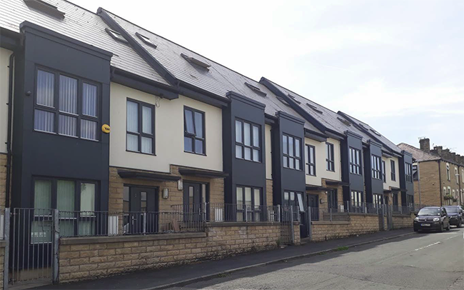
Photo – Housing, Burnley Wood
Starter Homes
5.1.19 Starter Homes are not currently defined as Affordable Housing. The Government’s new ‘Starter Homes’ were introduced in the Housing and Planning Act of May 2016, although the relevant provisions of the act are not yet in force. The Government also consulted on proposals for the implementation of the Act’s draft provisions in March 2016. The intention was for a statutory minimum requirement of 20% of units on sites of 10 units or more (subject to some exceptions) and these would be on site or off site through commuted sums in lieu where developers preferred. Starter Homes are homes for first time buyers to buy at a 20% discounted rate.
5.1.20 In December 2015 the Government also consulted on changes to national planning policy to amend the current definition of affordable housing to include Starter Homes. This intention was confirmed in the Housing White Paper of February 2017. The White Paper also set out some other changes to the definitions of affordable housing for consultation. The White Paper stated that the Government would not pursue the previously proposed statutory requirement for starter homes at the present time.
5.1.21 The Government subsequently consulted on proposals to change national policy so that regardless of viability consideration 10% of homes on housing schemes of 10 dwellings or more should be affordable (as per the new definition) (either on or off-site through commuted sums in lieu of on-site provision where ‘robustly justified’).41 Whilst the Council’s Local Plan Viability Study concluded that starter home provision in lieu of more traditional types of affordable housing would generally aid viability, this could still be an issue on brownfield sites. A rigid approach to the provision of affordable housing would be of great concern and could be at odds both with efforts to prioritise the development of brownfield sites and efforts to ensure the delivery of modern adaptable affordable homes to rent. Whilst the new approach most recently consulted upon by the Government would not specify the type of affordable housing that makes up the 10%, in Burnley, in most cases, starter home provision would preclude the delivery of affordable housing to rent or part rent/part buy.
5.1.22 Policy HS2 clauses 1) and 2) are sufficiently flexible to apply with or without the currently planned change in the definition of affordable housing. Clause 3) would however need to be read alongside any confirmed changes to national policy or legislation.
5.1.23 Policy HS2 allows for the affordable and starter home provision to be waived/varied and this is consistent with current national policy, and the Government’s intention for a minimum of 10% is not yet confirmed through a revised NPPF. It is considered that Burnley’s circumstances are such that greater flexibility is required in term of requirements, percentages and types.
Policy HS2: Affordable Housing Provision
1) The Council will work with public and private sector partners to seek to ensure that there is a sufficient supply of good quality affordable housing, particularly in the areas of highest need by:
- Supporting and facilitating the acquisition and adaptation of existing housing by registered providers;
- Working proactively with registered providers to identify sites and deliver schemes to provide affordable housing; and
- Requiring the provision of affordable housing through all housing developments of over 10 units, unless the applicant can demonstrate that a site, which would otherwise be supported by the policies in the Plan and meets the requirements of Policies SP4 and SP5, would not be viable with affordable housing provision on-site or off-site by way of a contribution.
2) The exact amount of financial contribution/number and tenure of affordable units will be determined by economic viability having regard to individual site and market conditions.
3) Any affordable housing required should be provided:
- on-site where this can be achieved without compromising other important policy considerations42 or viability; or
- off-site where on-site provision has been satisfactorily demonstrated not to be justified under i) and where it can be demonstrated that the contribution would facilitate the delivery of affordable housing of an appropriate type at a suitable policy-compliant site.
4) All new affordable housing should be designed to minimise indications of its tenure in order to facilitate inclusive communities. 5) Where affordable housing is being delivered, the Council will seek to ensure an appropriate tenure mix using the following percentages as a guide (and sizes and types as set out in Policy HS3).
- Affordable Rent or Social Rent: 80%
- Intermediate tenure: 20%
|
Housing Density and Mix
5.1.24 As set out in Section 2, Burnley has a high proportion of high density terraced housing stock, reflecting its industrial past.
5.1.25 If the Local Plan’s vision and objectives are to be achieved, increasing the quality and choice of the housing stock to meet both needs and the aspirations and to attract people to live and work in the borough, as well as to retain existing residents, is essential.
Housing Density
5.1.26 Paragraph 47 of the NPPF indicates that local planning authorities should set out their own approach to housing density to reflect local circumstances.
5.1.27 Burnley has an oversupply of high density housing, with some inner urban areas having concentrations of dwellings at a density of 100 dwellings per hectare. These are predominantly low rise ‘street’ terraces. Whilst high density development makes efficient use of land and can, therefore, limit encroachment both into the countryside and onto greenfield sites, as well as contributing to good quality and varied urban design, they do not always provide appropriate environments to suit all residents, especially those who wish to have a garden or convenient access and parking.
5.1.28 Past clearance of selected areas of high density 2-bedroom terraced properties has created an opportunity to provide lower density housing with gardens, off street parking, carefully designed bin storage, and improved green infrastructure in inner urban locations, whilst still retaining the character of the borough. Elsewhere, the Council wishes to maximise opportunities to provide lower density housing to improve quality and choice, subject to meeting other design and policy considerations. For allocated sites, indicative housing numbers have been set out which reflect the densities the Council considers appropriate. For other ‘windfall’ sites, the density policy set out in Policy HS3 will apply.
Housing Mix
5.1.29 Paragraph 50 of the NPPF clearly demonstrates the importance of delivering high quality homes and creating sustainable, inclusive and mixed communities by planning for a mix of housing based on current and future demographic trends, market trends and the needs of different groups in the community.
5.1.30 The 2016 SHMA identifies the need to diversify the current stock away from terraced properties towards larger, more aspirational detached and semi-detached dwellings; and that in order to compete against wealthier housing markets nearby and stem the tide of out migration of more affluent residents, development of higher quality 3-4 bed detached properties is required. It also recognizes, however, that a balance must be struck between the need to provide more aspirational property types, and the ability of residents to afford larger housing.
5.1.31 The SHMA provides a suggested housing mix by type and size as follows:
Table 3: Suggested Property Size and Type - 2016 SHMA
| Size |
All Tenures |
Affordable Housing |
| 1 bed flat |
40% |
70% |
| 2 bed flat / house / bungalow |
| 3 bed house / bungalow |
60% |
30% |
| 4 bed house |
| Semi-detached house |
35% |
35% |
| Detached house |
20% |
10% |
| Terraced house |
15% |
15% |
| Flat / Maisonette |
10% |
15% |
| Bedsit/Studio/Room Only |
0% |
0% |
| Bungalow/Elderly Housing |
20% |
25% |
| Caravan or temporary structure |
0% |
0% |
Burnley SHMA 2016
5.1.32 Providing a mix of new housing types across the borough is essential. Whilst each site will be assessed on its merits, taking into account its size, characteristics (including shape/landform) and context and townscape setting, as well as evidence of demand for the mix and type of dwellings it will be assessed against the proportions set out in Policy HS3 below as informed by the recommendation of the SHMA so that each site contributes as appropriate to meeting the overall borough-wide mix.
Policy HS3: Housing Density and Mix
Housing Density
1) New housing should make efficient use of land and be built at a density appropriate to its location and setting.
2) As a minimum, developments should seek to achieve 25 dph (dwellings per hectare gross43).
3) Higher densities of at least 40 dph (dwellings per hectare gross) will be expected within or close to the Town and District Centres, or where urban design and townscape considerations are considered to require a higher density approach. The density should be informed by the following site specific considerations:
- Its size;
- Its characteristics;
- Its context and townscape setting; and
- The likely marketability of the dwellings.
Housing Mix
4) All housing schemes on sites of 0.4 Hectares or for 10 units or more should consider a mix of housing types using the indicative proportions set out in the below. The precise mix should be informed by the following site specific considerations and the need to increase the quality and choice across the Borough:
- Its size;
- Its characteristics;
- Its context and townscape setting, and;
- The likely marketability of the dwellings.
|
| Property Type: |
Proportion: |
Size (bedrooms) |
| Detached |
20% |
3 to 4+ |
| Semi-detached |
35% |
2, 3, 4 |
| Terraced |
15% |
2 to 3 |
| Bungalow / accessible flat |
20% |
1, 2, 3 |
| Other flats / maisonette |
10% |
1, 2 |
Housing Developments
5.1.33 Our home and the places we live are important to the quality of life we all enjoy. Houses are often our biggest investment and are the places we spend more time than anywhere else. The design of new homes and streets has a fundamental impact not only on our daily lives, but also on the quality of our built environment and the sustainability or otherwise of our communities.
5.1.34 New residential development has an important role to play in the success of the borough in the future. Providing high quality housing is recognised as a key factor in promoting the growth of the borough’s economy.
5.1.35 The Plan’s overarching design policy is set out in strategic Policy SP5. Housing development should comply with the requirements of Policy SP5 in addition to the criteria set out in Policy HS4.
5.1.36 The Council’s Green Spaces Strategy and Play Strategy emphasise the importance of developing and maintaining sustainable quality open spaces and play spaces that integrate with the natural and built environment.
5.1.37 These strategies identify specific needs and quantitative or qualitative deficits or surpluses of publicly accessible open space, sports and recreational facilities. Policy IC5 protects the overall provision of public open space and play spaces. Policy NE2 seeks to protect those open spaces (be they publicity accessible or not) which are special. These may be supplemented by Local Green Space designations through Neighbourhood Plans.
5.1.38 Policy IC3 and Appendix 9 set out the parking standards for all types of new development including, housing schemes. Appropriate car parking should be provided in accordance with Policy IC3.
5.1.39 Adequate distances should be retained between buildings and particularly between habitable rooms of dwellings, to safeguard the privacy of occupiers of existing and proposed dwellings, to allow the admission of daylight and sunlight and to prevent cramped forms of development.
Custom and Self-build Housing
5.1.40 The Government is keen to enable more people to build their own homes. From April 2016, Councils have been required to keep a register of people who are interested in self or custom build housing, and plan accordingly to meet this demand. Applications for self-build and custom housing development will be judged against the relevant policies in the Plan and the nature of this type of housing will be a material consideration which weighs in its favour, particularly in the context of it increasing choice.44
Development of Residential Gardens
5.1.41 The NPPF indicates that local planning authorities should consider the case for setting out policies to resist inappropriate development in residential gardens. The NPPF defines residential gardens within built up areas as ‘greenfield’ land.
5.1.42 Private residential gardens make an important contribution to a settlement’s green infrastructure and to the character and quality of its residential areas. Concentrating development in sustainable locations, such as within urban areas, can increase pressure to develop on gardens and other ‘backland’ sites. Whilst such development can be acceptable, it can also adversely affect the character of an area, create overlooking and have an adverse impact on the local area e.g. through increased pressure for on-street parking and the loss of trees. Applications for new dwellings within residential gardens will be considered against Policy HS4 and other relevant policies of the Plan.
Adaptable Homes
5.1.43 As set out in Section 2, Burnley has an oversupply of high density terraced housing which can be difficult to adapt to suit the needs of some older residents and those with a disability, as there can be little scope for creating ground floor indoor bathrooms/toilets, ground floor bedrooms and introducing other adaptations. The modest increases to the overall housing stock planned means there are limited opportunities to provide new adaptable stock both in the market and affordable housing sectors. As indicated at paragraph 4.5.9 the Council considers there is sufficient justification to require a proportion of housing on major schemes to meet the optional technical standards of Part M4(2) of the Building Regulations 2010, and that schemes of more than 10 dwellings should provide at least 20% of dwellings designed to be adaptable to support the changing needs of occupiers over their lifetime, including people with disabilities.
Policy HS4: Housing Developments
- New housing developments should be high quality in their construction and design in accordance with Policy SP5.
- For schemes of more than 50 dwellings, planning applications should include a phasing plan which should include details of the proposed phasing, temporary works and security measures which should demonstrate an acceptable standard of development and amenity for early residents and existing adjacent residents.
- In addition, the Council will require new housing developments to:
- Provide private and functional outdoor space for occupants. For flats and mews/courtyard developments, outdoor space may be shared;
- Be well laid out to ensure habitable rooms45receive adequate levels of daylight; and
- Provide appropriate levels of privacy and outlook for occupants and for existing adjacent residents. Unless an alternative approach is justified to the Council’s satisfaction, the following privacy distances will apply:
|
| Type |
Situation |
Minimum distance |
| Single storey and two storey dwellings: |
Between facing windows of habitable rooms |
No less than 20 metres |
| Single storey and two storey dwellings: |
Where windows of habitable rooms face:46
- a blank gable; or
- other windows serving non-habitable rooms.
|
No less than 15 metres |
| Three storey dwellings/apartments or where levels creates a significant difference in heights |
For each additional storey above 2 storeys or where levels creates a significant difference in heights |
As above plus an additional set back of 3 metres |
Adaptable Homes
- For schemes over 10 dwellings, 20% of dwellings should be designed to be adaptable to support the changing needs of occupiers over their lifetime, including people with disabilities complying with the optional technical standards of Part M4(2) of the Building Regulations 2010.
Open Space provision in new housing development
- New housing developments will be required to provide or contribute to public open space provision as follows.
- Proposals for 50 dwellings or more will be expected to incorporate recreational public open space to a minimum standard of 0.3 Ha per 50 dwellings or a proportion thereof, in accordance with the Fields in Trust Standard of 2.4 hectares per 1,000 population; or exceptionally, provide or pay a contribution in lieu of part or all of the open space provision for the creation or benefit of existing public open space nearby.
- Proposals for new housing developments of between 10 and 49 dwellings will be expected to provide public open space in line with the above standard. Where such a public open space is impracticable or unusable the Council will negotiate with the developer the payment of a commuted sum for the benefit of existing Public open space nearby.
- Proposals for new housing development of between 5 and 9 dwellings will be expected to provide the payment of a commuted sum in accordance with the Council's published schedule of fees for the benefit of existing or proposed public open space nearby.
- As part of the overall recreational space requirement referred to in 5) above, developers of housing sites comprising predominantly family housing, will be required to provide 0.09 Ha (0.23 acres) of equipped children’s play space per 50 dwellings, or proportion thereof.
- Where public open space is provided in new housing development, it must normally be a single plot with a minimum functional size of 1,200m2 and be overlooked by adjoining properties. It should landscaped to a high standard of design and the space must be usable, and easily accessible by all residents, including those with disabilities, and provide a safe place to play and relax whilst not causing a nuisance to nearby residents. The type of open space should have regard to the local needs and standards for all types of open space set out in the Council’s Green Spaces Strategy.
- Landscaping works and the provision of play equipment and its future maintenance is the responsibility of the developer; where public open space is provided on-site, the developer will be expected to fund its maintenance for a period of at least 20 years, or put in place a sustainable scheme of management;
- Open space provision should be designed to deliver multifunctional benefits in particular by:
- Providing and contributing to a wider network of green infrastructure as set out in Policy SP6;
- Working with and retaining important existing landscape character, features, trees and habitats in accordance Policy NE1, 3 and 4;
- Contributing to the provision of Sustainable Drainage Systems in accordance Policy CC5.
- Public open spaces provided under this policy will subsequently be protected as Open Space under Policy NE2.
|
House Extensions and Alterations
5.1.44 Whilst many alterations and extensions to houses do not require planning consent, it is important that where they do they: respect the character and integrity of the original building and the streetscene in terms of their height, width, depth, building line, footprint, materials; retain useable amenity space; and do not have an detrimental impact on the amenity reasonably expected to be enjoyed by adjoining residents or other users.
5.1.45 Whilst some alterations and extensions can cause harm, they also offer the potential to improve the quality and character of the property and the streetscape. High quality matching or complementary materials should be used for extensions, appropriately and sensitively in relation to the context. This approach would not preclude proposals that are innovative or contemporary where these are of exceptional design quality and where these are fully justified where necessary through the design and access statement which should address the treatment of the existing property and effect on the streetscape.
Policy HS5: House Extensions and Alterations
1) Alterations and extensions, including roof extensions and the erection of buildings and structures within the curtilage of dwellings, should be high quality in their construction and design in accordance with Policy SP5. The Council will permit extensions and modifications to existing residential properties where:
- The extension is subordinate to the existing building, to allow the form of the original building to be clearly understood;
- The design respects the architectural characteristics, scale and detailing of the host building and its setting. High quality matching or complementary materials should be used, appropriately and sensitively in relation to the context. This would not preclude proposals that are innovative or contemporary where these are of an exceptional design quality;
- The proposal will not have an detrimental impact on the amenity reasonably expected to be enjoyed by the occupants of neighbouring properties through overlooking, lack of privacy or reduction of outlook or daylight, using the distances set out in Policy HS4 3)c);
- The proposal does not lead to an unacceptable loss of parking, both in curtilage or on street and does not create a danger to pedestrians, cyclist or vehicles; and
- The proposal does not lead to an unacceptable loss of useable private amenity space.
|
Agricultural and Rural Workers’ Dwellings
5.1.46 In order to support farm and other businesses appropriate to rural areas, the Council will permit new dwellings for rural workers where this is necessary. The Council will need to clearly establish whether the requirement for a new dwelling is genuine, whether it can be met by an existing dwelling on the holding or through the conversion of a building. Where a need for a new dwelling is successfully demonstrated, consent will be conditional on the dwelling remaining for occupation by a rural worker in perpetuity.
5.1.47 The Council has previously successfully used the now revoked national policy set out in Annex A of Planning Policy Statement 7: Sustainable Development in Rural Areas to determine the criteria for assessing housing development for use by rural enterprise workers. In the absence of new guidance from the Government following the publication of the NPPF, the Council will continue to use similar criteria.
5.1.48 In the context of this policy, the need relates to traditional rural activities such as agriculture, horticulture, forestry, fisheries, rural estate management, conservation etc.
Policy HS6: Agricultural Workers’ Dwellings
1) In the open countryside outside of the Development Boundaries, the erection of new dwellings in connection with a farm or other rural business will only be allowed where it satisfies other relevant policies of the Plan and meets all of the following criteria:
- Evidence has been submitted to the satisfaction of the Council that there is an existing functional need for a permanent dwelling in the particular location;
- The need relates to a full-time worker or one who is primarily employed in agriculture or another rural-based enterprise considered acceptable by the Council;
- The size of, and the accommodation to be included within the proposed dwelling, is commensurate with the needs of the enterprise rather than those of the owner or occupier and is well designed and well-related to existing agricultural buildings or other dwellings;
- The unit and the agricultural/rural activity concerned has been established for at least three years, has been profitable for at least one of them, is currently financially sound, and has a clear prospect of remaining so;
- The need could not be fulfilled by another existing dwelling or accommodation on the unit, or any other existing accommodation in the locality which is suitable and available for occupation, or through the conversion of an existing building; or through another suitable dwelling within the control of the applicant/enterprise which has been sold or let so as to prevent its occupation by the essential worker; and
- The development is in all other respects acceptable against other relevant policies in the Plan.
2) Conditions will be attached to any permission removing permitted development rights and limiting the occupancy to that required for the holding concerned or another agricultural/ rural use nearby. |
Gypsy, Traveller and Travelling Showpeople’s Provision
Establishing the Requirement
5.1.49 Research has shown that a lack of suitable sites, accommodation, and inadequate living conditions for the Gypsy and Traveller community are linked to poor health and educational attainment, as well as being at the root of ill-feeling between the settled and Traveller communities. By providing pitch provision for those who require them, these inequalities can be addressed. By ensuring an adequate pitch provision for Gypsies and Travellers, the likelihood of unauthorised encampments and associated costs to the Council can reduced.
5.1.50 The Housing Act 2004 placed a duty upon local authorities to produce assessments of accommodation needs for Gypsies and Travellers. This requirement was revoked by the 2016 Housing and Planning Act. The requirement to periodically review housing needs remains and this will include the needs of people residing in or resorting to their district “with respect to the provision of sites on which caravans can be stationed.”
5.1.51 Gypsy and Traveller needs for plan-making planning purposes can in future be assessed in the Council’s SHMA or in a separate assessment.
5.1.52 Current Government planning policy for Gypsies and Travellers is found in ‘Planning Policy for Traveller Sites’ (DCLG, 2015). This highlights that the traditional and nomadic way of life of Gypsies, Travellers and Travelling Showpeople should be facilitated while respecting the interests of the settled community. It indicates that planning authorities should use a robust evidence base to establish the likely permanent and transit accommodation needs of Traveller communities to inform the preparation of Local Plans. In order to achieve this, they should work with Travellers, their representative bodies, local support groups and other local authorities.
5.1.53 Based on any need identified, Gypsy and Traveller pitch targets and Travelling Showpeople plot targets should be set, and a supply of specific deliverable sites sufficient to provide five years’ worth of provision detailed. Additionally, a supply of specific, developable sites or broad locations for growth for years 6 – 10 and, where possible, years 11 – 15 should be identified.
5.1.54 In May 2012, Burnley and Pendle Borough Councils commissioned the Housing and Urban Studies Unit at the University of Salford to produce a Gypsy, Traveller and Travelling Showpeople Accommodation Assessment (GTAA). The main purpose of this assessment was to provide up to date information about the needs and requirements of travelling communities within the two boroughs in accordance with the definitions of these communities as set out in national policy at the time. The results of this research are shown in column A of Table 4.
5.1.55 In 2015, following the updated Planning Policy for Traveller Sites, the definition of Gypsies and Travellers for planning purposes changed to: “Persons of nomadic habit of life whatever their race or origin, including such persons who on grounds only of their own or their family’s or dependents’ educational or health needs or old age have ceased to travel temporarily, but excluding members of an organised group of travelling showpeople or circus people travelling together as such”. In light of this change, only those members of the Gypsy and Traveller community who still travel, or can be reasonably said to intend to live a nomadic lifestyle in the future, require their needs to be specifically and separately addressed in the Local Plan. For those who don’t, their needs, requirements and demands, including for caravan living would be addressed along with those of the non-traveller community through the SHMA.
5.1.56 The survey results from the 2012 GTAA have been revisited47 to reassess the need on the basis of the new definition, and the revised figures are shown in column B, below. This table shows the actual known need based on the survey results.
Table 4: Requirement for Gypsy and Traveller Pitches 2012 - 2026
| Time Period |
A: 2012 GTAA |
B: 2016 GTAA Addendum |
| |
Need/Pitches |
Need/Pitches |
| 2012 - 2016 |
22 |
4 |
| 2017 - 2021 |
3 |
1 |
| 2022 - 2026 |
3 |
0 |
| 2012 - 2026 |
28 |
5 |
Identifying Sites
5.1.57 In accordance with national policy, Local Plans have to identify land for allocation to meet any identified need for Gypsy and Traveller pitches. This matter is proposed to be addressed in a separate Gypsy and Traveller Sites Allocations DPD. Policy HS8 sets out criteria for responding to planning applications for Gypsy and Traveller Sites by establishing criteria’s against which applications can be judged. These provisions would apply to proposals to meet both the identified needs or demands of people who satisfy the current definition of Gypsies and Travellers.48 For those who don’t but wish to live in residential caravans, such proposals would be judged against the other policies relevant to housing development.
5.1.58 The 2012 GTAA made no specific recommendation regarding the provision of transit pitches in the borough. Transit pitches are generally designed for short stays only for those who were actively nomadic with no base or with a base elsewhere. They tend not to have the facilities of permanent pitches. The revised definition of ‘Gypsy and Traveller’ means that all five proposed permanent pitches will be required by those who still travel or intend to resume travelling in the future. However, these pitches could also be designed to be used for longer term accommodation as the definition allows.
5.1.59 The selection of sites for Gypsies and Travellers pitches should follow similar locational criteria to the selection of housing sites for the settled community. However, there are specific aspects of Gypsies and Travellers cultural traditions and preferences which need specific consideration, such as the preference for living in a caravan or working from home and the need to provide space suitable for both sustained periods of settled living whilst also facilitating a nomadic lifestyle. These factors need to be borne in mind when selecting sites.
5.1.60 Sites should be well designed and sympathetic to the local landscape/townscape. The use of soft landscaping on the edge of sites is encouraged even where security fences or walls may be required. Sites must be of a sufficient size to allow for this.
Assessing Further Need and Sites
Site Criteria
5.1.61 In assessing any future planning applications for ‘windfall’ caravan pitches for Gypsy and Traveller occupation to meet identified or newly arising need or demand, the suitability of the site and its impacts on the landscape or townscape need to be considered. Sites should be located close to local services and facilities.
5.1.62 It is important that site activity and usage does not have an adverse impact on existing residents e.g. from issues such as noise, fumes, or vehicular movements. Sites and proposals should to meet highway safety standards, especially in relation to the manoeuvring of large vehicles and trailers.
5.1.63 Caravan sites can be difficult to successfully integrate into the townscape, particularly in residential areas; and whilst the location of new caravan sites should be within the Development Boundaries set out in Policy SP4, where unmet need or demand exists, the Council would consider sites close to, but not necessarily within, existing settlements/Development Boundaries where these remain close to essential services.
5.1.64 Careful consideration should be given to how a site can deliver adequate living standards to residents. This includes provisions for power, water, drainage, sewage and waste disposal facilities.
5.1.65 Proposals will be favourably considered where they satisfy other relevant policies of the Plan e.g. those protecting heritage assets of nature conservation sites and meet the criteria set out in Policy HS7 below.
Policy HS7: Gypsy and Traveller Site Criteria
1) Where there is an identified need or a demand for the provision of transit and permanent pitches for Gypsy or Traveller use or plots for Travelling Showpeople49; proposals will be favourably considered where they satisfy other relevant policies of the Plan and meet the following criteria:
- The site is within or closely related to the Development Boundaries identified under Policy SP4;
- The proposed site is suitable for use as a Gypsy, Traveller or Travelling Showperson’s site and can provide an acceptable living environment for future occupiers;
- The site is not subject to physical constraints or other environmental issues that cannot be mitigated to an acceptable level, or that would impact upon the health, safety or general wellbeing of residents on the site;
- The site is or can be well integrated within the local townscape in a manner in-keeping with the local character, using boundary treatments and screening materials which are sympathetic to the existing urban/rural form;
- Good levels of acoustic and visual privacy can be achieved for both residents and adjacent occupiers. Proposals should include appropriate landscape measures to minimise adverse visual impact and to ensure adequate levels of privacy and residential amenity for occupiers and adjacent occupiers that avoid the use of high walls and fences;
- The site does not accommodate non-residential uses that would cause, by virtue of smell, noise or vibration; a significant adverse impact on neighbouring business or residents;
- The proposal does not cause demonstrable harm to the quality and character of the landscape or townscape in accordance with the requirement of Policies NE3 and SP5;
- The proposal does not have an adverse impact on a locally important nature conservation site in accordance with Policy NE1;50
- The proposed site is or can be made accessible to key local services such as primary schools, GPs, shops and other community facilities;
- The site has good access to the highway network and satisfactory provision is made for access, parking, manoeuvring and storage of cars, vans and trailers; and
- The site has, or could readily be provided with, electricity, mains water, drainage, sewage and waste disposal facilities.
2) The development of new Gypsy or Traveller sites will not be permitted in the following locations:
- Within the Green Belt;
- On the best and most versatile agricultural land;
- Within or adversely affecting an SSSI/SAC/SPA, Protected Open Space; or
- Within Flood Zones 3a & 3b or 2.
|
Local Gypsy and Traveller Occupancy
5.1.66 Planning applications for allocated or ‘windfall’ sites for Gypsy and Traveller usage will normally be subject to a condition restricting occupancy to those Gypsies and Travellers with a local connection. This will safeguard pitches for those leading, or intending to resume a nomadic lifestyle as identified within the GTAA, rather than allocations being used to accommodate unmet need from other areas, or demand from non-traveller households. These occupancy restrictions will only apply to sites which have been granted planning permission specifically to meet Gypsy and Traveller needs. For other residential caravan sites that have been judged acceptable against other policies, occupancy restrictions of this type would not be appropriate.
5.1.67 Local connection means:
- someone currently residing in Burnley borough who has done so for three of the past five years; or
- someone with close family (defined as mother, father, sister, brother, adult children and corresponding step relatives) who have resided in the borough for the last five years; or
- someone currently in permanent paid employment of at least 16 hours per week in the area or who has a confirmed offer of employment; or
- military personnel as defined in the Allocation of Housing (Qualification Criteria for Armed Forces) (England) Regulations 2012.
Policy HS8: Gypsy and Traveller Site Occupancy Condition
1) Planning permissions for allocated or appropriate ‘windfall’ sites, where these are granted specifically for Gypsy and Traveller use, will be subject to conditions restricting occupancy to:
- Gypsies and Travellers who practice a travelling lifestyle51; and
- Gypsies and Travellers who can demonstrate a local connection.
|
Policies in this Section:
| EMP1: Employment Allocations |
EMP5: Rural Business & Diversification |
| EMP2: Protected Employment Sites |
EMP6: Conversion of Rural Buildings |
| EMP3: Supporting Employment Development |
EMP7: Equestrian Development |
| EMP4: Office Development |
< Previous | ^ Top | Next >