
8.1 The Council has completed a level 1 Strategic Flood Risk Assessment (SFRA) that assesses the spatial distribution and magnitude of flood risk at the borough-wide scale. The level 1 SFRA reveals that one of the greatest sources of flood risk in the Borough is fluvial flooding, i.e. originating from rivers and watercourses. Enfield has a number of these, including the River Lee Flood Relief Channel, the River Lee itself and a number of its tributaries. In addition, there are risks of flooding from surface water, ground water, sewers and reservoir overtopping.
8.2 Level 2 SFRAs are being undertaken at southern Brimsdown, Meridian Water and Enfield Town. These will provide more detailed information to inform the management of the identified flood risk in these areas. In addition to the level 2 SFRAs, a pan-London project is being undertaken though the Drain London Forum1 to create a Surface Water Management Plan (SWMP) for Greater London.2 Enfield Council's Emergency Planning Team have produced a Draft Multi-Agency Emergency Flood Plan,3 in partnership with the Metropolitan Police, Met Office, London Fire Brigade, Enfield PCT, the Ambulance Service and the Environment Agency. The Plan identifies communities and key infrastructure sites potentially at risk of flooding, and the actions, roles and responsibilities of the relevant agencies in response to a widespread flooding event.
8.3 The Lee Flood Relief Channel protects significant parts of Enfield from fluvial flooding. Nevertheless, the Channel almost reached full capacity in 1987, 1993 and 2000 and significant residual risk remains. There have been a number of recent flood incidents, particularly affecting the Eley’s Estate, Montagu Road and Grange Park. Enfield Island, Grange Park and Upper Edmonton (including the Lee Valley Trading Estate) are identified as being at particular risk4 and increasing urbanisation and climate change will result in some areas being at greater risk of flooding in the future. A major challenge for the Borough is that the areas of greatest flood risk are also those with the greatest opportunities for development, growth and regeneration.
CORE POLICY 28 MANAGING FLOOD RISK THROUGH DEVELOPMENT The Council will take a risk-based approach to development and flood risk, directing development to areas of lowest risk in accordance with Planning Policy Statement 25: Development and Flood Risk. However:
The Sequential Approach, Exception Test, and all other requirements of PPS25 will still need to be applied to individual developments. Given that there is likely to be redevelopment within the floodplain, there will be increased emphasis on innovative, flood resistant and resilient design, including a requirement to normally set back development from the watercourse. Sustainable Drainage Systems (SUDS)6 will be required in all developments, irrespective of the flood risk at individual development sites. Developments proposed in areas identified as being at risk from surface or groundwater flooding (in level 1 and/or 2 Strategic Flood Risk Assessments and in any subsequent surface water management plans) will be required to demonstrate that further investigation of the extent of risk, and the feasibility of options for prevention or mitigation, have been considered. |
Justification
8.4 The PPS25 Practice Guide7 acknowledges that flooding is one of many considerations when deciding on the best location for development. The Upper Lee Valley lies within the London- Stansted- Cambridge- Peterborough growth corridor and is identified as an Opportunity Area within the London Plan. Furthermore, the Sustainability Appraisal that accompanies the Core Strategy recognises that there may be overriding social and economic reasons for development in these locations. In order to meet wider sustainability objectives, in particular the need for housing supply and transformational change in this deprived area, it is not possible to meet development objectives while completely avoiding areas of flood risk. A Sequential Test8 has been carried out in accordance with PPS25 and in discussion with the Environment Agency. The conclusions of this Test support the Council's approach to development in the area.9
8.5 The Lee Valley contains employment land that is safeguarded as Strategic Industrial Locations (SILs) at Brimsdown, Central Leeside and Great Cambridge Road that are identified as being of strategic importance in the London Plan. Many of these areas are at risk of flooding. However, there are no opportunities to re-locate them to areas of lower risk and there is significant financial capital and embodied energy invested in existing infrastructure. Therefore the most sustainable option is to maximise the social and economic contribution of the employment offer, through encouraging intensification and diversification,10 while using redevelopment opportunities to reduce flood risk overall.
8.6 Growth and “urban creep” outside of the floodplain has a significant and cumulative impact on flood risk elsewhere. Planning Policy Statement 25 (2006), the London Plan (2008) and the emerging Thames Catchment Flood Management Plan (TCFMP) state the need to reduce flood risk where possible and the use of Sustainable Drainage Systems (SuDS) is cited as a primary means of achieving this. Enfield’s level 1 Strategic Flood Risk Assessment (SFRA)(2008) also recommends standards for the use of SuDS in all developments and set-backs are recommended by both the Environment Agency and in Section 4 of the London Plan.
8.7 The level 1 SFRA identifies areas that may be at risk of groundwater flooding and recommends that measures be taken to investigate and reduce this risk. Level 2 SFRAs will investigate further the presence of surface water flood risk and make recommendations for where further site-specific investigations may be necessary.
Implementation
8.8 Area action plans are being prepared for both North East Enfield and Central Leeside, and further work is being undertaken within the strategic growth areas of Ponders End and Meridian Water respectively. This more detailed work will be informed by the level 2 Strategic Flood Risk Assessments and will identify development sites and the quantum and type of development needed. Masterplanning exercises and development briefs will ensure that flood risk is considered at an early stage, at an appropriate scale, and in close consultation with the Environment Agency. Sequential Tests will be conducted to ensure proposals are in accordance with PPS25, and flood risk assessments for individual development proposals will need to demonstrate that development is safe.
8.9 The Development Management DPD and Enfield Design Guide SPD will set out Borough-wide standards and guidance respectively for managing flood risk through development, including those relating to:
8.10 More detailed, location-specific guidance will be provided where necessary.
Monitoring and Targets
8.11 The number of planning permissions granted contrary to the advice of the Environment Agency on flood and water quality grounds will be monitored, to achieve a target of no planning permissions granted that are contrary to the advice of the Environment Agency.
8.12 The number of properties at risk of flooding will be monitored to achieve an overall reduction of flooding.
CORE POLICY 29 FLOOD MANAGEMENT INFRASTRUCTURE The Council will continue to work closely with key partners such as the Environment Agency, Thames Water and British Waterways to maintain and enhance the Borough’s existing flood defence infrastructure in the medium to long term. The Council will support flood risk management projects, (including the Salmon’s Brook Flood Alleviation Scheme), and will require that opportunities for multiple benefits are maximised (for example, resulting in increased biodiversity, access to waterways and recreation). As details of projects become available, the Core Strategy and/or other development plan documents as appropriate will be reviewed in consultation with the Environment Agency, to ensure their successful delivery (for example by safeguarding the required land). Proposals that compromise the function of existing, or planned, flood risk management infrastructure will normally be resisted. Opportunities for removal of culverts, river restoration and naturalisation should be considered as part of any development adjacent to a watercourse. Additional culverting and development of river corridors will be resisted. Development behind existing defences will be expected to reduce residual flood risk and works to open spaces within the floodplain or adjacent to watercourses elsewhere should explore opportunities for floodwater storage, river restoration and wetland creation. There may be particular opportunities for such projects in the Lee tributaries.11 Innovative responses to flood risk will be encouraged and explored as part of the transformation of Meridian Water and Central Leeside.12 |
Justification
8.13 The Environment Agency's emerging TCFMP and Lower Lea Flood Risk Management Strategy (LLFRMS)13 both support the maintenance of the existing defences within the Lower Lee catchment, as does London Plan Policy 4A.13.
8.14 There are a number projects for which sustainable flood risk management is a key theme, that are outlined in the emerging LLFRMS and in the London Rivers Action Plan14 but that are currently in the very early stages of development. The LDF will need to take account of the requirements of these projects as their delivery mechanisms and details of their design become more certain. All schemes will reduce flood risk in their immediate vicinity as well as elsewhere in the Borough, and so will be supported wherever possible. However, it is important that flood management projects take full advantage of the potential for multiple benefits and that the social, economic and environmental implications are assessed.
8.15 Although existing defences are to be retained in the short-medium term, the cost of maintaining these defences is likely to increase and they will become less effective, partly as a result of climate change, which will mean an increase in flood risk in many locations. The emerging TCFMP and Lower Lee Flood Risk Management Strategy, Planning Policy Statement 25 (2006) and section 4 of the London Plan (2008) require consideration of this issue. Therefore, the long-term aim should be their removal and a return to a more natural flooding regime as set out in the London Rivers Action Plan. For these reasons, the reduction of flood risk behind defences as areas are redeveloped is a key aim of the TCFMP. Attenuation of water in open spaces forms part of this strategy and is also recommended in PPS25.
Implementation
8.16 The maintenance of existing flood defence infrastructure is the responsibility of the owner of the asset in question, and the Environment Agency have powers to intervene where necessary. The Council will ensure that neither its activities, nor development which it approves, will preclude the ability of owners or the Environment Agency to carry out this function.
8.17 Flood management projects will be supported through any area action plans within which the proposal falls. Where necessary, the Core Strategy may be reviewed to protect the required land.
8.18 The Development Management DPD will set out the circumstances under which river restoration activities will be required as part of development and where the creation of storage areas in open spaces should be pursued. The reduction of flood risk to developments behind existing defences will be assessed through site-specific flood risk assessments.
8.19 Policies relating to strategic growth areas and other specific site allocations will be contained in the appropriate DPD where that allocation is made.
Monitoring and Targets
8.20 The progress of flood alleviation schemes and river restoration works will be monitored to achieve the individual targets relevant to each scheme.
8.21 New planning permissions will be monitored to achieve a target of no new culverts being granted planning permission in the Borough.
8.22 Enfield is a diverse borough, consisting of a mosaic of distinctive character areas. These include large areas of open, green land in the north west; relatively dense urban areas in the south east; and a number of distinct local centres built around historic settlements. The various character areas are discussed further in the London Borough of Enfield Characterisation Study (2008). A key aim is to build on the positive characteristics of the Borough, while addressing those areas and issues that would benefit from improvement.
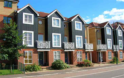
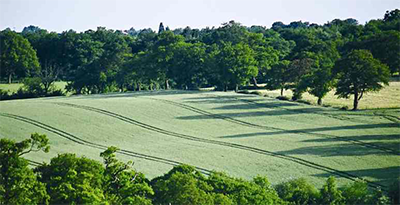
Figure 8.1 Thorneycroft Drive Enfield Island
CORE POLICY 30 MAINTAINING AND IMPROVING THE QUALITY OF THE BUILT AND OPEN ENVIRONMENT All developments and interventions in the public realm must be high quality and design-led, having special regard to their context. They should help to deliver Core Policy 9 (Supporting Community Cohesion) by promoting attractive, safe, accessible, inclusive and sustainable neighbourhoods, connecting and supporting communities and reinforcing local distinctiveness. The Council will: • Adopt Borough-wide standards and guidance relating to design quality, including:
• Build on and extend the Enfield Characterisation Study to investigate wider urban design issues and identify:
Tailored design standards and guidance will be prepared to:
|
Justification
8.23 The need to secure high quality places through good design is set out in PPS1 (Delivering Sustainable Development), PPS3 (Housing), PPG15 (Planning and the Historic Environment), and in section 4B of the London Plan. The Planning Act (2008) also requires that bodies preparing Local Development Documents must have regard to the desirability of achieving good design. The Council fully supports these aims and will incorporate local interpretations of the principles set out in key texts such as “By Design: Urban Design in the Planning System: Towards Better Practice” (Commission for Architecture and the Built Environment, 2000) and the “Urban Design Compendium” (The Housing Corporation and English Partnerships, 2007).
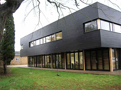
Figure 8.2 Abercrombie Building at Myddelton House, Freezywater
8.24 The national and regional imperative for high quality, design-led development needs to be implemented at the local level. Enfield's Characterisation Study identifies a number of broad issues affecting the quality of the environment (such as the loss of street greenery, architectural detailing, boundary treatments and the visual impact of parking in front gardens, poor highway and public realm quality including street furniture and the poor quality of many new buildings and alterations) that need to be addressed. In addition, Enfield has a extensive boundary between the greenbelt and urban environment and this needs to be managed to protect the qualities of both areas. Similarly, we have a wealth of blue and green assets which have the potential to make a much greater contribution to people's quality of life, especially concerning the Lea Valley Regional Park and waterways. However, further work is needed to provide a robust evidence base to identify location-specific priorities for action. This Core Policy therefore sets out a commitment to this work, to inform area action plans, the Development Management DPD, the Enfield Design Guide Supplementary Planning Document and future reviews of the Core Strategy.
8.25 Reference is made to the potential of the Upper Lee Valley Opportunity Area and the strategic growth areas it contains, to accommodate tall buildings, which have the potential to act as landmarks and beacons of regeneration. This potential is highlighted in the London Plan (Policies 2A.5 and 4B.9) and emerging Upper Lee Valley Opportunity Area Planning Framework. However, these benefits may equally be achieved through other means and the suitability of these areas for tall buildings may depend on the provision of sufficient transport infrastructure and a more detailed analysis of the potential impacts on their surroundings including local character, in accordance with Policy 4B.1 of the London Plan. Therefore, areas appropriate, sensitive or inappropriate for tall buildings will be considered in the Development Management DPD, and more detailed work will be conducted to inform proposals in relevant area action plans. This will be informed by the work set out above.
Implementation
8.26 An Urban Design Agenda is currently in the later stages of production. This document sets out the Council's plans for delivering high-quality, sustainable development and public realm through urban design. As part of this process an Urban Design Charter will be produced that will formalise the Council's commitment to good urban design and a more detailed Urban Design Strategy to identify key principles and priorities.
8.27 To inform this work, the Council will build on the Enfield Characterisation Study to identify both areas and characteristics of the Borough that warrant protection, as well as areas where improvements are desirable. Outcomes and recommendations from this study will be reflected in revisions to the Core Strategy, in area action plans and in the Enfield Design Guide SPD and the Development Management DPD.
8.28 Planning briefs will continue to be produced, with input from relevant Council departments. In addition, a Streetscape Policy and Guidance document is being produced to ensure that highways interventions support the Council's aspiration for consistently high quality public realm.
Monitoring and Targets
8.29 The Council's Urban Design Strategy and Charter is to be adopted in 2010/11, following which a review of relevant DPD documents will be undertaken.
8.30 On publication of the Enfield Design Guide Supplementary Planning Document, if necessary relevant DPD documents will be reviewed.
8.31 On publication of the extension to the Enfield Characterisation Study, if necessary a review of the relevant DPD documents will be undertaken.
8.32 Enfield’s Heritage Strategy (2008) defines heritage as: “all inherited resources which people value for reasons beyond utility”, including those resources described as natural, historic, material culture, intangible (e.g. language) and community-based (e.g. faith, and special interest groups). The Borough is rich in tangible heritage assets including:
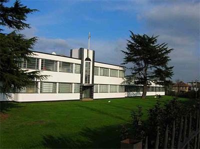
Figure 8.3 The Crescent, Hertford Road Edmonton

8.33 However, intangible heritage assets have been neglected in the past because they are less easily defined and the mechanisms for protection less obvious.
CORE POLICY 31 BUILT AND LANDSCAPE HERITAGE The Council will implement national and regional policies and work with partners (including land owners, agencies, public organisations and the community) to pro-actively preserve and enhance all of the Borough's heritage assets. Actions will include:
|
Justification
8.34 Protecting the distinctive characteristics of the Borough arising from its historical development is an objective of Enfield's Sustainable Community Strategy (2009 – 2017). The need for the protection of the historic environment and the many benefits this brings are set out in national planning policies PPG15 Planning and the Historic Environment, and PPG16 Archaeology and Planning. Regional policies are set out in section 4B of the London Plan.
8.35 Enfield's Conservation Area Character Appraisals document how the gradual erosion of traditional features, materials and details in both the public and private realm is undermining the special character of many of the Borough’s conservation areas. A more proactive approach is needed to halt and reverse this trend, and to reinstate these features as part of replacement works.
Figure 8.4 MAN (former Ripaults factory), Southbury Road Enfield
8.36 The Conservation Area Character Appraisals, Management Proposals and Enfield's Characterisation Study indicate that a number of historic buildings and areas are of distinctive quality, but do not meet the criteria for either statutory listing or designation. This is reflected in a number of applications for adding buildings to the statutory list that have been unsuccessful due to the state of their interior, but where the exteriors nonetheless make a valued contribution to the townscape and historic character of the area beyond that of being part of a coherent group.
8.37 The Council's Heritage Strategy states that, where possible, historic assets should be accessible for all to enjoy and that they can make a positive contribution to education, recreation and tourism.
Implementation
8.38 The architectural and historic interest of conservation areas will be proactively enhanced through the Conservation Area Management Proposals, which are specific to each area and will be regularly reviewed. The Review of Conservation Area Designation Guidance sets out formal criteria for the designation of conservation areas in the Borough. Proposals for new conservation areas, and reviews of existing areas will be judged against these criteria as necessary.
8.39 The Development Management DPD and Enfield Design Guide SPD will set out standards and guidance necessary to preserve and enhance Enfield's heritage assets. Where necessary, standards/guidance will be area-specific, as informed by the most up to date Conservation Area Character Appraisals and Management Proposals.
8.40 In addition, Enfield's Heritage Strategy sets out a number of actions which will enhance the Borough's heritage offer through: the winning of grants and funding for the protection and enhancement of individual assets; investment in the museum service; actively engaging the community to identify and protect examples of material culture and intangible heritage assets; becoming a a signatory to the Learning Outside the Classroom Manifesto; and actively engaging with learning providers to maximise the potential of Enfield's heritage as a learning resource. Finding solutions for buildings at risk must be conducted on a case-by-case basis, but progress is already being made in this regard, for example through the recent grant funding allocation to find a viable solution for the restoration and future use of Broomfield House.
8.41 Further work, to build on the existing Characterisation Study is already planned as described in Core Policy 30. This work will also assess and define important historical landscapes including the existing Area of Special Character. Monitoring and Targets
8.42 The number of buildings on English Heritage's Heritage at Risk Register will be monitored and the Council will work with partners to reduce the number of assets at risk in the Borough.
8.43 Conservation Area Appraisals and Management Proposals will be reviewed, with the next round of reviews due to commence in 2011. Following their publication, if necessary the relevant DPDs will be reviewed.
8.44 Enfield, in common with other urbanised areas, has to contend with pollution in its various guises, namely: air; water; noise; light pollution; and the risks associated with contaminated land and hazardous substances. Planning and other environmental regulatory regimes help to ensure that pollution and its associated risks are considered and minimised. The Council, working with its partners, will continue to place a strong emphasis on the prevention of environmental problems.
8.45 Together with other policies in this Plan, including those supporting and encouraging sustainable and efficient land use through the spatial strategy, energy, flooding, sustainable design and construction, and sustainable transport, this strategic policy will contribute towards reducing the impacts and incidence of pollution.
CORE POLICY 32 POLLUTION The Council will work with its partners to minimise air, water, noise and light pollution and to address the risks arising from contaminated land and hazardous substances. In particular, new development will be required to: Improve air quality by reducing pollutant emissions and public exposure to pollution, particularly in areas identified as having poor air quality in the Air Quality Action Plan. Criteria for assessing applications will be set out in the Development Management Document. The area action plans, particularly the North Circular Area Action Plan, will consider how pollution can be reduced or successfully mitigated against at a local level; Ensure that water quality will not be compromised, and to secure, where appropriate, improvements to water quality. The Council will work with partners, particularly the Environment Agency, to seek improvements to the water environment in adherence with the Water Framework Directive and as per the programme of measures set within the Thames River Basin Management Plan; Ensure that noise and light pollution is minimised; Address the risks arising from contaminated land through land remediation so that it is suitable for the proposed end use. Proposals on or in the vicinity of potentially contaminated land will be assessed according to criteria set out in the Development Management Document; and Assess and minimise the risks associated with establishments where hazardous substances are or have been used and stored, and the location of new development in the vicinity of these establishments, such as gasholder installations in the strategic growth areas. |
Justification
8.46 Poor air quality damages health and reduces quality of life, particularly affecting the most vulnerable in society. This policy approach is in line with national policy, the London Plan and the Mayor's Strategies for Air Quality and Noise , and is supported by sustainability appraisal objectives. The aim to reduce air pollution is a European, national and regional policy objective. The whole of the Borough of Enfield is declared an Air Quality Management Area (AQMA) for the pollutants Nitrogen Dioxide (NO2) and Fine Particles (PM10).
8.47 The Council has prepared an Air Quality Action Plan (2003) which identifies that road traffic is a major contributor to air pollution, and also notes a minor contribution from industry. The Air Quality Action Plan showed that the problems of air pollution are particularly marked alongside the Borough’s major roads, including the A406, A10 and Bullsmoor Lane. However, given the nature of air pollution, consideration of the issue needs to be applied to the Borough as a whole. An air quality modelling update is currently being undertaken for the seven North London boroughs, which provides a borough-wide air quality assessment of NO2 and PM10, as well as a detailed scenario on the North Circular Road. The aim is to predict NO2 and PM10 concentrations based on detailed dispersion modelling of road traffic emissions for the baseline year 2007. The modelling will provide information on areas that are likely to exceed the Air Quality Standard objectives and outcomes when known will inform any update of the Air Quality Action Plan.
8.48 The sources of water pollution and consequent poor water quality can be from a single source, or from diffuse sources, such as from agricultural and urban runoff. Environment Agency water quality monitoring data shows that there is room for improvement in Enfield's water environment. The EU Water Framework Directive (WFD) provides the opportunity to work with partner organisations, particularly the Environment Agency, to improve the whole water environment and promote the sustainable use of water for the benefit of both people and wildlife. It sets out the aim to achieve good status for all inland (surface and groundwater) and coastal waters by 2015. River Basin Management Plans (RBMP) are being prepared in order to set out environmental objectives and standards, and a programme of measures by which this aim can be achieved. The Thames River Basin Management Plan is expected at the end of 2009 and will inform the Core Strategy and area action plans.
Figure 8.5 Pymmes Brook, Arnos Park New Southgate

8.49 Water quality can be improved through a number of measures including the effective design, construction and operation of sewerage systems and sewage treatment plants, the use of wetlands/greenspace for flood alleviation, and the use of SUDS to reduce the impact of intense rainfall events. Some of these measures can be taken forward through the planning system and are covered in other sections in this document.
8.50 Noise and light pollution are emerging as pollution issues which need to be considered, especially in an urban context. The sustainability appraisal identifies a need to improve noise environments in Enfield, especially for housing, schools, hospitals and other noise sensitive uses; and to protect and enhance the tranquillity of open spaces, green networks and the public realm. Planning Policy Guidance (PPG) 24 and the London Plan seek to minimise the adverse impacts of noise, and maintain or enhance soundscape quality through sensitive design, management and operation. National planning guidance in PPS1 and PPS23 refers to the need to reduce light pollution from new development.
8.51 The Council has a responsibility to identify contaminated land and ensure that it is managed in an appropriate manner, as set out in the Environmental Protection Act 1990 and PPS23. The Council completed a Contaminated Land Inspection Strategy in 2001 and holds a Contaminated Land Register. The Strategy set out a phased programme of inspection which consisted of:
8.52 A review of the Contaminated Land Inspection Strategy was completed in 2007 and all the sites identified as potentially contaminated sites have now been inspected; no sites have been determined as meeting the statutory definition of contaminated land. However, the review mechanisms for the Strategy acknowledge that re-inspection of sites identified may be necessary for example, if the use of a site has changed.
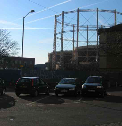
8.53 Hazardous substances legislation15 aims to prevent major accidents and limit the consequences of such accidents. As part of the planning process, with advice from the Health and Safety Executive (HSE), the Environment Agency, and any other appropriate agencies, risks associated with establishments where hazardous substances are used and stored and development within the vicinity of these establishments can be considered and minimised. Development on sites within set proximity to gasholder installations are subject to HSE advice. There are gas holder installations within the proposed strategic growth areas. Where these have been found to be surplus to requirements, the relevant area action plans will include a co-ordinated strategy to bring forward and realise their development potential.
Figure 8.6 Gas holders at Ponders End
Implementation
8.54 The Development Management DPD will set out the criteria against which applications for potentially polluting developments and developments near to polluted or potentially polluted sites will be considered, including the need for the impact assessments to be undertaken when appropriate. The Development Management DPD will also consider the criteria against which applications for proposals on or in the vicinity of potentially contaminated land will be assessed.
8.55 The Enfield Design Guide Supplementary Planning Document will provide advice on minimising light pollution through encouraging the use of lighting that is energy efficient and minimises light scatter.
Monitoring and Targets
8.56 The Borough's river quality will be monitored to achieve a percentage increase in Enfield's rivers or canals rated as 'fair' or better in terms of their chemical/biological water quality.
8.57 Air quality levels will be monitored (average NO2 and PM10 levels mg/m3) and the geographical areas of Enfield where air quality objectives are exceeded, will be expanded.
8.58 Almost a third of open land in Enfield is designated as green belt, contained in a green arc that wraps around the north and east of the Borough. This significant green asset is important for several reasons: its contribution to the overall suburban and rural setting; the opportunities it provides for access to the open countryside, for outdoor sport and recreation; and for other diverse uses including agriculture, nature conservation and historic significance.
Figure 8.7 Greenbelt
8.59 Although the green belt is an important part of the open space network, regard needs to be had to the different range of uses undertaken within it. For example, in the west of the green belt, farming has played an important role in creating and maintaining an attractive agricultural landscape, whilst the east lies predominantly within the Lee Valley Regional Park, with its associated waterways and leisure activities. Enfield has a strong horticultural tradition with a distinctive area of nurseries and garden centres centred around the Crews Hill area and the nationally renowned Capel Manor Horticultural College.
8.60 Within the green belt there are two major developed sites: Middlesex University's Trent Park campus and the Picketts Lock leisure complex.
8.61 Proposals for development in the green belt will generally be assessed according to national and regional guidance as set out in Planning Policy Guidance Note 2 (PPG2): Green Belts and the London Plan. As suggested in national and regional guidance, the Borough's role through the LDF process is to identify and provide evidence for any alterations to the green belt boundary.
CORE POLICY 33 GREEN BELT AND COUNTRYSIDE The Council will continue to protect and enhance Enfield’s green belt. The strategic green belt boundary is shown on the Proposals Map. Proposals for changes to the detailed boundary at the local level will be brought forward as part of the Development Management Document subject to criteria set out in Planning Policy Guidance 2 and reflecting more local priorities. Middlesex University's Trent Park campus and the Picketts Lock leisure complex are identified as Major Development Sites within the green belt, the boundaries of which are shown on the Proposals Map. Where existing uses become redundant, the Council will work with partners to prepare planning briefs or masterplans in order to guide appropriate future development that preserves and enhances the character of the green belt. The Council acknowledges the need for utilities companies to be able to carry out their statutory functions. Where this requires development within the green belt boundary, the Council will consider applications as cases of potential exceptional circumstance. The Council acknowledges that exceptional circumstances may be presented by the need for diversification of the farming industry and for continued business growth in the Crews Hill defined area (as shown on the Proposals Map). The Development Management Document will set out specific criteria for assessing proposals of this nature that fall within the green belt. In order to support the GLA's Green Arc initiative, the Council will promote positive uses for the use of the green belt whilst meeting its statutory purposes, as identified in the North London Sub-Regional Development Framework. The Development Management Document and Enfield Design Guide Supplementary Planning Document will set out criteria for assessing proposals in Areas of Special Advertisement Control and Areas of Special Character as shown on the Proposals Map. |
Justification
8.62 The Borough has undergone some changes since the adoption of the UDP and a strategic review was deemed necessary to ensure that its green belt boundaries are robust and defensible. Following this review, the extent of the green belt remains largely unaltered however, it is considered that special circumstances do exist to justify a strategic review of the green belt in the north east of the Borough at Enfield Island Village. This area of land formerly lay in Epping Forest District and was designated as green belt in that authority's Local Plan. The site was transferred to Enfield in April 1994, subsequent to the adoption of Enfield's UDP in March 1994. The site has been the subject of large-scale residential development, which is denser and more visually conspicuous than the the Royal Small Arms Factory, which was the previous use on the site. Given the now clear distinction between the residential development and the surrounding open land, it is considered that its continued inclusion would not meet any of the purposes of including land in green belts and that there are exceptional circumstances in this case to justify its removal from the green belt. The open land which runs through the development will be retained as green belt in order to maintain continuity with the green belt to the north and south.
8.63 In accordance with guidance contained in Annex C of PPG2 and in light of responses received from consultation on the Issues and Options and Preferred Options Reports, it is considered that the Middlesex University Campus at Trent Park and the Pickett's Lock leisure complex should be designated as Major Development Sites in the green belt. Middlesex University is looking at rationalising its estate in order to provide more suitable accommodation to meet the university's needs. This could result in the closure of the Trent Park campus. At Picketts Lock, there is an opportunity for improvements to the regional sports and recreational offer and biodiversity offer, as reflected in the Upper Lee Valley Vision, the emerging Lee Valley Regional Park Development Framework.
8.64 Within the green belt, there are a number of important utility operational sites, such as the William Girling and King George V Reservoirs operated by Thames Water. These sites may require future development and expansion in order for utility companies to carry out their statutory functions to meet environmental, social and economic change and new standards. Government guidance indicates that Development Plan Documents should take account of the future plans and requirements of utility companies and agencies for land and premises.
8.65 Support for farm diversification in line with locally specific criteria is in accordance with national policy expressed in PPG2 Green Belts and PPS7 Sustainable Development in Rural Areas.
8.66 The majority of the green belt is designated as an Area of Special Advert Control. The Council will review the Area of Special Character as part of the Characterisation Study.
Implementation
8.67 The Central Leeside Area Action Plan will set out the context for a more detailed masterplan /planning brief for Picketts Lock.
8.68 The Council will set out criteria and undertake a detailed review of green belt boundaries in accordance with PPG2 and the local character. This work will inform the Development Management DPD.
8.69 Locally specific criteria to protect Enfield’s special landscape features and character and the urban edge from development that is visually intrusive will be set out in the Development Management DPD.
Monitoring and Targets
8.70 The quantity of green belt land will be monitored with a target of no net loss of green belt, following proposed changes to the detailed boundary at local level.
8.71 In addition to its green belt, the Borough has a diverse network of open space, which includes parks, playing fields, cemeteries, allotments, civic spaces, and green corridors along its rivers and waterways. Some of this open space contributes to London's strategic network of open space and is designated as Metropolitan Open Land (MOL). Other open spaces play an important role in local provision.
Figure 8.8 Arnos Park, New Southgate

8.72 There are more than 340 open spaces over 0.4 hectares in size in the Borough, totalling some 2,005 hectares.16 35% of this lies within 66 public parks, rising to 57% if the Lee Valley Regional Park is included. 22% of open spaces are privately owned outdoor sports facilities. The remainder include children's play areas, allotments, private amenity, civic spaces, cemeteries and churchyards, and natural green spaces.
8.73 Despite Enfield’s green appearance and the overall good quality of public park provision in the Borough, the Enfield Open Space Study (2006) identifies that there are deficiencies in the quantity and quality of public parks and other types of open space in some areas, an uneven distribution of children's play provision and a need to improve facilities, and that some of the most deprived wards in the Borough are the most severely affected. Some of the areas with the greatest deficiencies lie in the east of the Borough in areas where there is also the greatest opportunities for regeneration and the creation of new communities. Here, creating new and improved green spaces can be at the very heart of the process for change.
CORE POLICY 34 PARKS, PLAYING FIELDS AND OTHER OPEN SPACES. The Council will protect and enhance existing open space and seek opportunities to improve the provision of good quality and accessible open space in the Borough by:
|
Justification
8.74 Improving the quality and quantity of, and access to, all types of open space is crucial to promoting community cohesion, providing opportunities for recreation and play, improving the health and well being of the community, promoting more sustainable development, enhancing the image and vitality of areas, and helping to ameliorate environmental effects including the urban heat island effect.
8.75 The continued protection of MOL to protect strategically important open land within London's built up area, and its extension to include the Borough's green chains and associated green spaces where they meet the MOL designation criteria, is in accordance with the London Plan Policy 3D.10.
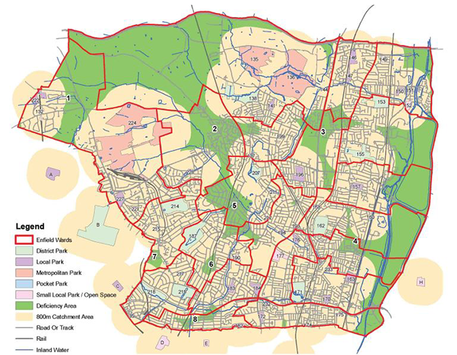
8.76 Enfield's Open Space Study (2006) identifies deficiencies in the access to, quantity and quality of types of open space (including parks, natural and semi, green space and allotments) and children’s play space. The Study found that the quantity of open space provision varies between wards with the following being deficient in public park provision:
Figure 8.9 Allotments, Bowes Park

8.77 These wards, with the exception of Haselbury, are also deficient in access to public parks as well as the wards of Cockfosters, Enfield Highway and Winchmore Hill. However, when considering the significance of the deficiency areas, priority should be given to Bowes, Lower Edmonton and Southbury (which have the highest need for open space due to high residential densities, high child densities, poor health or high deprivation scores).
8.78 Where there is limited scope to improve the quantity of public parks in order to address deficiencies, Enfield's Open Spaces Study suggests options for improving access or adapting other forms of open space for public park use.
8.79 Allotments are very popular in the Borough and demand for them continues to grow. The Enfield Open Space Study concludes that an extra 18 ha of allotment land is needed to meet existing deficiencies particularly in the south and east of the Borough, and to provide for population growth.17
8.80 The Enfield Open Space Study concludes that there are areas deficient in the quantity of, and access to natural and semi-natural greenspace, this is considered in section 8.7 on Biodiversity.
8.81 Current population projections, and the estimated child yield arising from additional housing growth proposed within each of the Borough's strategic growth areas, will mean that the Borough will be home to an increasing number of children and young people. Making provision for formal and informal play is therefore crucial however, the current distribution of children’s play provision is not even, and parts of the Borough are deficient in access to formal children’s play provision. All wards within the Borough have parts which are outside a 400m catchment area for play facilities. This policy will help to address these deficiencies and reflects London Plan Policy 3D.13 and the Mayor's SPG on Providing for Children and Young People's Play and Recreation (2008).
8.82 The Enfield Open Space Study identifies those open spaces which have the potential to upgrade existing or to accommodate children’s play facilities in order to alleviate deficiencies. It was noted that of six sites identified as accommodating a role for ‘teenagers hanging out’, this was predominately an informal role as just one site has dedicated provision for this use. It is therefore important for play provision to recognise the needs of older children as well.
8.83 Playing Pitches are an important sporting and recreational resource, and form part of the network of open space in the Borough. The Enfield Open Space and Sports Assessment identified a potential surplus in provision, however this study did not consider the projected population growth arising from developments in the strategic growth areas, and opportunities to remedy other open space deficiencies. In light of this, a review of the evidence base will be undertaken to ensure there is adequate provision of playing pitches to meet expected future needs, and opportunities are sought to maximise the potential of this as an open space and sporting resource.
8.84 Central Leeside is expected to house up to 5,000 new homes over the next 20 years. Given the scale of development, it is likely to create an even greater need for open space in an area where there are identified open space deficiencies. Therefore, in Central Leeside, the Council will require the provision of a large open space, along with the need to forge links and improve access to the Lee Valley Regional Park, and ensure that the open spaces in this area are accessible and of a good quality, as priorities when considering proposals for new development coming forward as part of the Area Action Plan. The scale of transformational change at Meridian Water at Central Leeside will provide an opportunity to ensure open space requirements and links to the wider Lee Valley Regional Park and East London Green Grid will form an integral part of more detailed masterplanning work.
8.85 Areas of deficiency in open space also overlap with other Area Action Plan areas so opportunities will be sought to improve access to nearby parks in North East Enfield, Central Leeside, and the North Circular area through the development of these Plans.
Map 8.1 Areas of the Borough deficient in public parks
Implementation
8.86 The Council is preparing a Parks and Open Space Strategy, which will outline how the wider role of open spaces fits into its four main aims: to make open spaces in Enfield places for everyone; to deliver high quality open spaces in partnership; to create sustainable open spaces for the future and to protect and manage the exceptional quality and diversity of Enfield's open spaces. It will be a ten year strategy that sets out the Council's plans for improving and conserving our parks and open spaces. The main focus of this strategy is delivery, providing a detailed delivery plan to prioritise actions and guide resource allocations.
8.87 In addition, a Food Strategy for the Borough will be developed to draw together all aspects of food production and consumption and how they are delivered locally. This Strategy will look at improving existing allotments, and new informal growing spaces, through the diversification of existing open spaces and new community growing spaces.
8.88 The Open Space Study does not set specific standards of provision for other types of open space, including civic spaces and areas of hard landscaping. However, it is acknowledged that these open spaces form an integral part of the urban fabric and contribute towards local interest, character and distinctiveness; and where appropriate should be integrated as part of development proposals. In light of this, the Council will explore the potential for creating and improving these spaces as part of further work on the Enfield Characterisation Study (referred to in the section 8.2); and a design led approach will be used to identify the appropriate level of provision. A review of the evidence base will be undertaken to inform the provision of playing pitches to meet expected future needs.
8.89 Based on the London Plan open space hierarchy, the Development Management Document will set out the hierarchy for Enfield's open spaces, setting out the main function for each open space type. This will be used to assess priorities for future open space provision. It will also set out the criteria for open space provision requirements as part of development proposals. As recommended by the Enfield Open Space Study, locally specific standards will be applied for the provision of open space. These standards will be set out in the Development Management Document and will ensure that existing deficiencies are alleviated, and there continues to be an adequate overall supply of open space provision. These standards will be revised following the review of the London Plan and adoption of a revised housing target for Enfield which reflects the proposed growth in the area action plan areas. The London Plan provides the most recent assessment of requirements for children's play space in London and, as such, should replace the standards recommended in Enfield's Open Space Study.
8.90 The area action plans provide the most scope for intervention through new development. The Core Policy sets out the broad priorities for open space provision in these areas. The area action plans will define the location and manage the delivery of new open space, including their long term funding and management arrangements.
Monitoring and Targets
8.91 The quantity of open space by type will be monitored to achieve a target of no net loss of protected open space designated as Metropolitan Open Land due to new development.
8.92 Children and young people's satisfaction with parks and play areas will be monitored to increase satisfaction year on year and to improve Enfield's London ranking.
8.93 General satisfaction with parks and play areas will be monitored to increase satisfaction year on year.
8.94 An Allotment Strategy is to be completed 2010-11, the recommendations of which will be monitored.
CORE POLICY 35 LEE VALLEY REGIONAL PARK AND WATERWAYS The Council will work with the Lee Valley Regional Park Authority, British Waterways, riparian owners, the EnvironmentAgency and other partners to:
|
Justification
8.95 The Lee Valley Regional Park is a large and unique swathe of public open space on the doorstep of communities in the east of Enfield. However, much of the area consists of reservoirs to which access is restricted and the opportunities for formal and informal recreation are limited to pedestrian and cycle routes to the west of the Regional Park and to fishing. The Park is under-used in terms of a major recreational asset and in places there is a lack of access and visibility. Enfield's Open Space Study suggests that although the Regional Park's catchment covers most of Enfield Borough, its potential to fulfil the role of a Metropolitan Park, thereby addressing deficiencies in Metropolitan Park provision, is limited. The Core Policy therefore has two strands. The first is to improve access to the Regional Park in places where there is most potential to intervene and need has been identified in the Open Spaces Study (Ponders End and Central Leeside). The second is to improve the recreational potential of the Park.
Figure 8.10 New River Path, Palmers Green

8.96 The Lee Valley Regional Park Authority is preparing a new Park Development Framework to set out the Authority's vision, proposals and policies for the future management of the Park for the next 5-10 years. Within the emerging Park Development Framework, Picketts Lock is identified as one of the main destinations in the Park with the potential for multiple uses for sport, recreation, accommodation and biodiversity. The forthcoming Park Development Framework will inform the preparation of the Central Leeside Area Action Plan and future reviews of the Core Strategy.
8.97 The North London River Restoration Strategy18 highlighted a number of areas within Enfield where improvements could be made to the river corridors. It suggested that the River Lee together with Turkey, Salmons and Pymmes Brook have a great potential to be restored, bringing improvements in biodiversity, green corridors (linking the east and west of Enfield), pathways, recreational and educational facilities, including fishing and access to nature. The London Rivers Action Plan identifies a series of current and known river restoration projects in Enfield, to inform decisions on priority projects to be funded.
Implementation
8.98 To incorporate the provisions of the Park Development Framework into the Central Leeside and North East Enfield Area Action Plans where relevant to improving access to, and providing for recreational uses in the the Lee Valley Regional Park.
Monitoring and Targets
8.99 Lee Valley Regional Park Authority are to review the Park Development Framework, following the publication of which relevant DPD documents will be reviewed if necessary.
8.100 The Borough's wealth of green open spaces and extensive stretches of rivers and waterways host a variety of habitats and species. Given their importance, these biodiversity interests are designated for their international, national, regional and local importance, and accorded a level of protection appropriate to their place within this hierarchy.
8.101 The UK Biodiversity Action Plan (BAP) sets out national priorities for conservation action and targets. The London BAP has 26 action plans for important habitats and species in London. It aims to improve the condition and increase the extent of the BAP habitats and species found in London, and has set targets accordingly. In addition, the Strategy for Restoring Rivers in North London (2006)19 looks at potential improvements to the waterways in Enfield which could contribute towards enhancing biodiversity.
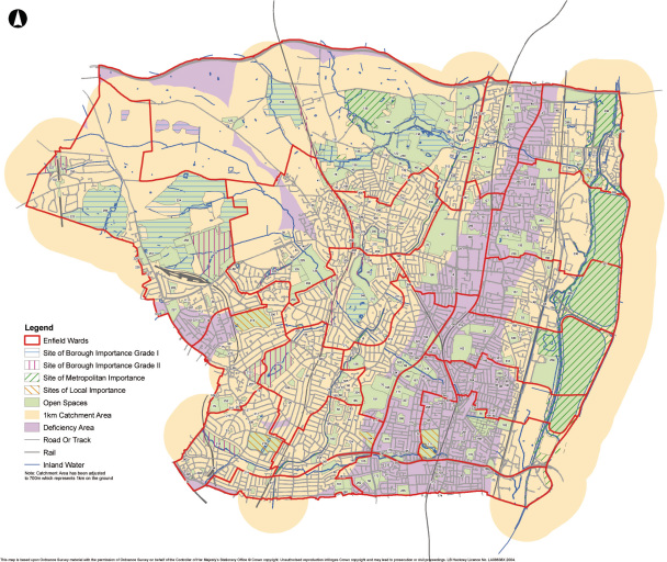
8.102 Access to biodiversity is particularly important in a London context, where opportunities for contact with nature and wildlife may be more limited. There are, however, areas identified which are deficient in access to nature. Enfield’s Open Space Study (2006) and the Mayor’s Improving Londoners' Access to Nature Implementation Report (2008) identifies a large deficiency area in the eastern part of the Borough, and smaller areas in the northern and south west corners of the Borough (as shown in Figure 8.1).
Map 8.2 Areas Deficient in Access to Ecological Designations (Open Space Study, 2006)
8.103 A Appropriate Assessment20 (or Habitats Regulations Assessment) screening assessment has been undertaken in consultation with Natural England to assess whether any likely significant effects would result from the proposals contained within the Core Strategy in relation to Special Protection Areas, Special Areas of Conservation or Ramsar Sites, whether in isolation or in combination with other plans and projects. The screening concludes there are no likely significant effects arising from the Council's spatial strategy and core policies. Where additional proposals are made in lower tier documents, such as the Area Action Plans, further screening will be required in each case in order to determine whether a full Appropriate Assessment is necessary.
CORE POLICY 36 BIODIVERSITY The Council will seek to protect, enhance, restore or add to biodiversity interests within the Borough, including parks, playing fields and other sports spaces, green corridors, waterways, sites, habitats and species identified at a european, national, London or local level as being of importance for nature conservation by:
|
Justification
8.104 The protection and enhancement of biodiversity is necessary to achieve our objective of sustainable development. It has an important role to play in developing locally distinctive and sustainable communities and its conservation will play a vital role in mitigating the effects of climate change. It provides key ecosystem services including food systems, flood management, pollination and the provision of clean air and water. It is an indicator of the wider health of our environment.
8.105 The Council has a statutory obligation to conserve and enhance biodiversity; in particular through the 1994 Habitats Regulations and the 2006 Natural Environment and Rural Communities Act. The identification, improvement and protection of biodiversity interests is a requirement of the London Plan and Planning Policy Statement (PPS) 9 "Biodiversity and Geological Conservation".
8.106 In accordance with the policies set out in the London Plan and procedures adopted by the Mayor in the Biodiversity Strategy, the GLA has undertaken an ecological survey of the Borough to provide an overview of its biodiversity and to update the Boroughs list of Sites of Importance for Nature Conservation (SINCs). This will help to inform and provide the evidence for the identification of sites.
8.107 The identification of areas deficient in access to biodiversity accords with the London Plan policy approach. Local evidence identifying such areas also justifies the need to seek opportunities to address these existing deficiencies. The Enfield Open Space Study (2006) looked at the provision of natural green space. The study recommends a Borough-wide benchmark of 1ha of SINC per 1,000 population and a distance threshold of 1 km from either a Site of Borough or Metropolitan Importance. It identifies eight wards within the Borough (Bowes, Bush Hill Park, Haselbury, Palmers Green, Southbury, Town, Turkey Street and Upper Edmonton) which provide less than 1ha of SINC per 1,000. It also notes, when a GLA standard 1km catchment is applied, that deficiencies in access to biodiversity exist along a linear strip running from the north to the south of the Borough, roughly in line with the A1010 Hertford Road, in the eastern half of the Borough.
Implementation
8.108 The Development Management DPD will set out more detailed policies for the protection of biodiversity including the criteria that will be used to assess development proposals that are likely to have an adverse ecological impact. Where appropriate, an ecological assessment may be required in order that any adverse ecological impacts of the proposed development can be understood and mitigated.
8.109 Alongside the Development Management DPD, the Enfield Design Guide Supplementary Planning Document will provide guidance on the opportunities to enhance biodiversity as part of development proposals, for example through appropriate landscape design, site management plans and green roofs.
Monitoring and Targets
8.110 The Enfield Biodiversity Action Plan, which is to be adopted during 2010, will contain targets for biodiversity enhancements across the Borough. This will include targets for National Indicator 197 (Improved Local Biodiversity – proportion of Local Sites where positive conservation management is being achieved), the restoration of rivers in line with the London Rivers Action Plan and targets for the maintenance, enhancement and increase in area of priority habitats in line with those given in the London Plan. These and other Enfield BAP targets will be monitored and reported on through the Enfield Biodiversity Partnership.
8.111 The condition of SSSIs are to be monitored, to achieve reclassification of the three sites in Enfield from 'unfavourable recovering' in 2008, to 'favourable'.
1 The Drain London Forum was created by the GLA to bring together representatives from organisations with the information and/or responsibility for managing surface water drainage in London including: the Department of Environment Food and Rural Affairs; the Environment Agency; Government Office for London; the Greater London Authority; London Boroughs; London Councils; London Development Agency; Thames Water; and Transport for LondonThe Drain London Forum was created by the GLA to bring together representatives from organisations with the information and/or responsibility for managing surface water drainage in London including: the Department of Environment Food and Rural Affairs; the Environment Agency; Government Office for London; the Greater London Authority; London Boroughs; London Councils; London Development Agency; Thames Water; and Transport for London
2 SWMPs form a "framework through which key local partners with responsibility for surface water and drainage in their area work together to understand the causes of surface water flooding and agree the most cost effective way of managing surface water flood risk" (Surface Water Management Plan Technical Guidance: Living Draft Version 1, [February 2009]).
3 Draft Multi-Agency Emergency Flood Plan (July 2009).
4 Lower Lee Flood Risk Management Strategy: Consultation Update , (June 2008).
5 As defined in table D.1 of Planning Policy Statement 25
6 SUDs are discussed in detail in Chapter 5 of the PPS25: Development and Flood Risk: Practice Guide (2008)and are defined there as "a sequence of management practices and control structures designed to drain surface water in a more sustainable fashion than some conventional techniques". They include, for example, permeable paving, swales and detention ponds
7 Planning Policy Statement 25: Development and Flood Risk: Practice Guide, (2008, paragraph 2.8)
8 The Sequential Test is a requirement of PPS25 and must be applied where development is proposed in flood zones 2 or 3 (as defined in table D.1 of PPS25). The basic requirement is to demonstrate that there are no reasonably available alternative development sites in areas which are at a lower risk of flooding
9 High Level Sequential Test: London Borough of Enfield Core Strategy Submission Document (2009)
10 See Core Policies for Economic Development and Enterprise
11 A Strategy for Restoring Rivers in North London, (Environment Agency, 2006).
12 Please refer to Core Policies for Places 37-46.
13 Lower Lee Flood Risk Management Strategy: Consultation Update, (June 2008).
14 The London Rivers Action Plan can be found at: http://www.therrc.co.uk/lrap.php.
15 Namely the Planning (Hazardous Substances) Act 1990, the Planning (Hazardous Substances) Regulations 1992, and Planning (Control of Major Accident Hazards) Regulations 1999"
16 Enfield's Open Space Study (2006).
17 GLA household growth projections up to 2016.
18 Now the London Rivers Action Plan led by the River Restoration Centre.
19 Now the London Rivers Action Plan 2009 (LRAP) led by the River Restoration Centre. The LRAP has been developed to provide a delivery mechanism to take forward this Strategy.
20 This is a requirement of the Conservation (Natural Habitats &c) (Amendment) (England and Wales) Regulations 2007, which is abbreviated to the Habitats Regulations. The Appropriate Assessment screening report is available on the Council's website at http://www.enfield.gov.uk/info/856/planning-local_development_framework/502/core_strategy/5
< Previous | ^ Top | Next >