
| Area | Site Ref | Site Name |
|---|---|---|
| Maidenhead | AL13 | Desborough, Harvest Hill Road, South West Maidenhead |
| AL14 | The Triangle site (land south of the A308(M) west of Ascot Road and north of the M4), Maidenhead | |
| AL24 | Land east of Woodlands Park Avenue and north of Woodlands Business Park, Maidenhead | |
| AL25 | Land known as Spencer's Farm, north of Lutman Lane Maidenhead | |
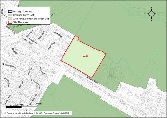
| AL26 | Land between Windsor Road and Bray Lake, south of Maidenhead | |
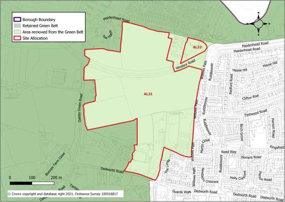
| Windsor | AL21 | Land west of Windsor, north and south of A308, Windsor |
| AL22 | Squire's Garden Centre, Maidenhead Road, Windsor | |
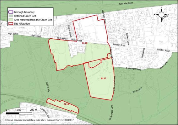
| Ascot | AL16 | Ascot Centre |
| AL17 | Shorts waste transfer station and recycling facility, St Georges Lane, Ascot | |
| AL18 | Ascot Station Car Park | |
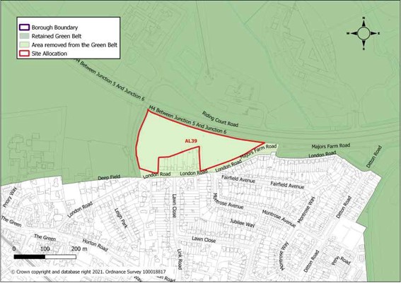
| Datchet | AL39 | Land at Slough Road/Riding Court Road, Datchet |
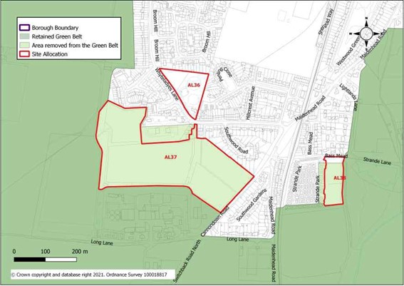
| Cookham | AL37 | Land north of Lower Mount Farm, Long Lane, Cookham |
| AL38 | Land east of Strande Park, Cookham | |
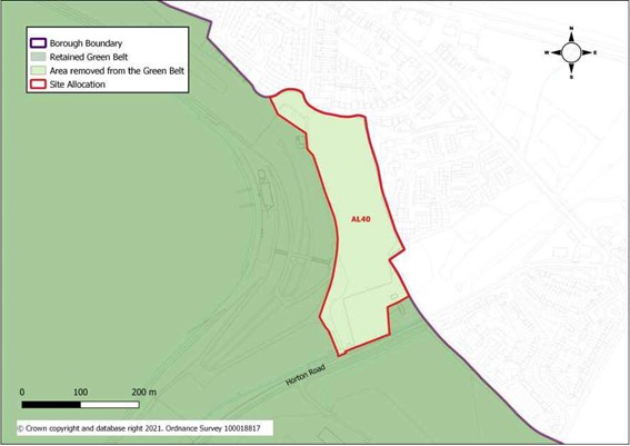
| Other Areas | AL40 | Land east of Queen Mother Reservoir, Horton |
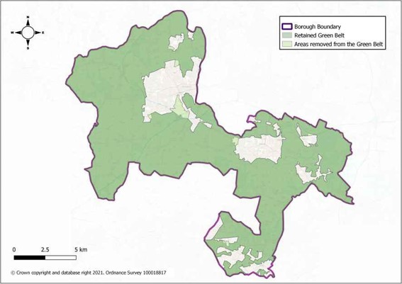
Table 30 : Sites where there are alterations to the Green Belt boundary
Green Belt Boundary Alterations Overview
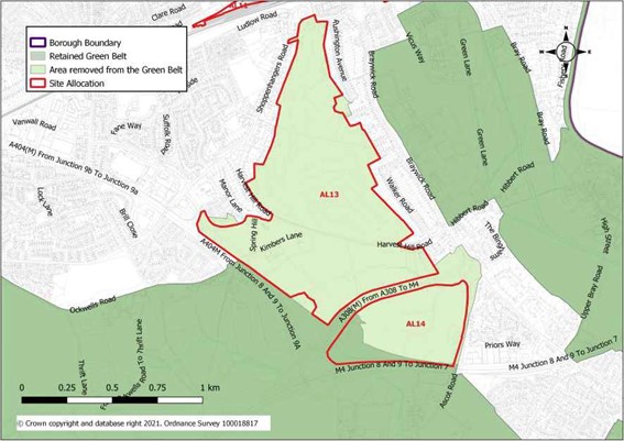
AL13: Desborough, Harvest Hill Road, South West Maidenhead and AL14: The Triangle Site Land south of A308(M), west of Ascot Road and north of the M4), Maidenhead
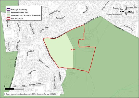
AL24: Land east of Woodlands Park Avenue and north of Woodlands Business Park, Maidenhead
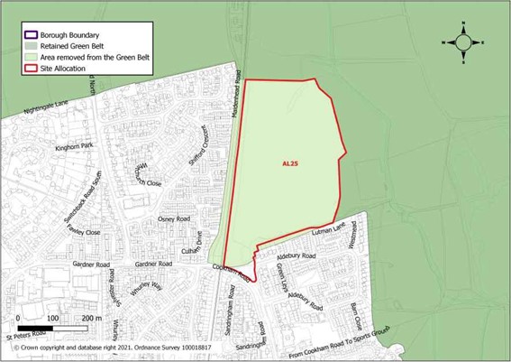
AL25: Land known as Spencer's Farm, north of Lutman Lane, Maidenhead
AL26: Land between Windsor Road and Bray Lake, south of Maidenhead
AL21: Land west of Windsor, north and south of the A308, Windsor and AL22: Squire's Garden Centre, Windsor
AL16: Ascot Centre, AL17: Shorts waste transfer station and AL18: Ascot railway station
AL39: Land at Riding Court Road and London Road, Datchet
AL37: Land north of Lower Mount Farm, Long Lane, Cookham and AL38: Land east of Strande Park, Cookham
AL40: Land east of Queen Mother Reservoir, Horton
< Previous | ^ Top | Next >