
6.1 The quality of the City’s environment, ensuring sustainable development and dealing with the impacts of climate change will be central to the successful delivery of the BDP. Taking a proactive and positive approach, will be vital to the quality of life of existing and future citizens and enable the City to remain an attractive proposition for investment and visitors.
6.2 The City Council is committed to a 60% reduction in carbon dioxide (CO2) emissions produced in the City by 2027, based on 1990 figures. This is an accelerated commitment compared to the current government target which requires a 22% reduction by 2022 and an 80% reduction by 2050. Planning policies have a major role to play in helping to achieve this challenging target.
| Policy TP1 Reducing the City’s carbon footprint | ||||||||||||||
The City Council is committed to a 60% reduction in total carbon dioxide (CO2) emissions produced in the City by 2027 from 1990 levels. Actions to help achieve this target will include:
Implementation
|
Why we have taken this approach
6.3 Climate Change - the rise in average global temperature due to increasing levels of greenhouse gases in the earth’s atmosphere - is contributing to rising average global temperatures and more frequent extreme weather. The impacts of climate change and the need to reduce the cause are fundamental challenges facing the world. Birmingham is committed to taking action to tackle climate change and has set itself demanding CO2 reduction targets. These cannot be achieved through the planning process alone, but will require action on a number of fronts. However, planning does have a significant role to play and it is important that full advantage is taken of this. This policy highlights the key areas where planning can make a contribution.
6.4 The Green Commission’s Birmingham Carbon Roadmap (autumn 2013) provides more detailed guidance on how Birmingham will achieve its 60% target, largely through:
6.5 The BDP and the planning process have a significant role to play in implementing the City Council’s wider policies for tackling climate change and creating a green city. It also provides opportunity for maximising the social and economic opportunities available to the people of Birmingham from building a leading green city.
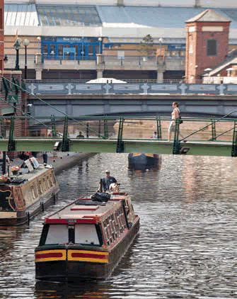
City Centre canal at Brindleyplace
6.6 The policies in the BDP are supportive of National, European Union and International policies and programmes aimed at tackling climate change. They will also play an important role in supporting the delivery of some of the objectives of the Green Commission's Carbon Roadmap.
6.7 Planning has a role to play in managing the impact of climate change. Climate change could potentially have a major impact on Birmingham including extreme weather events such as flash flooding, storms, drought and heat waves and extended cold periods. The impacts can affect everyone who lives and works in Birmingham. The BDP can play a role in managing and mitigating these effects.
| Policy TP2 Adapting to climate change | ||||||||||||||
The City will need to adapt to the impacts of extreme weather and climate change. Measures to help manage the impacts will include:
In order to minimise the impact of overheating, new development and residential schemes should also:
The Council will also encourage the retrofitting of these features in areas particularly susceptible to the risk of climate change. Implementation
|
6.8 Climate change will lead to a greater intensity and frequency of extreme weather events including droughts, storms and heatwaves. While it is not possible to neutralise the impact of these events, it is possible to put in place measures to minimise and mitigate them.
6.9 As a densely built urban area Birmingham suffers from the urban heat island effect and work by the University of Birmingham shows that the City Centre can be up to 5°C hotter at night than the surrounding rural areas.
6.10 The projections for future rises in average temperatures would have serious implications for Birmingham's built infrastructure and the health of its people. Urban greening can make a significant contribution to reducing the effects of urban heating. Birmingham's Green Living Spaces Plan sets the priorities for creating a green network covering open spaces and parks, linear corridors, blue infrastucture, trees and green roofs/walls to help cool the City. Flood risk is also likely to increase significantly through the 21st Century and there is a need to steer development to areas with lower flood risk and improve storage and re-use of rainwater. Climate change will also impact on biodiversity within the City - but conversely maintaining and enhancing habitats can help to mitigate its impact.
6.11 Blue infrastructure refers to waterways, rivers, streams, watercourses and canals including their towpaths and environs. The blue network refers to the network of such features across the city. Areas particularly subject to the effects of climate change are shown on Plan 1 of the Green Living Spaces Plan.
6.12 Ensuring that new buildings within the City meet high standards of sustainable design and construction will be essential in reducing CO2 emissions and creating adaptable buildings in environmental terms. Households and non-domestic buildings account for a high proportion of the City’s CO2 emissions.
| Policy TP3 Sustainable construction | ||||||||||||||
New development should be designed and constructed in ways to which will:
From whatever date the Government prescribes for the introduction of residential zero carbon standards through the Building Regulations, all new non-residential built developments in excess of 1,000 sq. m. gross permitted floorspace or being developed on a site having an area of 0.5 ha or more should aim to meet BREEAM standard excellent (or any future national equivalent) unless it can be demonstrated that the cost of achieving this would make the proposed development unviable. Developers will be encouraged to find innovative solutions to achieve the objectives of this policy. Developers will need to demonstrate how their proposals accord with the provisions set out above and if not to provide a justification as to why they cannot be achieved. A post construction review certification process will be required for developments expected to meet the BREEAM excellent standard. Measures to adapt and enhance the sustainability of existing buildings and neighbourhoods, for example through the Birmingham Energy Savers Scheme, will also be encouraged providing there is no conflict with other policies such as the protection of heritage assets. Implementation
|
Why we have taken this approach
6.13 The City will need to accommodate significant housing and economic growth in the period to 2031 increasing the demand for energy and water consumption. There is an opportunity to minimise the impact of this growth by creating high quality sustainable developments and new sustainable communities. In the case of new residential development, this will be achieved through energy performance standards applied
through the Building Regulations in line with the Ministerial Statement of March 25th, 2015.
6.14 Ensuring that development is constructed in the most sustainable way, will require consideration to be given to the inclusion of measures reducing energy and water consumption, reducing waste and using sustainable building materials.
6.15 The Building and Research Establishment Environmental Assessment Method (BREEAM) provides market recognition for low environmental impact buildings that are not housing. It addresses a wide range of environmental issues and enables developers and designers to prove the environmental credentials of their buildings. Standards for buildings range from pass to excellent.
6.16 In meeting the requirements of this policy developers should, where relevant and applicable, demonstrate the performance of their proposals against the relevant national standard or code.
6.17 Improving the energy efficiency of the City Council's existing and new building stock is a key objective of the Green Commission's Carbon Roadmap (Autumn 2013) and Birmingham's Climate Change Action Plan 2010+. The Summerfield Eco Neighbourhood Scheme is an example of a partnership approach towards a large scale renewable retrofit project. The project helped to reduce energy usage amongst households as well as providing local employment opportunities.
6.18 The Birmingham Energy Savers Scheme is a City Council and Carillion project working with organisations across the city, aiming to help the people of Birmingham save money on their fuel bills, become more energy efficient and help protect the environment with no upfront costs.
6.19 Reducing energy consumption and finding alternative sources will be central to meeting CO2 targets and helping achieve more sustainable forms of development. Moving toward lower carbon forms of energy will play an important role in achieving this.
| Policy TP4 Low and zero carbon energy generation | ||||||||||||||
New developments will be expected to incorporate the provision of low and zero carbon forms of energy generation or to connect into low and zero carbon energy generation networks where they exist, wherever practicable and unless it can be demonstrated that the cost of achieving this would make the proposed development unviable. In the case of residential developments of over 200 units and nonresidential developments over 1,000 sq.m. first consideration should be given to the inclusion of Combined Heat and Power (CHP) generation or a network connection to an existing CHP facility. However, the use of other technologies - for example solar photovoltaics or thermal systems, wind turbines, biomass heating or ground source heating - will also be accepted where they will have the same or similar benefits, there is no adverse impact on amenity and, in the case of ground source heating, environmental risks can be adequately managed. Smaller developments should also connect to a District Heating Scheme where such schemes exist, unless it is demonstrated that such a connection is not practicable or viable. Encouragement will also be given to the development and implementation of new technologies which reduce energy consumption such as SMART Grid and promoting new homes to be SMART Grid ready. Implementation
|
6.20 There is significant potential to utilise lower carbon forms of energy production, in particular Combined Heat and Power (CHP) as part of District Heating Schemes in Birmingham. CHP has particular potential for expansion within the city. CHP involves the simultaneous generation of heat and power and is a highly efficient way to use both fossil and renewable fuels. Large residential developments on sites over 200 units in size and new non-residential developments over 1,000 sq.m. offer the economies of scale necessary to include CHP generation or a network connection to an existing CHP facility.
6.21 There are already examples within Birmingham of CHP generation. The Broad Street District Energy Scheme serves many of the City Centre's most prominent buildings including the ICC, NIA, REP Theatre, Council House and Town Hall. The project utilises a large CHP engine in the ICC boiler house and heating mains linking the various buildings to the energy centre. The scheme will result in cost savings for those linked to it and reduce the City Centre's CO2 emissions by 20%. A similar scheme is proposed in the Eastside area of the City Centre.
6.22 There is also potential within Birmingham to use natural renewable energy sources such as solar panels. Other initiatives to reduce energy consumption include the development of Smart Grids. A Smart Grid delivers electricity from suppliers to consumers using digital technology to save energy and reduce costs. Whilst Smart Grids are not being widely used at present it is possible that during the plan period the technology will become more widely available.
6.23 Because of Birmingham's location and topography, wind power is unlikely to be a significant source of renewable energy in the City.
6.24 Further guidance on the application of this policy will be contained in the 'Your Green and Healthy City' Supplementary Planning Document.
6.25 The need to adapt to climate change and reduce the dependence on traditional fossil fuels represents an opportunity for the Birmingham economy to lead the way in the development of new low carbon technologies.
| Policy TP5 Low carbon economy | ||||||||||||||
The development of innovative energy technologies to reduce the use of fossil fuels and CO2 emissions and promotion of low carbon industries will be supported and encouraged. In particular the following initiatives will be supported:
Implementation
|
6.26 Birmingham has been designated as a Science City, which is a partnership of public, private and research sectors to drive forward innovation. The Science City Research Alliance of the Universities of Birmingham and Warwick is funded by Birmingham Science City. It is currently undertaking a range of projects including energy futures such as hydrogen cells and advanced lightweight materials.
6.27 Birmingham's Carbon Roadmap (autumn 2013) promotes the development of low carbon fuel efficient technologies and the benefits of efficient resource management and waste minimisation. In this respect small scale local biomass projects such as woodfuel heat and power offer the potential to minimise the costs and carbon emissions associated with transport.
6.28 Facilitating the roll out of low carbon technology and encouraging the sustainable management of the City's waste is a major growth opportunity and offers potential for existing companies to diversify and for new companies to be formed creating new jobs and investment.
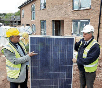
New housing with solar panels
6.29 Flooding is one of the most immediate and visible consequences of extreme weather. Measures to minimise the risk of flooding and mitigate its effects are therefore required. The City Council will work with the Environment Agency to reduce floodrisk in Birmingham in line with the River Trent Catchment Flood Management Plan.
| Policy TP6 Management of flood risk and water resources | ||||||||||||||
| Flood Risk Assessments | ||||||||||||||
| Site specific Flood Risk Assessments will be required in accordance with the requirements of the relevant national planning policy and the guidance outlined in the Birmingham Strategic Flood Risk Assessment (SFRA). | ||||||||||||||
| Sustainable Drainage Assesment and Operation and Maintenance Plan | ||||||||||||||
A Sustainable Drainage Assessment and Operation and Maintenance Plan will be required for all major developments, as defined in Article 2(1) of the Town and Country Planning (Development Management Procedure) (England) Order 2015. As part of their Flood Risk Assessment (FRA) and Sustainable Drainage Assessment developers should demonstrate that the disposal of surface water from the site will not exacerbate existing flooding and that exceedence flows will be managed. For all developments where a site-specific Flood Risk Assessment and/ or Sustainable Drainage Assessment is required, surface water discharge rates shall be limited to the equivalent site-specific greenfield runoff rate for all return periods up to the 1 in 100 year plus climate change event, unless it can be demonstrated that the cost of achieving this would make the proposed development unviable. |
||||||||||||||
| Sustainable Urban Drainage (SuDS) | ||||||||||||||
To minimise flood risk, improve water quality and enhance biodiversity and amenity all development proposals will be required to manage surface water through Sustainable Drainage Systems (SuDS). Wherever possible the natural drainage of surface water from new developments into the ground will be preferred. Surface water runoff should be managed as close to its source as possible in line with the following drainage hierarchy:
All SuDS must protect and enhance water quality by reducing the risk of diffuse pollution by means of treating at source and including multiple treatment trains where feasible. All SuDS schemes should be designed in accordance with the relevant national standards and there must be longterm operation maintenance arrangements in place for the lifetime of the development. |
||||||||||||||
| Rivers and Streams | ||||||||||||||
Rivers and streams are liable to natural flooding and will be managed in ways which will ensure that this can take place in locations which will not place built development or sensitive uses at risk. The Sustainable Management of Urban Rivers and Floodplains SPD (SMURF) provides more detailed guidance. River corridors are also important elements of the City's green infrastructure network. The management of floodplains will also need to take into account the potential to increase benefits to wildlife. The following development principles will apply:
|
||||||||||||||
| Enhancements of Water Resources | ||||||||||||||
As well as providing water and drainage, the City's rivers, streams, canals, lakes and ponds are an important amenity and are also valuable as wildlife habitats. Opportunities to increase the wildlife, amenity and sporting value of natural water features and canals will also be encouraged, provided that there is no adverse impact upon water quality, flood risk or the quality of the natural environment. Proposals should demonstrate compliance with the Humber River Basin Management Plan exploring opportunities to help meet the Water Framework Directive's targets. Development will not be permitted where a proposal would have a negative impact on surface water (rivers, lakes and canals) or groundwater quantity or quality either directly through pollution of groundwater or by the mobilisation of contaminants already in the ground. |
||||||||||||||
| Trees and Woodland | ||||||||||||||
Trees and woodland can provide significant benefits in terms of water management and flood alleviation and as part of SuDs in addition to their wider landscape, recreation, economic and ecological benefits. The provision of additional trees and woodland will therefore be encouraged. Implementation
|
6.30 Parts of Birmingham are at risk of flooding from main rivers, ordinary watercourses, surface water, sewer flooding and groundwater. There is also the potential for canal and reservoir breach and overtopping. As there has been development within flood zones, particularly along the Rea and the Tame, fluvial flood risk is an issue. There have also been considerable instances of flooding from surface water with small watercourses and sewers being particularly susceptible to flash flooding.
6.31 In order to manage this risk it is essential that future development is planned appropriately to ensure
that where possible:
6.32 The Strategic Flood Risk Assessment (SFRA) reinforces the need to apply a Sequential Test and the Exception Test, in accordance with the relevant national planning policy, to many proposed development schemes. Furthermore the SFRA includes further policies to ensure that all sources of flood risk are managed as part of any development.
6.33 The SFRA outlines the need to implement adequate SuDS techniques as part of a development. Large increases in impermeable areas for a site could contribute to a significant increase in surface water runoff, peak flows and volumes. In turn this could contribute to an increase in flood risk elsewhere. A Sustainable Drainage: Guide to Design, Adoption and Maintenance will be produced to provide detailed guidance to support the implementation of sustainable drainage systems including guidance on the national requirements for SUDS, the local requirements placed on developers and the technical requirements.
6.34 In taking forward the SFRA the City Council will have regard to developing strategies such as the Local Flood Risk Management Strategy, Surface Water Management Plan, Trent Catchment Flood Management Plan, Humber River Basin Management Plan and future development of the Flood and Water Management Act 2010.
6.35 Historically many of Birmingham's watercourses have been culverted. This limits their amenity and wildlife value and may also inhibit the potential for natural drainage. The removal of culverting through development can therefore bring significant benefits and contribute to the Water Framework Directive targets. Birmingham lies within the Tame, Anker and Mease catchment for which a catchmentbased approach is being promoted by DEFRA and the Environment Agency. A Catchment Management Plan has been prepared for the Birmingham element of this catchment.
6.36 Water courses are important for some sports and the improvement of the main water courses will also enhance the sporting experience.
6.37 Canals have a wildlife and amenity value and take a proportion of surface water run-off. They also have a role as non-natural watercourses to help alleviate flooding in some cases.
6.38 Green infrastructure has a critically important role to play in mitigating the impacts of extreme weather events, particularly extended heat waves, and reducing flood risk. In addition green infrastructure helps support biodiversity and makes an important contribution to the quality of the City’s environment, its quality of life and human wellbeing and its economic status and performance.
| Policy TP7 Green infrastructure network | ||||||||||||||
The City Council will seek to maintain and expand a green infrastructure network throughout Birmingham. The integrity of the green infrastructure network will be protected from development and where possible opportunities will be taken to extend and enhance the network and to improve links between areas of open space. Any development proposal that would sever or significantly reduce a green infrastructure link will not be permitted. New developments will be expected to address green infrastructure issues in an integrated way and to take advantage of new opportunities such as green and brown roofs. It is important that all new green infrastructure features and assets are designed to help the City adapt to a changing climate. The City Council will also seek to conserve and enhance Birmingham's woodland resource (collectively known as 'The Birmingham Forest'). Particular attention will be given to protecting the City's ancient woodlands as irreplaceable semi-natural habitats. All trees, groups, areas and woodlands will be consistently and systematically evaluated for protection and all new development schemes should allow for tree planting in both the private and public domains. The importance of street trees in promoting the character of place and strengthening existing landscape characteristics will be recognised. Implementation
|
6.39 Green infrastructure includes landscapes, natural environment, biodiversity and geological features which make Birmingham distinctive. Open spaces, linear corridors, blue infrastructure and blue spaces such as waterways, rivers, streams, watercourses, canals, towing paths and their environs and green-roofs or green-walls all contribute. The City Council's approach to the maintenance and improvement of the Green infrastructure network throughout the City reflects the seven key principles which are set out in the Green Living Spaces Plan and the objectives of the Birmingham and Black Country Nature Improvement Area.
6.40 Birmingham has a network of green spaces including rivers, many small urban brooks, canals, parks and open spaces including playing fields, allotments and cemeteries. A more detailed analysis of this network together with a strategy for managing and enhancing it is provided in the Green Living Spaces Plan.
6.41 Waterways are important in creating character of place, provide biodiversity corridors and allow green leisure and commuting routes within the City. The rivers, Cole, Rea, Tame and numerous smaller watercourses together with their catchments and the canals, pass through the City and serve to link different parts of the City and provide valuable links to the countryside encouraging wildlife into the urban area. These linear corridors join other open spaces which enhance and provide variety to the natural environment. In addition to parks and recreational open space, the City's allotments and cemeteries all play a role.
6.42 The City's green infrastructure network provides a wide range of social, economic and environmental benefits. Specifically it:
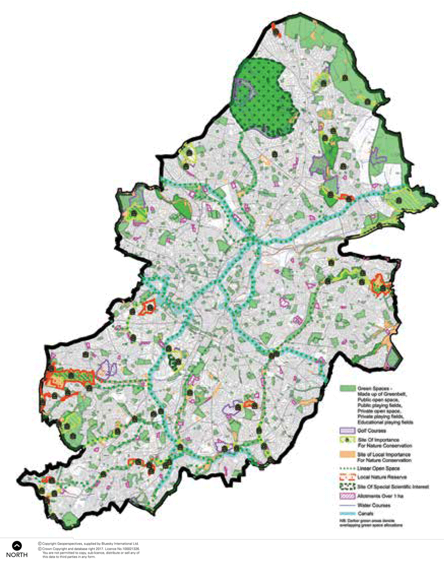
The green infrastructure network is illustrated on plan 15 and can be viewed at a larger scale on the Council's website at: www.birmingham.gov.uk/plan2031
6.43 Trees cover some 23% of the City's land area. This woodland resource is now being referred to as 'The Birmingham Forest'. The importance of trees is increasingly recognised in maintaining biodiversity and contributing to tackling climate change. Within the City the number and variety of trees is seen as being one of its most valuable environmental assets and one which the public perceive to be at risk.
Plan 15 Green infrastructure network
6.44 The need for new trees is well documented and their visual and structural benefits are enhanced by concerns in respect of climate change (such as water run off, temperature control, pollution interception) and therefore every opportunity to plant new trees, especially large species, will be fully explored. Creating new woodland or community orchards and more tree planting is especially useful in tackling urban heat islands, encouraging biodiversity and in assisting in dealing with surface water run off. The use and value of hedgerows and permanent grasslands are also increasing in their importance and functional use within urban areas, will also be considered, as part of the green infrastructure.
6.45 Birmingham’s biodiversity and geodiversity are critical components of a high quality of life and contribute significantly to the quality of the environment within the City. These natural assets are valuable and their protection is important, not just for their intrinsic worth, but because of the wideranging services and benefits they deliver.
| Policy TP8 Biodiversity and Geodiversity | ||||||||||||||
The maintenance, enhancement and restoration of sites of national and local importance for biodiversity and geology will be promoted and supported. These include Sites of Special Scientific Interest (SSSIs), National Nature Reserves (NNRs), Local Nature Reserves (LNRs), Sites of Importance for Nature Conservation (SINCs) and Sites of Local Importance for Nature Conservation (SLINCs). Development which directly or indirectly causes harm to sites of national importance (SSSIs and NNRs) will not be permitted. An exception will only be made where the benefits of the development, at that site, clearly outweigh the impact that it is likely to have on the features that make the site special and any broader impacts on the national network of SSSIs. Development which directly or indirectly causes harm to local sites of importance for biodiversity and geology (LNRs, SINCs and SLINCs), priority habitats and important geological features, species which are legally protected, in decline, are rare within Birmingham or which are identified as national or local priorities will only be permitted if it has been clearly demonstrated that:
Development proposals which are likely to affect any designated site or important habitat, species or geological feature must be supported by adequate information to ensure that the likely impact of the proposal can be fully assessed. The integrity of wildlife corridors and 'stepping stones' connecting them will be protected from development which would harm their function. Priority habitats and priority species listed in Section 41 of the Natural Environment and Rural Communities Act 2006 or in the local Biodiversity Action Plans will be maintained and opportunities to enhance and add to these natural assets will also be identified. The Biodiversity Action Plan for Birmingham and the Black Country and data from EcoRecord (the ecological database for Birmingham and the Black Country) will be used to inform the development of a strategic landscape-scale framework for the restoration and creation of priority habitats and recovery of priority species populations across Birmingham, including opportunities to create or restore linkages between important wildlife areas. All development should, where relevant, support the enhancement of Birmingham's natural environment, having regard to strategic objectives for the maintenance, restoration and creation of ecological and geological assets, such as those identified for the Birmingham and Black Country Nature Improvement Area. Biodiversity and geodiversity enhancement measures should be appropriate to the nature and scale of the development proposed. Development proposals should clearly identify how ongoing management of biodiversity and geodiversity enhancement measures will be secured. Implementation
|
6.46 Birmingham has a diverse range of biodiversity and geodiversity assets, including sites, habitats and species of national, regional and local importance. There are currently two Sites of Special Scientific Interest (SSSIs), 11 Local Nature Reserves (LNRs), 55 Sites of Importance for Nature Conservation (SINCs) and 121 Sites of Local Importance for Nature Conservation (SLINCs); these designated sites will be carried forward. In line with guidance produced by Birmingham and Black Country Local Sites Partnership, the City Council will designate additional SINCs, SLINCs or LNRs where there is adequate supporting information and consequently sites may receive new or increased protection during the plan period. Sites which are currently designated as of national, regional or local importance are shown on a plan which is available on the Council's website at: www.birmingham.gov.uk/plan2031
6.47 In addition to these designated sites, the City includes a wide range of other semi-natural green spaces of value to wildlife and which create a network of habitat resources that help to connect designated sites. River and stream corridors, canals, and active and disused rail corridors are important linear landscape features; other areas of open space, including urban wasteland sites, woodlands, playing fields, churchyards, allotments and gardens, also contribute to the habitat network.
6.48 The Habitats Regulation Assessment (HRA) confirms that there are no sites of European significance within Birmingham's administrative boundary although there are sites nearby - for example, the Cannock Chase and Cannock Chase Extension Canal Special Areas of Conservation (SACs). The HRA confirms that the proposals within this Plan are not likely to have an adverse effect on any of these sites. However the Council will continue to have regard to the need to protect these sites in considering major development proposals.
6.49 Biodiversity has been much affected by climate change in recent years. Increases in average temperatures and changing weather patterns have impacted on species' distributions, affected the timing of seasonal events and caused wide-ranging effects on ecosystems. The City's green infrastructure network has a vital role in enabling biodiversity to adapt to the impacts of climate change. The network of green corridors and open spaces such as river corridors, parks, allotments and informal green spaces need to be maintained to facilitate the movement of species to new locations in response to the changing climate.
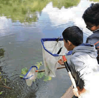
Net fishing at a local pool
6.50 Open space encompasses a wide range of spaces, not just traditional parks and gardens, grassed areas and woods but also cemeteries, allotments and civic spaces. All are important in providing recreational, health and other benefits for Birmingham residents and others who work in or visit the City.
| Policy TP9 Open space, playing fields and allotments | ||||||||||||||
Planning permission will not normally be granted for development on open space except where:
Playing fields will be protected and will only be considered for development where they are either shown to be surplus for playing field use, taking account of the minimum standard of 1.2 ha per 1000 population, through a robust and up to date assessment and are not required to meet other open space deficiencies, or alternative provision is provided which is of equivalent quality, accessibility and size. |
||||||||||||||
| Provision of public open space | ||||||||||||||
Public open space should aim to be provided throughout Birmingham in line with the following standards:
New developments, particularly residential, will place additional demand upon all types of open space and children's play areas. New residents, visitors to Birmingham and people working within the City all place varying demands upon open space. In new residential developments provision of new public open space will be required broadly in line with the standard of 2 ha per 1000 population. In most circumstances, residential schemes of 20 or more dwellings should provide on site public open space and/or children's play provision. However, developer contributions could be used to address the demand from new residents on other types of open space such as allotments and civic spaces. Further detail on the implementation of these requirements is provided in the Public Open Space in New Residential Development SPD. The emphasis will be on good quality, accessible public open space that people want to use and feel safe to use. There should be well maintained paths, hard and soft landscape elements, bins, seats and other appropriate site furniture and the needs of people with disabilities should be taken into account. |
||||||||||||||
| Allotments | ||||||||||||||
Provision of allotments should relate directly to demand in the area. Where there is a shortage of provision then consideration will be given to using other surplus open space land for allotments. Allotment land will only be released for development where it can be shown that the site is not required to satisfy the demand for allotments in the area, or equivalent alternative provision will be made available. Where it is demonstrated that an allotment site is surplus then the first consideration should be whether it can be used as other open space where there are deficiencies. If this land is not required for other open space use then it can be considered for development. Planning permission for the development of allotments will not be granted simply because the site has fallen out of use and become derelict. Every effort should be made to improve allotment provision in areas of deficiency when the opportunity arises. Implementation
|
6.51 Given Birmingham's built up character and with an increasing population and pressure for development, opportunities to create new areas of open space are limited within the existing urban area. Further development pressures on the City's open space resource will be carefully considered.
6.52 The main emphasis is on quality and accessibility; ensuring that people have access to good facilities and sufficient recreational space. Therefore accessibility and quality will inform the assessment of how much public open space provision is required.
6.53 In response to the need for assessments the City Council undertook a survey of demand which was published in 2004 which included 5,000 households, 4,000 within the City and 1,000 just outside. This together with work on the Parks Strategy has formed a background to the approach set in Policy TP9.
6.54 The City Council maintains records of provision for public open space, public and private playing fields expressed in hectares (ha) per 1,000 population by ward. A minimum 2 ha per 1,000 population standard is a simple, initial indicator of adequacy of provision. It serves to identify where there are supply problems. The use of up to date assessments of need provides more subtle information, reflecting quality and accessibility issues as well as quantity.
6.55 The City Council has a Playing Pitch Strategy. This shows a significant short-fall of natural turf and artificial grass pitches.6.56 Allotments play an important role in recreation and sustainability and form part of the green infrastructure network. There has been renewed interest in allotments and a diversification of users. Assessing need is more straightforward as waiting lists and vacant plots provide barometers of demand and supply. Where there is a demonstrated shortage of provision then the possibility of creating new provision by using surplus open space land can be considered.
6.57 For the purposes of the BDP the following definitions apply:
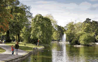
Cannon Hill Park
6.58 Birmingham's Green Belt forms a small part of the much wider West Midlands Green Belt which surrounds the West Midlands conurbation and Coventry. The five purposes of the Green Belt as set out in the relevant national planning policy are to check the unrestricted sprawl of large built up areas, prevent neighbouring towns from merging into one another, to assist in safeguarding the countryside from encroachment, to preserve the setting and special character of historic towns and to assist in urban regeneration by encouraging the recycling of derelict and other urban land. Green Belt policies may contribute to urban regeneration by encouraging new investment away from greenfield sites to locations within the built-up area. However, as explained in Section 3 of the BDP there is a need to remove land from the Green Belt for both housing and employment development to support essential elements of the BDP strategy.
| Policy TP10 Green Belt | ||||||||||||||
The revised Green Belt Boundary is shown on the Policies Map. There is a general presumption against inappropriate development within the Green Belt, and such development will not be permitted unless very special circumstances exist. Development proposals, including those involving previously developed land and buildings in the Green Belt, will be assessed in relation to the relevant national planning policy. The Green Belt in Birmingham includes a number of areas of countryside which extend into the City, often along river valleys. Such areas are particularly important because of the valuable links which they provide to the open countryside, their visual quality, and their accessibility. The following areas form part of the Green Belt, the detailed boundaries of which are shown on the Policies Map:
Measures to improve public access to these Green Belt areas and the wider Green Belt will be encouraged. Outdoor sport and recreational facilities will also be supported, provided that their provision preserves the openness of the Green Belt, and does not conflict with the purposes of including land within it. Implementation
|
6.59 National planning policy makes it clear that established Green Belt boundaries should be altered only in exceptional circumstances and only when a local plan is being prepared or reviewed. As outlined in Section 3 and policies GA5 and GA6 it has been necessary to amend the Green Belt boundary to meet the needs of both housing and employment development. The remaining Green Belt within the City will be protected for the long term and opportunities which enhance the Green Belt particularly in terms of public accessibility will be supported.
Sutton Park

6.60 Birmingham has a wide rangeof sports facilities which provide fora variety of recreational sportingneeds. Participation in sport hasphysical and mental health benefitsand promotes community cohesionand the City Council's approach isto ensure facilities reflect need. Thepolicy focuses on sports facilitiesthat are used directly by membersof the public.
| Policy TP11 Sports facilities | ||||||||||||||
The provision and availability of facilities for people to take part in formaland informal activity, that contributes to healthier lifestyles and canprovide a 'stepping stone' into more formal sport will be supported and promoted. The City Council will keep the provision of sports facilities within theCity under review in the light of changing demands and preferences,and where deficiencies and oversupply are identified in an up-to-dateassessment will aim to work with partners to address this. Sports and physical activity facilities will be protected from development,unless it can be demonstrated that they are surplus to requirementsthrough a robust and up to date assessment of need. Where there isidentified need for particular sports and physical recreation facilities, theloss of existing sports facilities for these sports will not be allowed unlessan equivalent or better quantity and quality replacement provision isprovided. Facilities within the City's educational establishments that can be used bythe community provide a useful contribution towards the recreational andleisure requirements of the City and this will be encouraged. Facilities for participation sport which attract large numbers of visitorsand incorporate elements of entertainment, retail or leisure uses whichoperate for many hours of the day should be located in highly accessiblelocations, preferably in or adjacent to town centres. It is importantthat community sport and leisure facilities should be located in easilyaccessible sites, with safe pedestrian and cycle access as well as beingclose to local public transport routes. Proposals for new facilities or the expansion and/or enhancement ofexisting facilities will be supported subject to compliance with otherrelevant planning policies. Appropriate and sympathetic sports lighting can enhance the use andsustainability of community sports provision to the benefit of the localcommunity. However, any development involving sports lights shouldbalance the benefits for sport with the amenity of local residents. Adviceshould be sought from Sport England when considering proposals forsports lighting. The use of planning conditions to control the use ofsports lights may be applied where appropriate. Implementation
|
6.61 Birmingham has a wide rangeof sporting facilities ranging fromsmall community sports halls andplaying pitches through to largerleisure centres
6.62 The City Council recognises the important role that sport and physical activity facilities have in terms of providing wider health and social benefits. These include:
6.63 The City Council will continue to review its sporting and physical activity facility infrastructure and
work with Sport England, national governing bodies of sport and other agencies to improve sport
and physical activity provision within the City.
6.64 The City Council is endeavouring (with its key partners) to increase the levels of participation and formal sport and informal physical activity within its various assets across the City.
6.65 There are opportunities to link activities, for example the opportunity exists when planning transport infrastructure to include walk, run and cycle trails between these existing facilities to form a network of inter linked facilities.
6.66 It is recognised that the City has a number of stadia and facilities which attract residents and visitors
to watch sport or leisure activities. While these are not covered by policy TP11 they will continue to be
important assets for the City and are covered by policy TP25.
6.67 Birmingham's character isshaped by its historic development,which is represented by a rich andvaried environment consisting ofarchaeological remains, historicbuildings, townscapes andlandscapes. Some, such as theJewellery Quarter and Bournvilleare nationally renowned. Allcontribute to the unique essenceof the City, identifying it as a placewith its own special character andhistory.
6.68 In addition to its intrinsic importance the historic environment is a finite and non-renewable resource and its protection is therefore an essential element in ensuring a sustainable future. The reuse of historic buildings can contribute to sustainability though retaining rather than wasting embodied energy and avoiding use of energy and materials for new build.
| Policy TP12 Historic environment | ||||||||||||||
The historic environment consists of archaeological remains, historic buildings, townscapes and landscapes, and includes locally significant assets and their settings in addition to designated and statutorily protected features. It will be valued, protected, enhanced and managed for its contribution to character, local distinctiveness and sustainability and the Council will seek to manage new development in ways which will make a positive contribution to its character.
Where a Conservation Area Character Appraisal or Management Plan has been prepared, it will be a material consideration in determining applications for development, and will be used to support and guide enhancement and due regard should be given to the policies it contains. The City Council will support development that conserves the significance of non-designated heritage assets including archaeological remains and locally listed buildings. The historic importance of canals is acknowledged, and important groups of canal buildings and features will be protected, especially where they are listed or in a Conservation Area. Where appropriate the enhancement of canals and their settings will be secured through development proposals. Implementation
|
6.69 The historic environment contributes to local distinctiveness and provides a sense of place.Reinforcing and revealing the historic environment through incorporating it rather than isolating it provides a context for new development and inspires innovative design which respects existing local character and distinctiveness.
6.70 The historic environment is not just important for its own sake, it adds value to regeneration, improves quality of life and has been a major draw in attracting businesses to the City; acting as a stimulus for local economic growth. It is also a source of significant local pride, contributing to local identity and acting as a valuable educational resource.
6.71 Birmingham’s historic environment is exceptionally rich and diverse for a predominantly urban area. The City’s post-war commercial architecture, town planning, public spaces and public art are also significant parts of its character.
6.72 It contains well-preserved archaeological remains of prehistoric, Roman, medieval and post-medieval date, including deposits containing information on past environmental conditions and industrial processes. In addition to buried remains, earthworks survive in open spaces. Birmingham’s historic buildings include dwellings, public buildings, churches, and industrial and agricultural structures. There are relatively few buildings dating from before the 18th century, so their rarity gives them a special local significance.
6.73 Historic townscapes in theCity Centre and suburbs consistof buildings, land divisions andstreet patterns resulting fromdifferent periods of the City'shistoric development. The varyingcharacter of much of the historicenvironment of the City and itssuburbs results from the survivalof many Victorian and Edwardianbuildings and structures, includingpublic buildings, industrialbuildings, canals, railways,schools, places of worship andhouses. Historic landscapes inparks and open spaces and in theurban fringe include agriculturalbuildings, ancient land divisions,historic woodland and plannedparks and cemeteries.
6.74 English Heritage's annual Heritage at Risk Register includes scheduled monuments, grade I and II* listed buildings, listed places of worship, registered parks and gardens, and conservation areas. The Register records condition, occupancy and use, vulnerability, priority actions and trends in condition. In addition, the City Council has itself identified other listed buildings at risk.
6.75 The City Council will review or prepare character assessments and management plans for conservation areas and other areas of particular local significance to supplement existing policies for protection and enhancement. Historic Landscape Characterisation will be used to inform and understand the contribution of the historic environment to the city's character and identity.
6.76 The City Council will adopt a protocol for the inclusion of the historic environment in AAPs, SPDs, Neighbourhood Plans, development briefs and other non-statutory area-based planning documents, and Local Development Orders, to ensure that its significance is conserved and its positive contribution to character is recognised.
6.77 The City Council will maintain a list of heritage assets of local importance and a Historic Environment SPD will be produced.
6.78 The Historic Environment Record will be maintained and developed to include all aspects of the City's historic environment so that it is a tool for decision-making and policy formulation.
6.79 Where appropriate and feasible, opportunities will be sought to bring heritage assets at risk, as identified in English Heritage's Heritage at Risk Register and by the City Council itself, into sustainable economic use that retains their significance.
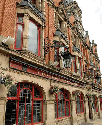
The Barton Arms in Newtown
6.80 There is a need to reduce the waste the City produces from its homes and businesses and carefully
and sustainably manage what is left. How the City deals with waste will be central to planning for
sustainable growth.
| Policy TP13 Sustainable management of the City’s waste | ||||||||||||||
The City Council will seek to prevent the production of waste whereverpossible, and where this is not feasible will seek to move and manageBirmingham's waste up the waste hierarchy. The key policy objectives of the City Council will be to minimise theamount of waste created, treat waste as a resource and encouragerecycling, reuse and composting. The City Council will seek to ensure that the tonnage of waste treatedand managed within Birmingham is equivalent to the tonnage of wastearising. There is currently a shortfall in the number of material recyclingfacilities within the City and more will need to be constructed duringthe plan period. The City Council will seek to reduce the proportionof the City's waste which is sent to landfill. This will require an increasein alternative disposal capacity. The type of facilities needed and sitelocation criteria are outlined in Policies TP14 and TP15. In the case of development on any site of over 5 ha, the Council willrequire the preparation of a strategy for the prevention, minimisation andmanagement of waste. Implementation
|
6.81 The City Council as a Waste Planning Authority (WPA) is required by Government to monitor and manage the City's waste in asustainable way by promoting the 3Rs - Reduce, Reuse, Recycle. The overarching objective set out in the national waste strategy is that wastemust be considered a resource, and that its management should be pushed up the waste hierarchy. A significant part of this reduction inwaste should include the removal of biodegradable and recyclable materials prior to waste being landfilled. Disposal, particularly tolandfill is the least sustainable and desirable option for management of our waste.
6.82 The City Council supports the concept of 'self sufficiency' where Birmingham will seek to manage an equivalent of every tonne of waste that arises. It is not however viable for Birmingham to manage all the various types of waste the City produces. Some types of waste will be more effectively managed at facilities outside Birmingham.
6.83 The City Council has undertaken a Waste Capacity Study (BWCS) and a subsequent Update, which explores a range of issues including predicted waste arisings and future capacity requirements. The Study shows that total waste arisings within the City are currently around 2.9 million tonnes per annum and taking account of planned growth in this period, total waste in Birmingham is expected to increase to 3.4 to 3.7 million tonnes.
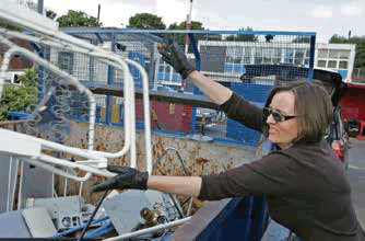
Recycling facilities
6.84 Whilst there is theoretical capacity to deal with all of the City's waste, Birmingham has limited disposal facilities. There are no active landfills in the City and the Tyseley Energy Recovery Facility primarily accepts municipal waste. There is potential for the City to increase disposal capacity to deal with specific waste streams such as commercial and industrial waste and reduce the amount of waste sent to landfill. The BWCS also shows that there is a shortage of Material Recycling Facilities (MRFs) within Birmingham, and that over 27,000 tonnes of waste is being exported cross boundary to facilities outside Birmingham.
6.85 The BWCS shows there will be a requirement for additional waste management facilities during the plan period, particularly facilities that increase the City’s disposal capacity. These additional facilities should enable the City to increase recycling and reduce the amount of waste sent to landfill.
| Policy TP14 New and existing waste facilities | ||||||||||||||
The expansion of existing or the development of new wastemanagement facilities will be supported, providing that proposals satisfythe locational criteria set out in Policy TP15. Opportunities to improve theenvironmental performance of existing facilities will be explored. This approach will include:
Implementation
|
6.86 Evidence in the BWCS supports the provision of new waste management facilities and highlights a particular need for additional material recycling facilities and facilities for the treatment of food waste. It also identifies the potential for additional facilities for the disposal of commercial and industrial waste and for the recycling of construction waste.
6.87 There are a number of current and emerging technologies which offer more sustainable ways of managing these waste streams within the urban area. Anaerobic digestion for example, has the potential to provide a more sustainable method of disposing of food waste while energy from waste and gasification/pyrolysis technologies offer the potential to recover value from commercial and industrial waste which is currently landfilled. 'Urban quarries' can provide high value aggregate from construction and demolition waste. New technologies may also emerge during the plan period.
6.88 Birmingham has a large number of existing waste management and treatment facilities. These will inevitably change over time but it is important that this does not lead to the loss of overall waste treatment capacity.
6.89 In order to reduce the amount of waste the City sends to landfill, and to assist Birmingham to push its waste management up the hierarchy, new waste facilities will be required.
| Policy TP15 Location of waste management facilities | ||||||||||||||
The following locations are considered suitable for developments that involve the management, treatment and processing of waste:
Proposals for new or expanded waste management facilities, including in the locations listed above, will be considered against the following criteria:
Proposals will be supported where it is demonstrated that these criteria are satisfied. Implementation
|
6.90 The City Council will supportthe distribution of new wastefacilities across the City providingthe sites and facilities meetspecified criteria. Where proposalsfor waste facilities can demonstratethey are sustainably locatedand meet waste management requirements and fulfil a need theywill be supported. Modern well-runwaste management facilities maypresent no more noise or loss ofamenity than a typical industrialuse and are essential to managingwaste in a sustainable and efficientway.
6.91 Industrial areas with existing and complementary waste and industrial uses are well placed to specialise in new waste and sustainable energy technologies. There is an opportunity for the development of such technologies at Tyseley as an Environmental Enterprise District (EED), which has potential to cluster complementary waste and sustainable energy uses. The City Council will actively encourage and promote appropriate recycling and CHP energy generation schemes in this location.
6.92 Policy TP17 seeks to ensure that there is a reservoir of 96 ha of land available within Birmingham for industrial development, including proposals for the management and treatment of waste. This should ensure that there is a constant supply of suitable sites for waste-related uses.
6.93 The delivery of the growth strategy set out in this Plan will require the use of a significant amount of aggregates and other minerals. Although there are no active mineral workings within the city, it is important that potentially valuable mineral deposits are not sterilised, and that minerals infrastructure is protected.
| Policy TP16 Minerals | ||||||||||||||
Prior to the commencement of development on any site of over 5 hectares, an investigation should be undertaken into the existence of mineral deposits on the site and any viably workable minerals should be extracted. Minerals infrastructure, including sites for concrete batching, the manufacture of coated materials, other concrete products and the handling, processing and distribution of substitute, recycled and secondary aggregate material, and any associated bulk transport facilities will be protected. Proposals that would lead to the loss of such facilities without adequate replacement will normally be refused. Implementation
|
6.94 There are no active mineral workings within Birmingham, and this has been the position for many years. However there are known to be mineral deposits within the city boundary, including deposits which extend beneath the existing built-up area. Where major development/redevelopment schemes take place, it is important that any viably workable minerals are identified and extracted in order to prevent them from being sterilised.
6.95 The Council's policies for the management of waste seek to encourage the recycling of construction and demolition waste. This can make an important contribution to meeting the demand for aggregates within the city. The Council will therefore seek to protect facilities associated with this, and minerals infrastructure generally.
6.96 The Council will continue to work in partnership with the other Metropolitan Authorities to produce and keep up-to-date a Local Aggregates Assessment and will continue to contribute to the work of the Regional Aggregates Working Party.
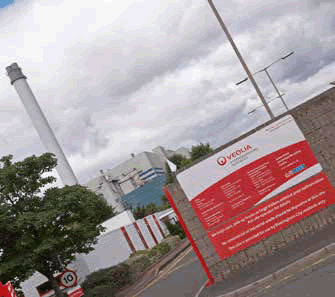
Tyseley waste disposal depot
< Previous | ^ Top | Next >