
2.1.1 This chapter sets out a ‘portrait’ of the North East Enfield [NEE] Area that describes its context, character, how the area functions, the problems with the area that need to be addressed and the ways in which the area could be improved. The following themes are addressed:
2.1.2 The chapter concludes with a summary setting out the scale of the opportunity and challenge.
 Hertford Road Corridor |
 The eastern rail corridor |
2.2.1 The North East Enfield AAP area is defined by four key north-south transport routes:
2.2.2 The M25 motorway forms the northern boundary to the area, and the A10 connects with it at Junction 25. The A110 runs east-west within the southern part of the area, changing its name from Lea Valley Road to Nags Head Road to Southbury Road as it moves westwards. This road forms an important gateway into the NEE area.
2.2.3 Part of the eastern side of the AAP area lies within the Lee Valley Regional Park, an important natural asset not only for local people but also for the wider area. However, the open spaces and waterways are largely hidden from view, inaccessible and thus under utilised.
2.2.4 The central part of the study area is predominantly residential outside of the Hertford Road corridor, and includes a range of social and community uses such as schools, GP surgeries, open space and small parades of shops. The eastern side of the study area is dominated by the very large Brimsdown Industrial Estate. The area adjacent to the A10 includes some large retail parks as well as residential areas. The land use and character of the area is described in more detail overleaf.
Figure 2.1: Land Use and Character Plan


2.3.1 The Enfield Characterisation Study1 identifies the NEE area as one of three distinct urban zones within Enfield, and describes it as the ‘Eastern Corridor’ - comprising the historic chain of settlements along the old Hertford Road, defined on the eastern side by the Lee Valley and on the western side by the Great Cambridge Road.
2.3.2 There are a number of sub-neighbourhood areas within this Eastern Corridor that reflect different historical land use and physical characteristics. Neighbourhoods have developed naturally around local centres and shopping parades. Local Centres are the focus of communities and underpin their character and local identity. Figure 2.1 on page 19 draws on the Enfield Characterisation Study, showing the patchwork of land use and character that make up the NEE area.
2.3.3 The main sub-neighbourhood areas are identified on Figure 2.1. Working from the north of the area southwards, include:
2.3.4 Some of these sub neighbourhood areas tend to blur into one another and it is difficult to distinguish between them. There are opportunities to improve the image and character of individual areas so that they become more distinctive. There is a particular opportunity to improve areas of historic interest such as conservation areas and the setting of listed buildings, and to make sure new development relates sensitively to them in terms of height, scale and design. The descriptions of the area’s land use and character in this section identifies some of the key opportunities for creating memorable, high quality places.
2.3.5 Freezywater: This area lies just south of the M25 and is bisected by the busy A1055 Bullsmoor Lane which runs east-west, connecting to the Hertford Road in its centre and Mollison Avenue to the east and the A10 in the west. These busy roads divide the area, and so it feels rather fragmented. However, the roads are important to the success of the Freezywater Industrial Estate, which has some high quality, modern distribution uses.
 Freezywater |
 Innova Park Employment |
 Innova Park Residential |
 Enfield Island Village Waterside |
 Enfield Lock |
|
2.3.6 The residential uses in this area are mostly two storey traditional suburban homes, most with generous front and rear gardens. The demand for car parking has resulted in many front gardens being paved over to provide parking spaces, and so the pleasant green character of streets has been eroded.
2.3.7 The area includes some significant areas of open space that links from Bullsmoor Lane in the north all the way to Turkey Street in the south. These spaces include allotments, Aylands Open Space and the Belmore Playing Fields.
2.3.8 Innova Park: Innova Park comprises a mixture of uses including new housing, a flagship Academy, and commercial, business, office and warehousing employment buildings. It contrasts with the older parts of the NEE area, particularly through the high quality of its public realm and landscape compared to older employment areas. Innova Park has scope for further development. At present, it feels somewhat cutoff from the wider area although its range of uses has the potential to create a real community.
2.3.9 Enfield Lock and Enfield Island Village: These are two distinct but connected areas that are physically isolated from the wider NEE area. There is only one vehicular route in and out of the area, Smeaton Road which connects with Mollison Avenue.
2.3.10 Enfield Lock Conservation Area consists of a relatively narrow area around the River Lee Navigation and opens out to include the Prince of Wales open space to the south. The listed terraced dwellings along the River Lee Navigation form ‘Government Row’ - these make a very important contribution to the character of the area. Also included within the Conservation Area are a number listed buildings remaining from the area’s former use as the Royal Small Arms Factory. These are now converted to new uses as part of Enfield Island Village’s Local Centre.
2.3.11 The lock forms a key focus for the area, and is accessed by both the London Outer Orbital Path (LOOP) and the Lee Valley walk. However, this area has lost some of its attraction for visitors through the closure of the Rifles Pub. Now derelict, this site has planning permission for new residential dwellings.
2.3.12 Enfield Island Village is a residential neighbourhood developed in the 1990’ s and comprises a range two and three storey houses and four storey flats. Although the area looks on the surface to be an attractive place to live, its isolation has led to a number of social problems.
2.3.13 Area around Turkey Street Station: Turkey Street Station is at the meeting point of the small Turkey Street Conservation Area, the Elsinge Housing Estate to the west and traditional suburban housing to the east. The Elsinge Housing Estate north of Turkey Street has a distinctive identity, with something of a ‘garden city’ character of buildings set in green open space. The new ‘pocket park’ next to Turkey Street Station introduces a sense of identity to the area that could be further strengthened through other public realm works.
 Enfield Island Village Library |
 Aerial photograph showing part of the A1010 Hertford Road corridor within |
 Elsinge Estate |
2.3.14 Area around Enfield Wash Local Centre: Enfield Wash Local Centre is the focus for the area, containing a variety of small independent shops, mostly in traditional buildings. The Co-operative Store marks the northern edge of the Local Centre, and the Albany Leisure Centre marks the southern edge. Both are low scale buildings that offer little to the street scene - there is an opportunity to improve these gateways to an otherwise attractive Local Centre.
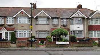
2.3.15 The residential streets around this area are in the main either two-storey Victorian terraces or 1930s/1950s suburban terraces. The area has a low-key, pleasant suburban character that is similar to many other residential parts of the NEE area.
2.3.16 Area around Enfield Highway Local Centre: Again, the Local Centre is the focus for the area, with a range of mainly independent shops in a variety of purpose-built and traditional buildings. Enfield College lies to the south of the Local Centre - the recent works to upgrade the College have made this not only a social but also a visual landmark in the local area. Durants Park creates a green edge to Hertford Road and provides the area with a very large open space. The area to the east of Hertford Road is characterised by quite dense two-storey housing, ranging from Victorian terraces to semidetached dwellings form the 1930s and 1950s. To the west of Hertford Road, the residential areas are punctuated by green spaces that - together with generous front gardens - give the area a more spacious feel.
2.3.17 Brimsdown Industrial Estate: The Brimsdown Industrial Estate forms one homogenous area that sits between the railway line to the west and the Lee Valley Regional Park and Green Belt to the east. The area is characterised by large, single storey employment buildings that provide for a range of warehousing, distribution, and manufacturing uses. There is a significant amount of traffic generated both by large lorries accessing the employment uses, and the people commuting to work in the area.
2.3.18 The Brimsdown area is dominated by buildings and hardstanding. However, there are some quite substantial pockets of landscaping and tree planting that provide relief. These landscaped areas are particularly successful where they are linked to waterside routes and connections to the nearby Lea Valley Regional Park, such as at Riverwalk Road.
2.3.19 Although it is a distinct and easily identifiable quarter within the NEE area, Brimsdown lacks identity. It is difficult to distinguish one part from another as many of the streets look the same: large sheds angled towards roads resulting in poor quality ‘left-over’ space that is often used for parking, as there is more demand than can be accommodated within designated parking areas.
2.3.20 There is an opportunity to improve the image and identity of Brimsdown, so that it becomes a more readily identifiable quarter within the NEE area.
 Enfield Highway Local Centre |
 Typical residential area around Enfield Highway |
 Brimsdown Industrial Estate |
 Greggs, Brimsdown Industrial Area |
2.3.21 Southbury’s retail and industrial areas: The area defined by the Great Cambridge Road, the western railway line, Lincoln Road to the south and Crown Road to the north forms a large concentration of employment and ‘out of town’ retail uses. The retail uses are oriented towards the Great Cambridge Road offering a high degree of visibility. Industrial uses continue to operate away from the main road in locations such as Crown Road. The quality of buildings varies, with the newer retail generally being of good quality (albeit with a character that is not specific to the area) and some of the older industrial buildings being somewhat run down.
2.3.22 There is a new pressure for the conversion of office buildings on the Southbury Road to residential uses that is changing the make up of the area.
2.3.23 Area around Ponders End High Street: Ponders End is the largest of the local centres in North East Enfield, with a mix of different types of uses including retail, residential, employment and community facilities. Buildings along Hertford Road are a mix of ages and styles, all with a human scale of two to four storeys. Towards Ponders End station, however, this delicate building mix and historical cohesion is severed by 1960’s large-scale residential tower developments that lack integration with the urban fabric.
2.3.24 The centre has a large amount of retailing and services with the majority of the retail units located on the High Street with a small number located on South Street. Southbury Station is located 500m west of the centre.
2.3.25 However, the Ponders End area is in need of much improvement and investment. The Ponders End Central Planning Brief was adopted in May 2011, and the area has begun to change in response. The major makeover of Ponders End Park has been particularly successful in transforming the park into an open, welcoming place that is well integrated into the area.
2.3.26 Of the three Local Centres along the Hertford Road, Ponders End has the most potential for change as it has development opportunities at the Electric Quarter site, Swann Annex and potentially at Tesco.
2.3.27 Ponders End: South Street and the Alma Estate: South Street runs eastwards from Hertford Road, connecting Ponders End High Street to Ponders End Station. The street is characterised by two-storey housing until it suddenly changes character at the Alma Estate, where large residential towers dominate the skyline. On the southern side of the street is a collection of community uses, including the completed Oasis Hadley Academy which forms a social and architectural landmark for the area. Regeneration of the Alma Estate is likely to start in late 2014 once a planning application has been submitted and approved, and so this area will change significantly within the lifetime of the AAP.
 Enfield Retail Park |
 Ponders End High Street |
 Alma Housing Estate |
 Ponders End Station Bridge Crossing |
2.3.28 South Street ends at Ponders End Station, and only pedestrians and cyclists can cross the railway line at this point to access Wharf Road and the area known as Ponders End Waterfront.
2.3.29 Part of the Ponders End: South Street and the Alma Estate area falls within two important view corridors - westwards from King’s Head Hill in the adjacent London Borough of Waltham Forest; and eastwards on the approach to Enfield Town from Windmill Hill. The views chosen are valued because they make a significant contribution to a person’s ability to understand the borough and Enfield’s position within the wider north London context.
2.3.30 The bridge over the railway line provides important long views southwards towards the City of London and Docklands with tall buildings clearly visible and silhouetted on the horizon.
2.3.31 Ponders End Waterfront: This area is isolated from the wider NEE area as it is difficult to access. The focus is the Ponders End Flour Mills Conservation Area, which encompasses the operational G.R.Wright and Sons Limited’s Flour Mill and the open space and water meadows next to the River Lea. There is no public access to the Conservation Area.
2.3.32 There is an attractive pub next to the Conservation Area, overlooking the River Lee Navigation, that is popular with both local people and visitors despite its difficult access.
2.3.33 The Meridian Industrial Estate lies to the south of the Conservation Area, and Brimsdown lies to the north. The elevated Lee Valley Road bisects the Conservation Area. The most southern part of Brimsdown Industrial Estate has been released from its designation as Strategic Industrial Land (SIL) and has the potential to come forward for re-development.
2.3.34 This is a characterful area that has the potential to bring a strong identity to the southern part of the NEE area, and provide improved links to the Lee Valley Regional Park.
 Aerial photograph of Ponders End Waterfront |
 Tha Navigation Inn at Ponders End Waterfront |
 G.R.Wright and Sons Limited's Flour Mill at the heart of the Conservation Area |
2.4.1 An updated assessment of the socio-economic profile of the NEE area has been undertaken to inform this AAP. This assessment is included in the Baseline Update document that accompanies the AAP. In this section, we provide a summary of key issues.
2.4.2 Population: The wards in the NEE area comprise Enfield Lock, Enfield Highway, Ponders End, Southbury and Turkey Street. Collectively, these make up about 25% of the population of Enfield Borough as a whole. NEE area has an estimated population of 77,000 people (2011 Census). This represents an increase of about 19% compared to 2001.
2.4.3 Enfield’s overall population grew by 6.5% between 2001 and 2009, relatively slower than 8% growth for London. As a whole Population churn has resulted in a significant change in the profile of our population. More people moved out of Enfield [17,280] each year compared to 15,600 moving in from London boroughs and elsewhere in the UK. More people migrated in to Enfield from outside the UK [3,060], particularly from Eastern Europe, compared to 2,480 people migrating out of Enfield to international destinations.
2.4.4 Enfield has a high level of deprivation, as measured in the 2010 Indices of Multiple Deprivation Office of National Statistics, [ONS2]. There are high levels of inequality within the Borough with some neighbourhoods in the east and south amongst the most deprived in Britain. These have high unemployment, low skills, high benefit claimant level, income deprivation affecting children and older people together with high levels of localised child poverty.
2.4.5 The NEE area has a relatively young population compared to the rest of the Borough and London has a whole. Over a quarter of NEE’s population are children aged 0-15. This is above the Borough average (22%) and the London average (20%). The proportion of residents above the age of 64 is only about 10% which is slightly below the Borough (12%) and London (11%) percentages.
2.4.6 In terms of the ethnic make-up in the NEE area, the largest ethnic groups in the area include White British, White other, Black Caribbean and Black African. There is a relatively high proportion of White British in Enfield Lock and Enfield Highway, and in Ponders End there is a high proportion of Bangladeshi although the largest group is White British. Migrants continue to make up a large proportion (32%) of Enfield’s population (Source: ONS, 2012).
2.4.7 A factor influencing in-migration to Enfield is the relative affordability of the Borough’s rental accommodation, particularly in the south and eastern-side of the Borough where some of the least expensive accommodation in London and much of Enfield’s social housing and rented accommodation is concentrated.
2.4.8 In terms of future growth the Greater London Authority’s latest (2012) projections for the Borough suggest that, between 2013 and 2023:
2.4.9 Enfield ranks as one of the lowest London Boroughs for projected population and household growth. The average population and household growth rate for outer London is forecast to be around 8%, while for London as a whole the figure is about 10%. Nevertheless - as outline below - more housing is required in the area.
2.4.10 Crime and disorder: In the context of the Borough, crime and disorder is low but criminal damage is high in Enfield Lock and Enfield Highway. Ponders End however is a high crime area.
2.4.11 Child poverty: According to figures from End Poverty3, in 2012 the proportion of Enfield’s children living in poverty was about 29%. Approximately 18,609 of Enfield’s pupils qualify for pupil premium based on their level of deprivation, which is nearly 40% of the pupil population. This is well above the London average and is the 16th highest in London out of the 32 London Boroughs.
2.4.12 In general, child poverty is high in the east of the Borough, and child poverty in NEE’s wards is above the Borough average.
2.4.13 Employment and skills: Enfield has one of the smallest proportions of residents of working age (that is, aged 16-64) in London at about 64%. Enfield’s employment rate of about 65%4 is below that of London as a whole (about 70%).
2.4.14 The occupation profile of the Borough is mainly of a mid to low level skills set. The NEE area has a relatively high proportion in the lowest social grade (DE)5 of nearly 40%, almost twice the London average. Whereas about 12% of the NEE area working age residents are in the highest social grade, AB6 (Higher and intermediate managerial and professional occupations). This is less than half of the London average. The NEE area has a higher proportion of employees working in relatively mid to low value jobs in wholesale and retail trades and human health and social work activities compared to the rest of the Borough and London as a whole.
2.4.15 In contrast, high value employment sectors such as professional, scientific and technical activities only employ less than 5% of NEEA’s workforce which is significantly lower than the rest of the borough and London average of about 11%.
2.4.16 In 2012, the average resident in Enfield earned £555 a week, before any deductions. This figure compares unfavourably with the London average, which, during the same period, was close to sixty pounds higher at £613.30.7
2.4.17 Enfield has a high percentage of public sector employment. About a quarter of the working population work in this sector8 which is above the London average (18%). Average earnings in the Borough rank one of the lowest in London with gross pay of around £24,0009.
2.4.18 Unemployment in Enfield continues to be above the London average. According to the latest claimant count statistics the unemployment rate was about 4.2% of the resident population in September 2013. This is above the London (3.4%) and National percentages (3.1%).
2.4.19 A key factor affecting the employability of residents in the borough is their low level of skills relative to those in advertised vacancies with only 1 in 12 jobs advertised by Job Centre Plus (JCP) requiring low or no skills. Access to occupations requiring a relatively high skill set is impeded by a number of factors. One of these - the low skills profile of residents - is particularly apparent in the NEE area where about 44% of usual residents aged 16 or above hold only “Level 1” or “no qualifications”. This is above the Borough average of about 36% and well above the London percentage of 28%10. Other issues such as a lack of employability/soft skills, language barriers, and psychological/mind-set factors have meant that a number of residents are excluded such opportunities.
2.4.20 Access to public transport around shift patterns has been identified as a potential barrier to securing employment - buses and trains do not coincide with shift workers’ hours. This has been seen as a particularly important factor influencing claimants with families; the high levels of female unemployment in the borough; and the connectivity of Enfield to highly skilled jobs in Stansted and Cambridge.
2.4.21 The Council is developing an Employment and Skills Strategy. The four strategic objectives for 2014-16 are:
 The average resident in Enfield earned £555 per week in 2012 |
 Access to public transport around shift patterns is a problem |
 Enfield College: Increasing skills and qualifications is key to improving |
2.4.22 Education - Early Years: Studies show that an effective provision of Early Years Foundation Stage (EYFS) to 3 and 4 year olds is essential for reducing levels of child poverty. It has a positive impact on the child’s development physically, cognitively and emotionally through a balance of child-initiated play, focused and structured learning prior to attending school.
2.4.23 From September 2013 the Government expanded the scheme to offer EYFS places for some 2 year olds in the term following the second birthday. Enfield Council provides EYFS places for 2 year olds from 20% of the disadvantaged families.
2.4.24 Enfield Council’s Joint Strategic Needs Assessment (JSNA) notes that NEE has a higher number of children per EYFS provider than the rest of the Borough. The average across Enfield is 58 children per provided. The averages in Enfield Lock, Enfield Highway, Turkey Street and Ponders End are all above this borough-wide average.
2.4.25 From 2014 Enfield Council is expanding EYFS provision to 40% of the most disadvantaged two-year-olds. For NEEA this will mean that some 2,700 two-year olds will be eligible for EYFS. Trajectory funding has been secured from Central Government in the near term. Based on evidence to date the key issues around the provision of EYFS are:
2.4.26 In order to encourage take-up of early, a number delivery options will need to be considered. For instance, a mixed market offering covering both full time day-care and sessional provision may be useful to address the needs of working parents and enable parents back to work or to undertake further education or training – which is also a key component of the area’s Employment and Skills Strategy Previously there had been a shortfall of school places for a number of years in the NEE area. In more recent times a number of expansions of existing schools have taken place and new schools have opened, significantly increasing the number of places in the area.
2.4.27 Education - Primary Provision: Current pupil number projections and capacity in schools indicate that extra primary provision is not required until at least 2018. The Council reviews this position on an annual basis and if the demand for primary places is projected to exceed available capacity in schools options to provide that capacity are investigated.
2.4.28 Education - Secondary Provision: The new approved academy provision is expected to meet projected demand for secondary places up to 2018. Whilst further places are forecast to be needed for 2018, this need could be met by the ARK North Enfield Academy which is to be located on the former Oasis Hadley Bell Lane site.
2.4.29 Further Education: The College of Haringey, Enfield and North East London provides further and higher education based over two centres in Tottenham (Tottenham Centre) and North East Enfield (Enfield Centre). Serving an area of North London, the College draws its students mainly from Haringey, Enfield, and Hackney.
 Enfield College |
 Oasis Academy Innova Park |
 Oasis Academy, Hadley Ponders End |
2.4.30 The Enfield Centre is primarily targeted at students looking to pursue further (non-degree level) education, vocational courses, apprenticeships, and low level qualifications (adult literacy, English for Speakers of Other Languages, warehousing, logistics, public services and construction). The College offers a unique rail engineering course that draws students from a wide area. The College is a 10 minute walk from Southbury and Brimsdown train stations and also served very well by local buses. The College is engaged in a number of partnerships with education providers and businesses.
2.4.31 Health: Average life expectancy for males is 77.5 years and for females is 81.7 years, with the area suffering from poorer health than the Borough average. Ponders End is the most deprived of the study area wards and Enfield’s third most deprived.
2.4.32 In terms of mortality, Enfield ranks at 14th of the London Borough’s across all age groups based on the Standardised Mortality Ratio (SMR)11. The national SMR is expressed as 100. Within the NEE area, Enfield Lock (137.2) and Ponders End (114.15) have higher SMRs than the national rate - that is, there is excess mortality.
2.4.33 The JSNA notes childhood obesity as an area of concern in the borough, with a significant number of children and young people overweight (13.6% of pupils) compared to the London (11.2%) and national average (9.6%) in 2011. Obesity rates for the Enfield’s Reception pupils are highest in the east of the Borough.
2.4.34 Tackling obesity requires long-term action. In 2009 Enfield Council, in conjunction with NHS North Central London, and Healthy Enfield, produced its first ‘Healthy Weight Strategy for Children and Young People’ in response to the growing threat of obesity. This set out a strategy and aspirations for the next ten years, which aims to halt the trend of increasing obesity rates, through a range of measures including:
2.4.35 The British Medical Association standard for the number of GP’s required is 1 per 1800 people. The existing number of GP’s in Enfield broadly meets the current NHS standard. However, taking account of the Borough’s growth agenda, the projected increase in population will result in a need for approximately an additional 25 GP’s, nurses and other primary care staff within the Infrastructure Delivery Plan (IDP) period (ref: Infrastructure Delivery Plan Review 2013 – consultation draft).
2.4.36 The regeneration of the Alma Estate will help meet these requirements through the delivery of facilities for a new GP practice. In addition, the scheme will provide a gym in the first phase of development.
2.4.37 Community facilities: The population within the NEE area is diverse in terms of age and ethnicity compared to the rest of the Borough. Figure 2.2 opposite shows the key facilities within NEE and these include:
2.4.38 The Ponders End Framework for Change programme (2009) identified a lack of space that could be used by community groups. In response the Council explored opportunities to provide community spaces through the refurbishment of existing buildings (for instance, the Ponders End Youth Centre); the flexible use of existing school and college facilities; and the provision of new buildings (e.g. Oasis Hadley Academy).
2.4.39 The Infrastructure Delivery Plan Review (2013) noted that further research is required to ascertain the level of usage, capacity and demand for meeting halls. Evidence of Federation of Enfield’s Community Associations (FECA) suggests that the community halls that they manage are well used, with higher usage levels at halls that have been recently refurbished. Evidence from the council’s school letting service also indicated that schools’ premises are regularly used usage can vary considerably from school to school and from day to day.
2.4.40 The increase in population will lead to an increase in levels of demand for community hall/meeting spaces. While, it is difficult to predict future requirements for community facilities an indication of this can be determined with reference to external benchmarks. The Sports Facility Calculator (SFC)12 is a tool commonly used to help identify new and future demand for facilities that is created by a given population.
Figure 2.2: Location Of Key Community Facilities


2.4.41 Applying GLA mid-year population estimates to the SFC, the results indicates that the current provision of swimming pools and sports hall facilities, and are adequate for the population. However, based on GLA projections the population of NEEAis to increase by about 12% by 2023. The SFC forecasts a demand for additional swimming pool and a community hall.
2.4.42 A survey was conducted by Community First in spring 2013, with the main purpose being to refine community plans in each of the five wards in North East Enfield and South East Enfield for the programmes running from April 2011 – March 2015 . For NEE the survey included Enfield Lock, Enfield Highway and Ponders End.
2.4.43 The survey as a whole also showed a divided opinion as to whether the area is “interesting for adults and young people.” Respondents from NEE suggested that more community activities, making better use of existing facilities, are required, to cater for the diverse population. Fitness classes and sports activities aimed at particular groups (women only, young adults, and children) were listed as potential solutions. A need for local enforcement groups, for instance, a residents’ association was also highlighted, in order to improve safety in the area.
2.4.44 Housing: Enfield continues to be one the most affordable Boroughs in London for housing. The median price of property in the NEE area is £225,000 which is well below the figure for the Borough of around £350,000 (source: homes.co.uk, October 2013). Much of the residential area is formed of two storey terraced and semi-detached houses, many of which date from the 1930s and 1950s. There are pockets of higher density housing, ranging from the soon to be redeveloped Alma Estate to a variety of three storey flats (many of them over shops) along the Hertford Road corridor.
2.4.45 Rental accommodation is also relatively affordable in the Borough. About a fifth of accommodation is rented from the Local Authority or a Housing Association, while the same proportion is rented from private landlords13. The median rent in the NEE area is about £1,100 pcm which is well below that of London as whole (£2,680 pcm).
2.4.46 In 2011/12, the average weekly rent for a property in the private sector was two to three times (depending on the property size) of that seen in Local Authority and Housing Association properties14 . Further there has been an increase in the number of households claiming housing benefit (up 44% in the last 6 years). This has led to increase in demand for social and rented homes in Enfield. This has also contributed to an increase in inequality between the more affluent West of the Borough and the Eastern wards.
 Innova Park has delivered high quality new housing |
 Higher density residential is clustered around the Hertford Road local centres |
 1930s/1950s housing forms a large part of the residential areas of NEE |
2.4.47 As part of the Core Strategy evidence base, Enfield’s 2008 Strategic Housing Market Assessment (SHMA), identifies that there is much need for affordable housing with a range of housing types required in the Borough. At present there is a continuing supply of two-bedroom dwellings in new development. There is a stronger need for family housing in the form of 3+ bedroom dwellings that have not been delivered in the past so the build up of need is higher.
2.5.1 As an Outer London borough, the functional economic geography of Enfield extends substantially beyond the Borough’s boundaries and beyond the metropolitan boundary of London. Sixty percent of our employed residents travel out of the Borough to work, mainly in Central London and a growing percentage “reverse commute” beyond the M25 to Hertfordshire and Essex.
2.5.2 NEE forms part of the London-Stansted-Cambridge- Corridor, a £161 billion economy built on the high-tech, clean, green and knowledge sectors. The corridor brings together excellent connections to London, Cambridge and Europe, a variety of sites and premises, and a productive population with a diverse range of skills. It crucial that Enfield’s infrastructure improvements continue to result in greater connectivity to access the corridor as it offers a fertile ground for labour market and business specialisation.
2.5.3 North East Enfield contains the second largest concentration of industrial/commercial land in London. Owing to good levels of investment in employment land and buildings over recent years, these employment areas are generally thriving and in good condition.
2.5.4 Enfield has experienced substantial changes to its economy and business-base over the past 40 years, shifting away from being dominated by large businesses and 53% employment in the manufacturing sector, to a broader servicebased economy made-up predominantly of small and micro businesses. The key sectors in the NEE area are:
 North East Enfield contains the second largest concentration of industrial/ commercial land in London |
 Enfield Business Centre |
2.6.1 An updated assessment of transport and movement issues is provided in the Baseline Update Document that accompanies this AAP. In this section, a summary of the key issues is set out.
2.6.2 At first sight, the NEE area appears to have relatively good strategic transport links – it is close to the M25 and there are two rail lines running north-south through the area: the Lee Valley railway line to the east and the London Liverpool Street to Cheshunt line to the west. However, this is misleading.
2.6.3 Figure 2.3 opposite sets out the key transport and movement issues, and these are described below.
2.6.4 Rail: The eastern corridor rail line is limited to 3 stopping services per hour at both peak and off-peak times. It forms a major barrier to east-west movement: crossing points at Enfield Lock and Brimsdown are provided by level crossings, which - even with the limited rail service - are closed for 40 minutes out of every hour. There are only two unrestricted road crossings: to the north at Mollison Avenue and to the south at Nags Head Road / Lee Valley Road.
2.6.5 The western rail corridor is less of a barrier, as all of the crossings are over or under the railway line. Nevertheless, it reduces opportunities for east-west movement.
2.6.6 Roads: The A10 Great Cambridge Road is a busy dual carriageway, and acts very much as an ‘edge’ to the NEE area as it has limited opportunities for pedestrians and cyclists to cross it.
2.6.7 The A1010 Hertford Road forms the main spine of the area as a whole, and is a focus for local shopping and community facilities. The road is busy, and there are conflicts between vehicles, pedestrians and cyclists.
2.6.8 The only connection with the M25 motorway in the area is from the A10 [Junction 25]. The A121 and Junction 26 east of the Lee Valley cannot be utilised in its current road layout. As a result of this, it appears that Brimsdown traffic to and from M25 motorway currently uses “rat-runs” through the NEE area, causing traffic and pollution problems in vulnerable residential and mixed-use areas and compromising the character of the area, particularly through the neighbourhood centres along Hertford Road and A1055 Bullsmoor Lane/ Mollison Avenue.
2.6.9 Car ownership: The average car ownership within the NEE area is 93.4%. 51% of residents of Enfield Highway and Ponders End travel to work by car, with 31% using public transport and 9% walking. In contrast, 68% of those who work in the area but live outside travel to work by car. 15% use public transport and 7% walk.
2.6.10 Pedestrian and cycle links: The area has access to some good pedestrian and cycle links: the National Cycle Network route along the River lee Navigation provide a route linking to London’s Docklands in the South and Waltham Cross in the north. The London Outer Orbital Path (LOOP) extends east-west across the north of the NEE area.
2.6.11 Public transport accessibility: Despite the high number of train stations, the accessibility to public transport in the area is generally low. The London Plan uses a Public Transport Accessibility Level 20 [PTAL]16 measure as a broad indication of accessibility to London’s public transport network. A rating of ‘0’ equates to very low public transport accessibility, whereas a rating of ‘6b’ equates to very high public transport accessibility. PTAL ratings for the AAP area confirm that the areas between Enfield Highway and Enfield Wash along with Enfield Lock are particularly badly served by public transport.
2.6.12 Figure 2.4 overleaf shows public transport accessibility within the area by setting out the location and frequency of bus services within the NEE area along with walking times from stations. There are good north-south links on Great Cambridge Road (A10) and Hertford Road (A1010), and also to Enfield town centre. However, there is moderate penetration of residential areas, typically on 10 minute frequencies, The service to the Brimsdown Industrial Estate is moderate (15 minute), but has no direct links to Enfield town centre. Overall, east-west bus links are poor: they are largely limited to Lea Valley Road (A110), due to severance created by the rail line. Those that exist tend to be indirect and have circuitous routes, e.g. 191 between Brimsdown and Edmonton.
Figure 2.3: Key Transport Issues


2.6.13 Potential transport improvements: The Council wishes to ensure that transport improvements are coordinated so that a package of projects helps to secure long-term change in the area. The Council is developing through detailed technical assessment the Northern Gateway Access Package (NGAP) that will bring together a range of potential transport improvement options that may include:
2.6.14 NGAP is being considered in the context of further technical studies being undertaken in partnership with stakeholders, including Transport for London and the Highways Agency. It will require a significant amount of further work, including an Environmental Impact Assessment and an Economic Assessment to establish the potential benefits, particularly in relation to businesses within NEE.
2.6.15 The West Anglia Mainline Enhancement Project is currently being explored. The works will involve increasing from two tracks to three or four tracks to allow for additional train services. The project has the potential to significantly enhance train services to the NEE area. However, it would potentially require the level crossings at Brimsdown and Enfield Lock to be closed so preventing vehicular movement.
2.6.16 The impact of the possible level crossing closure at Enfield Lock on bus service 121 to Enfield Island Village could be severe. Given the isolation of this area, it will be important to plan for a bus link in the event of the 3/4 tracking going ahead.
2.6.17 The West Anglia Mainline Enhancement project would enable Crossrail 2 to come forward. Crossrail 2 is being promoted by Transport for London and Network Rail as one of the key long-term projects needed to support London’s rapid growth.
2.6.18 The earliest that Crossrail 2 would be operational and open to the public is by the early 2030s.
2.6.19 The West Anglia inner services, between Liverpool Street Station to Enfield Town, Cheshunt (via Seven Sisters) and Chingford, will come under TfL management in May 2015 and will be operated as part of the London Overground network. This will cover Turkey Street and Southbury stations in the NEEAAP area, and it is expected that there will be a range of station improvements across the new network.
Figure 2.4: Public Transport Accessibility


2.7.1 An updated assessment of the property market is provided in the Baseline Update Document that accompanies this AAP. In this section, a summary of the key issues is provided.
2.7.2 Economic Overview: Enfield holds a strategic position, sitting within the robust economy of London and the London- Stansted-Cambridge-Corridor. The Upper Lee Valley covers a significant part of the Borough is also designated as an Opportunity Area (by the Greater London Authority) with the capacity to accommodate up to 15,000 new jobs and a large number of new homes by 2016.
2.7.3 Despite the opportunities that this strategic location presents and the position it holds within the London Stansted Cambridge Growth Corridor, the Borough’s economy remains relatively weak. The sectoral weaknesses and the lack of presence in growth sectors such as high tech and knowledge intensive industries, and reliance on traditional (declining) sectors is clear, which make the Borough vulnerable in terms of the present volatile economic environment. It is also thought that development has been hindered by a number of local factors. These local factors include (as per the Skills and Employment Strategy, 2012); transport bottlenecks, blighted industrial estates, some neighbourhoods having poor quality urban fabric, a degraded environment and perception of high crime rates.
2.7.4 The area is however undergoing a number of regeneration initiatives and projects which will assist its economic development; such as the Industrial Estates Strategy, Alma Estate Regeneration and others. Also transport improvements are expected in the short and long term which will potentially improve economic prosperity in North East Enfield. In the short term increased frequency of trains on the present rail line linking Ponders End to Hertford and London Liverpool Street are expected and in the long term Crossrail 2 would also provide vital new connectivity for Islington, Hackney, Tottenham and the Lee Valley in north-east London. The Crossrail 2 link is expected to assist in driving regeneration, similar to how the extension of the tube drove London’s expansion and regeneration of the outer areas in the 1930’s (Crossrail 2: Supporting London’s Growth, 2013). Crossrail 2 is however not expected to be delivered until 2029/2030 at the earliest.
2.7.5 Property Market Sectors: The updated assessment considers the following sectors:
2.7.6 Offices: The office market in NEE is small compared to nearby City Fringe locations. There are a limited number of large offices available, with the majority of units available being sub 25,000 sqft. Similarly, there is a distinct lack of offices below 1,000 sqft; most offices available are between 1,001 – 10,000 sqft. B1 units between 1,001 and 2,500 sqft were in highest demand over the period November 2007 – November 2013. The majority of stock is second-hand; and the level of new build stock is very limited. There is very limited demand for traditional office space within NEE.
2.7.7 There may, however, be some opportunities for office accommodation. Enfield has a high number of small businesses, and as identified in the Employment Land Review (2012) there may be scope for a micro-business hub to cater for this demand. At present the Wenta Business Centre is the only space offering incubation services and small serviced units. A micro-businesses hub/shared space and small offices/ workshops between 150 and 1,500 sqft are most likely to be in demand within NEE.
2.7.8 Managed workspace providing smaller units that are suited to B1 (c) (sub 2,500 sqft) may also be suitable as part of mixed use developments as they are relative compatible with residential uses. It may also be appropriate to consider the potential sub-division of some of the exiting office stock that is currently on the market to meet the needs of SMEs in the borough.
2.7.9 Industrial / distribution: In terms of the B2/B8 market analysis, it is clear that the market for these uses is much greater than the office market, particularly in terms of warehousing and distribution given NEE’s strategic location, thus meeting both local and strategic demand. The industrial estates tend to be popular, providing vital employment/ industrial land to service the greater London area. However, we aware through consultations with local businesses that congestion is seen as a key issue that is starting to affect the attractiveness of the industrial estates to potential occupiers. The key findings are as follows:
2.7.10 Industrial / distribution opportunities: There is a high level of flexibility in terms of industrial accommodation, with many occupiers utilising industrial space for non-traditional uses. With this in mind, and the high levels of demand established for sub 5,000 sqft industrial units (from the services industries) such space is likely to be very appealing to the market (so long as it is reasonably priced (£8-9 psf approximately). There is also demand for larger distribution space; however, this will require the redevelopment of parts of the existing (older/obsolete) stock in order to meet these requirements.
2.7.11 North East Enfield has healthy industrial areas and should continue to be promoted for employment uses. There is opportunity for redevelopment when older buildings become obsolete; depending on the number of units/land available for redevelopment, B8 warehouse and/or B2 units can be brought for development.
2.7.12 Residential: At present the area is characterised by a low value property market with high levels of social housing and private rented properties relative to the wider Enfield Borough. A high level of demand for all house types and tenures has however been noted.
2.7.13 Residential opportunities: All housing unit types are likely to be in demand and improvements in the wider area and regeneration schemes/projects coming forward (e.g. Alma Estate and Dujardin Mews) are likely to positively impact on desirability and thus values in the area. Improvements in transport links will encourage further interest in the area for commuters and purchasers. The West Anglia Mainline Enhancement Project of the existing West Anglia railway line will improve the attractiveness of NEE as a residential area by improving the frequency of trains into Central London. Recent research undertaken on the impact of the current Crossrail on residential property prices in Outer London are set to rise by approximately 33% by the end of 2018, should they be located within a Crossrail Station ‘walkzone’ (within a 15 minute walk to a Station). It is estimated that for every 250m distance from the station entrance, there will be a decrease in prices or impact of 1.9% of the additional property value increase.
2.7.14 Although some way in the future, Crossrail 2, will also help to improve connectivity with Central London and although it is not yet clear what stops are proposed within NEE, the improved connectivity in the wider area will help to increase the desirability of the area as an affordable residential location compared to more inner London boroughs.
2.7.15 Retail / leisure: At present the retail/leisure offer is limited and concentrated along the A1010 in the Enfield Wash, Enfield Lock and Ponders End. The local centres have a role in servicing the local population with convenience stores and small local services; comparison retail on the whole is concentrated in the higher order centres such as Enfield Town and Edmonton Green (following the town hierarchies).
2.7.16 Comparison retailing is expected to grow within Enfield Borough (Retail Study Update, 2009); however any expansion is likely to be concentrated in the dominant centres and at locations such as the Palace Xchange in Enfield Town centres or Edmonton Green both of which have an established retail offer or outside the borough in places such as Waltham Cross. However, NEE has two high quality retail parks on the Great Cambridge Road: Enfield Retail Park and De Mandeville Retail Park and these are good locations for comparison retailing.
2.7.17 At Waltham Cross there are presently aspirations to redevelop the Northern part of the High Street, this redevelopment is likely to include a 3,500 sqm (38,000 sqft) Sainsbury’s as well as an improved comparison shopping offer (Waltham Cross Draft Town Centre Strategy, 2013). Given the convenience offer that is proposed as part of this development there is likely to be some impact on the local centres; with potential trade diverted form Tesco at Ponders End and Coop at Enfield Wash Local Centre to the new Sainsbury’s store.
2.7.18 The Waltham Cross development will offer larger format stores, household names, and comparison retailers which will attract residents of NEE. The Council has raised concerns that the development is likely to adversely impact on retailing in NEE, in particular the convenience offer.
2.7.19 Retailers are normally attracted to established shopping locations with good levels of expenditure. The potential for NEE to compete with the comparison retail offer at more established locations is thus unlikely unless a significant mass of units could be delivered to establish a retail destination. This is unlikely in the NEE area. Such an aspiration is also hindered by the levels of local spend, which in the short-medium terms is likely to be low relative to other more prosperous areas. As mentioned above retail provision that services local need is likely to be suited to the area, such as children’s clothing provision, convenience and local services.
2.7.20 Retail / leisure opportunities: Similar to the above opportunities in respect to residential, further regeneration in the area may result in greater demand from occupiers due to the increased spend capacity that new developments may bring. The capacity to attract greater spend for comparison and convenience retail is likely to be limited to the local area although specific site opportunities may exist to attract wider interest from a slightly wider catchment area - for example, the potential redevelopment of the Co-operative Store at Enfield Wash and/or development at the retail parks. In terms of retail warehousing there are known occupier requirements in the area, however the accommodation needs cannot currently be fulfilled.
2.8.1 Many parts of the NEE area are well served by some form of open space, such as public parks. However, they are at the same time deficient in other facilities, such as children’s play provision or natural/semi-natural green space. Enfield’s Open Spaces and Sports Assessment update [2012] provides recommendations to address deficiencies, which relate to diversifying existing areas of open space to provide for different types of use and activity, including the provision of new children’s play provision, new planted gardens, seating and the creation of nature areas.
2.8.2 Stretching the whole length of the AAP area, the Lee Valley Regional Park is a place for leisure, recreation and sport, and for nature conservation. Indeed, the park is used by a number of organisations and groups for recreation activities and is an important resource for encouraging improvements to health and general well-being. The Council is seeking to maximise the amenity value of this resource to overcome deficiencies in natural / semi-natural space. However, the park needs to be made more visible and accessible if local people are to be able to access the park easily, by:
2.8.3 The Ponders End Waterfront area provides a key opportunity for increasing the visibility of and connecting to the Lee Valley Park
2.8.4 Although there are some deficiencies in provision, in addition to the LVRP the NEE Enfield area has access to several large parks and smaller areas of green space. These are shown in Figure 2.4: North East Enfield Green Infrastructure. These include:
2.8.5 Whilst some of these spaces are large, they tend to have a somewhat bland character of flat open areas of grass. The opportunities to diversify the parks to create richer environments has been recognised. For example: the recent improvements to Ponders End Park have transformed it, and a masterplan for Albany Park is currently being developed that will create a place of diverse landscapes, recreational activitiesand ecological value.
2.8.6 The Borough of Enfield has a long history of food production. In the late nineteenth century the Lea Valley was the most important concentration of glasshouse (market gardening) industry in the world. Although diminished, the glasshouse industry survived in Enfield into the late 1960s.
2.8.7 The Council is developing a Food Strategy that aims to:
2.8.8 The NEE area has significant areas of open space within its eastern area that could once again be used for food production.
Figure 2.5: North East Enfield Green Infrastructure


2.9.1 This section sets out a summary of the issues highlighted in this chapter, so giving an overview of the scale of opportunity and challenge in North East Enfield.
2.9.2 In responding to opportunities and challenges, the fundamental principle is to create sustainable communities within NEE. Sustainability must form a key part of the vision and therefore must be considered within all of the projects and initiatives developed within this AAP.
2.9.3 Land use and character. Whilst the NEE area has some very distinct areas such as Brimsdown, the area generally lacks places of strong and identifiable character. However, there are opportunities to raise the profile of the area by:
2.9.4 Socio-economic issues: Key challenges relating to Enfield’s population include:
2.9.5 The key socio-economic opportunities that have informed this AAP are:
2.9.6 Employment: Key opportunities and challenges relating to employment include:
 |
 |
Improving transport and movement within NEE is key to unlocking its potential |
|
2.9.7 The NEE area has space to accommodate new businesses and grow the overall number of jobs in the Borough. There is also an opportunity to intensify existing industrial sites, ensuring that the number of jobs is at least maintained or increased.
2.9.8 Transport and movement: Key transport and movement opportunities for the AAP are to:
2.9.9 Property market: The industrial areas within NEE are - in general - healthy, and this is the area’s greatest strength. Improving the quality of the retail and leisure offer will largely depend on attracting a more prosperous population to the area, which in turn is dependent on improving the quality of residential development. High quality new residential is needed to transform the image of the area, changing perceptions from the current view that NEE is a place for low quality housing. The regeneration of the Alma Estate is likely to have a significant effect in changing perceptions, with smaller developments such as Dujardin Mews helping to support this more radical transformation. The design and environmental quality of new residential is therefore important to securing long-term, sustainable regeneration.
2.9.10 Poor access by public transport depresses the property market. The proposed West Anglia Mainline enhancements along with the much longer-term Crossrail 2 have the potential to support regeneration, particularly in those areas close to Ponders End, Brimsdown and Enfield Lock. However, the precise nature of the regenerative effect of improvements in public transport is difficult to quantify given the long-term nature of the schemes. A coordinated package of measures to improve transport by all modes within and to NEE will help to support new development that - in the longterm - can have a knock-on effect in supporting community, retail and leisure activity within NEE.
2.9.11 Green network and food growing The key opportunities are to:
2.9.12 All of these opportunities and challenges have informed the vision and objectives that are set out overleaf.
1 Enfield Characterisation Study (February 2011)
2 Index of Multiple Deprivation (IMD), Office for National Statistics, 2014.
3 The Child Poverty Map of UK, End Poverty, 2013.
4 GLA Borough Profiles, GLA Datastore, 2014.
5 The Greater London Authority's definition of approximate social grade. The lowest approximate social grades are C1 (Supervisory, junior managerial, administrative), C2 (Skilled manual occupations), and DE (Semi-skilled, unskilled manual and unemployed.
6 The Greater London Authority's definition of approximate social grade. The highest approximate social grade is AB Higher and Intermediate managerial and professional occupations.
7 Annual Survey of Hours and Earnings (ASHE), Office for National Statistics, 2013.
8 Business Register and Employment Survey (BRES), Office for National Statistics, 2013.
9 Annual Survey of Hours and Earnings (ASHE), Office for National Statistics, 2013.
10 Experian, 2013.
11 SMR -measured by the actual deaths in a given population divided by the number of expected deaths once the local population structure and size have been factored.
12 Sport England. The SFC has been created by Sport England to help local planning authorities quantify how much additional demand for the key community sports facilities (swimming pools, sports halls and artificial grass pitches), is generated by populations of new growth, development and regeneration areas. The SFC was first developed to help estimate the facility needs of the new communities in the Eastern Quarry Development, Dartford, and the Milton Keynes future growth areas. It has been used to help local authorities in infrastructure planning, s.106 and Supplementary Planning Documents.
13 http//www.home.co.uk, 2013
14 Joint Strategic Needs Assessment (JSNA), Enfield Health and Wellbeing, Enfield Council, 2012.
15 Low Carbon and Environmental Goods and Services: an industry analysis, BIS, 2009.
16 PTAL - Public Transport Accessibility Level - It is a method sometimes used in United Kingdom transport planning to assess the access level of geographical areas to public transport.
< Previous | ^ Top | Next >